TopoQuest Logo
Do you find TopoQuest useful?
Help keep TopoQuest running and adding new maps/features by donating!
Bitcoin:  19c7KJd3qBynnjoSw5npx9KScwjBe4ifkT
Litecoin:  LXs6TkuXGGXo1vDsWCkWVdjQX94eUKd6ui
Home View Maps Find Maps Find Places Resources & Links


Olney, Montana Topographic Map

USGS Map Title: Olney, MT
USGS Map MRC: 48114E5
DRG (GeoTIFF) Download: o48114e5.tif


Neighboring USGS Topographic Map Quads:


  Bull Lake, MT  
48114F6
 

  Upper Whitefish Lake, MT  
48114F5
 

  Moose Peak, MT  
48114F4
 

  Radnor, MT  
48114E6
 

  Olney, MT  
48114E5
 

  Werner Peak, MT  
48114E4
 

  Johnson Peak, MT  
48114D6
 

  Tally Lake, MT  
48114D5
 

  Beaver Lake, MT  
48114D4


Map MRC Location:

N49°
W115°
N49°
W114°
H8 H7 H6 H5 H4 H3 H2 H1
G8 G7 G6 G5 G4 G3 G2 G1
F8 F7 F6 F5 F4 F3 F2 F1
E8 E7 E6 E5 E4 E3 E2 E1
D8 D7 D6 D5 D4 D3 D2 D1
C8 C7 C6 C5 C4 C3 C2 C1
B8 B7 B6 B5 B4 B3 B2 B1
A8 A7 A6 A5 A4 A3 A2 A1
N48°
W115°
N48°
W114°

Olney, MT USGS 1:24K Topographic Map Preview:
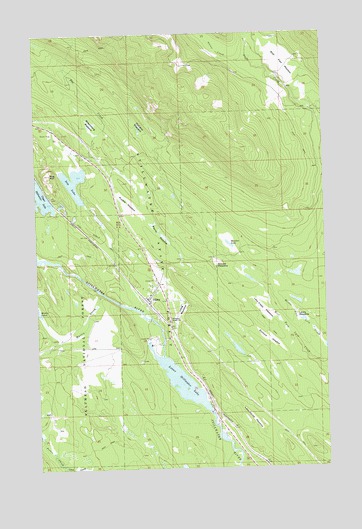
Olney, MT USGS Topographic Map
Click on map above to begin viewing in our Map Viewer.

This topographic map contains these locations and features:
Feature Name Type Latitude Longitude GNIS ID View Map
32N23W07AC__01 WellWellN48.5533°W114.5774°1635859View Map
32N23W07BABB01 WellWellN48.5514°W114.5740°1635853View Map
32N23W08CAD_01 WellWellN48.5500°W114.5590°1635851View Map
32N23W17BB__01 WellWellN48.5425°W114.5693°1635838View Map
32N23W17BBBC01 WellWellN48.5433°W114.5685°1635840View Map
33N23W30BDBD01 WellWellN48.5977°W114.6193°1635985View Map
33N23W32DD__01 WellWellN48.5747°W114.5882°1635922View Map
Antice CreekStreamN48.6175°W114.5315°798955View Map
Bear Paw MeadowFlatN48.6169°W114.5196°779557View Map
Bootjack MeadowFlatN48.5366°W114.5263°780235View Map
Dog CreekStreamN48.5433°W114.5790°782441View Map
Dog Creek CampgroundLocaleN48.5902°W114.6038°1795904View Map
Dog LakeLakeN48.5826°W114.6089°782444View Map
Dog MountainSummitN48.5847°W114.6193°782446View Map
Lake House MeadowFlatN48.5139°W114.5335°785916View Map
Lazy Creek MeadowFlatN48.5450°W114.5290°786003View Map
Lewis MeadowFlatN48.5422°W114.5093°786077View Map
Long MeadowFlatN48.5475°W114.5635°786532View Map
Lower Stillwater LakeLakeN48.5246°W114.5636°786680View Map
Martin CreekStreamN48.5502°W114.5976°786884View Map
McCabe MeadowFlatN48.5980°W114.5821°786987View Map
Meadow LakeLakeN48.5644°W114.5423°787158View Map
Mock Post Office (historical)Post OfficeN48.5777°W114.6190°1795987View Map
Mock School (historical)SchoolN48.5777°W114.6190°1795983View Map
OlneyPopulated PlaceN48.5486°W114.5782°788442View Map
OlneyLocaleN48.5472°W114.5774°1795976View Map
Olney AmbulanceBuildingN48.5508°W114.5745°2738274View Map
Olney Census Designated PlaceCensusN48.5488°W114.5720°2583831View Map
Olney Community ChurchChurchN48.5486°W114.5782°1795808View Map
Olney Elementary SchoolSchoolN48.5500°W114.5771°1796280View Map
Olney Post OfficePost OfficeN48.5522°W114.5733°1795977View Map
Olney Rural Fire DistrictBuildingN48.5507°W114.5746°1796128View Map
Potter CreekStreamN48.5008°W114.6154°789146View Map
Purple MeadowFlatN48.5547°W114.5754°798920View Map
Ritsenburg MeadowFlatN48.5994°W114.6018°789603View Map
Round MeadowFlatN48.5591°W114.5479°793882View Map
Ruppel MeadowFlatN48.5722°W114.5899°789864View Map
Skunk MeadowFlatN48.5675°W114.5713°790616View Map
Stillwater Ranger StationLocaleN48.5425°W114.5676°791523View Map
Whitefish DivisionCivilN48.5086°W114.5839°1940740View Map

Note: Coordinates in the location and feature list above are referenced to NAD83 datum.


Copyright (C) 2008-2024 Ryan Niemi / Sunset Dynamics ... All Rights Reserved