TopoQuest Logo
Do you find TopoQuest useful?
Help keep TopoQuest running and adding new maps/features by donating!
Bitcoin:  19c7KJd3qBynnjoSw5npx9KScwjBe4ifkT
Litecoin:  LXs6TkuXGGXo1vDsWCkWVdjQX94eUKd6ui
Home View Maps Find Maps Find Places Resources & Links


Oregon Butte, Washington Topographic Map

USGS Map Title: Oregon Butte, WA
USGS Map MRC: 46117A6
DRG (GeoTIFF) Download: o46117a6.tif


Neighboring USGS Topographic Map Quads:


  Eckler Mountain, WA  
46117B7
 

  Panjab Creek, WA  
46117B6
 

  Stentz Spring, WA  
46117B5
 

  Godman Spring, WA  
46117A7
 

  Oregon Butte, WA  
46117A6
 

  Diamond Peak, WA  
46117A5
 

  Wenaha Forks, OR  
45117H7
 

  Elbow Creek, OR  
45117H6
 

  Eden Ridge, OR  
45117H5


Map MRC Location:

N47°
W118°
N47°
W117°
H8 H7 H6 H5 H4 H3 H2 H1
G8 G7 G6 G5 G4 G3 G2 G1
F8 F7 F6 F5 F4 F3 F2 F1
E8 E7 E6 E5 E4 E3 E2 E1
D8 D7 D6 D5 D4 D3 D2 D1
C8 C7 C6 C5 C4 C3 C2 C1
B8 B7 B6 B5 B4 B3 B2 B1
A8 A7 A6 A5 A4 A3 A2 A1
N46°
W118°
N46°
W117°

Oregon Butte, WA USGS 1:24K Topographic Map Preview:
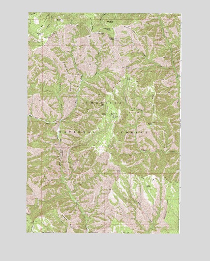
Oregon Butte, WA USGS Topographic Map
Click on map above to begin viewing in our Map Viewer.

This topographic map contains these locations and features:
Feature Name Type Latitude Longitude GNIS ID View Map
Ant FlatFlatN46.0010°W117.6696°1503038View Map
Box CanyonValleyN46.0321°W117.7205°1503515View Map
Cougar CreekStreamN46.0943°W117.6307°1504186View Map
Danger PointCliffN46.0943°W117.6705°1504318View Map
Dickinson CreekStreamN46.0638°W117.7224°1504480View Map
East Butte Creek TrailTrailN46.0790°W117.7094°1510036View Map
East Fork Butte CreekStreamN46.0632°W117.7230°1504632View Map
Emergency SpringSpringN46.1202°W117.6805°1504748View Map
French RidgeRidgeN46.0846°W117.7157°1505038View Map
Grizzly Bear RidgeRidgeN46.1132°W117.6607°1505307View Map
Hatfield SpringSpringN46.1132°W117.7389°1505417View Map
Huckleberry SpringSpringN46.0675°W117.6825°1505648View Map
King CreekStreamN46.0857°W117.7060°1505980View Map
Little Turkey SpringSpringN46.1151°W117.7471°1514021View Map
Lodgepole SpringSpringN46.0489°W117.6844°1506248View Map
McBain SpringSpringN46.0876°W117.6691°1506530View Map
Moolack SpringSpringN46.1207°W117.7270°1511532View Map
Oregon ButteSummitN46.1104°W117.6791°1512537View Map
Oregon Butte SpringSpringN46.1149°W117.6829°1507205View Map
Patterson RidgeRidgeN46.0145°W117.6353°1125231View Map
Pearson SpringSpringN46.0620°W117.6482°1507350View Map
Rattlesnake RidgeRidgeN46.0066°W117.7147°1125839View Map
Rettkowski SpringSpringN46.0659°W117.6808°1507786View Map
Ruth SpringSpringN46.0729°W117.6866°1507969View Map
Smooth Ridge TrailTrailN46.0313°W117.6438°1531516View Map
Taylor SpringSpringN46.0680°W117.6859°1508926View Map
Teepee CampgroundLocaleN46.1168°W117.7157°1514020View Map
Teepee SpringSpringN46.1189°W117.7146°1514019View Map
Tepee CampgroundLocaleN46.1182°W117.7144°1508949View Map
Trout CreekStreamN46.0885°W117.6280°1509088View Map
Twin SpringSpringN46.0270°W117.6528°1509156View Map
Weller ButteSummitN46.0351°W117.6727°1512785View Map
Wenaha-Tucannon WildernessReserveN46.0276°W117.7216°1132760View Map
West ButteSummitN46.1138°W117.6930°1512789View Map
West Fork Butte CreekStreamN46.0632°W117.7230°1509390View Map
Yearling RidgeRidgeN46.0735°W117.6474°1509653View Map

Note: Coordinates in the location and feature list above are referenced to NAD83 datum.


Copyright (C) 2008-2024 Ryan Niemi / Sunset Dynamics ... All Rights Reserved