TopoQuest Logo
Do you find TopoQuest useful?
Help keep TopoQuest running and adding new maps/features by donating!
Bitcoin:  19c7KJd3qBynnjoSw5npx9KScwjBe4ifkT
Litecoin:  LXs6TkuXGGXo1vDsWCkWVdjQX94eUKd6ui
Home View Maps Find Maps Find Places Resources & Links


Organ, New Mexico Topographic Map

USGS Map Title: Organ, NM
USGS Map MRC: 32106D5
DRG (GeoTIFF) Download: o32106d5.tif


Neighboring USGS Topographic Map Quads:


  Bear Peak, NM  
32106E5
 

  Bennett Mountain, NM  
32106E4
 

  Organ Peak NW, NM  
32106D6
 

  Organ, NM  
32106D5
 

  White Sands, NM  
32106D4
 

  Tortugas Mountain, NM  
32106C6
 

  Organ Peak, NM  
32106C5
 

  Davies Tank, NM  
32106C4


Map MRC Location:

N33°
W107°
N33°
W106°
H8 H7 H6 H5 H4 H3 H2 H1
G8 G7 G6 G5 G4 G3 G2 G1
F8 F7 F6 F5 F4 F3 F2 F1
E8 E7 E6 E5 E4 E3 E2 E1
D8 D7 D6 D5 D4 D3 D2 D1
C8 C7 C6 C5 C4 C3 C2 C1
B8 B7 B6 B5 B4 B3 B2 B1
A8 A7 A6 A5 A4 A3 A2 A1
N32°
W107°
N32°
W106°

Organ, NM USGS 1:24K Topographic Map Preview:
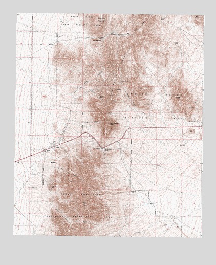
Organ, NM USGS Topographic Map
Click on map above to begin viewing in our Map Viewer.

This topographic map contains these locations and features:
Feature Name Type Latitude Longitude GNIS ID View Map
Anvil CreekStreamN32.3779°W106.5542°900287View Map
Baylor PassGapN32.3831°W106.5789°886120View Map
Baylor PeakSummitN32.3931°W106.5775°886121View Map
Ben NevisMineN32.4343°W106.5603°916474View Map
Big Three MineMineN32.4484°W106.5772°939797View Map
Black Hawk ProspectMineN32.4634°W106.5200°916136View Map
Black Prince CanyonValleyN32.4420°W106.5269°886445View Map
Black Prince MineMineN32.4618°W106.5539°886446View Map
Black Quart LodeMineN32.4381°W106.5889°916889View Map
Boone WellLocaleN32.4270°W106.5117°886608View Map
Buck Deer ProspectMineN32.4690°W106.5428°916882View Map
Captain Smith LodeMineN32.4381°W106.5889°916884View Map
Chippewa LodeMineN32.4529°W106.5883°916886View Map
Cobre GrandeMineN32.4487°W106.5694°916141View Map
Copper Bar ProspectMineN32.4315°W106.5925°916878View Map
Copper BuckleMineN32.4523°W106.5731°916879View Map
Copper Bullion and Cobre Grand MineMineN32.4484°W106.5631°939934View Map
Cordova WellLocaleN32.4009°W106.5442°887843View Map
CowpuncherMineN32.4523°W106.5836°916881View Map
Cox Home RanchLocaleN32.3829°W106.5181°933953View Map
Crested Butte ProspectMineN32.4426°W106.5697°916147View Map
Davy King MineMineN32.4484°W106.5772°939799View Map
Dona DoraMineN32.4529°W106.5047°916873View Map
Dummy B ProspectMineN32.4470°W106.5094°916874View Map
E J Isaacks RanchLocaleN32.3806°W106.6092°933952View Map
Empire Zinc MineMineN32.4023°W106.6003°888874View Map
Eureka ProspectMineN32.4651°W106.5197°916875View Map
ExcelsiorMineN32.4526°W106.5861°916876View Map
First Baptist ChurchChurchN32.4256°W106.5967°921033View Map
Foster WellLocaleN32.3820°W106.5253°889171View Map
Garrett SpringSpringN32.4845°W106.5200°889365View Map
Goat MountainSummitN32.4351°W106.5081°889455View Map
Golden Lily ProspectMineN32.4481°W106.5061°916132View Map
Gray EagleMineN32.4284°W106.5631°916869View Map
H and H MineMineN32.4495°W106.5358°916872View Map
Hilltop MineMineN32.4576°W106.5581°890022View Map
HomestakeMineN32.4359°W106.5981°916865View Map
Iron Mask and Ophelia ClaimsMineN32.4490°W106.5681°916866View Map
Lady Hopkins ProspectMineN32.4459°W106.5067°916675View Map
Little BuckMineN32.4562°W106.5661°916677View Map
Loman CanyonValleyN32.4995°W106.6197°920636View Map
Lower Loman WellLocaleN32.4856°W106.5678°891436View Map
Maggie GMineN32.4443°W106.5022°916573View Map
Markham SpringSpringN32.4978°W106.5297°891606View Map
MemphisMineN32.4412°W106.5914°916679View Map
Merrimac MineMineN32.4554°W106.5731°916129View Map
Merrimac SpringSpringN32.4534°W106.5692°891852View Map
Mineral HillMineN32.4456°W106.5103°916575View Map
Mineral HillSummitN32.4534°W106.5153°892098View Map
MormonMineN32.4834°W106.5011°916681View Map
Mountain ChiefMineN32.4981°W106.5083°916682View Map
Old Homestead LodeMineN32.4381°W106.5725°916683View Map
Old Tough Nut ProspectMineN32.4559°W106.5869°916568View Map
OrganPopulated PlaceN32.4256°W106.5967°899827View Map
Organ CemeteryCemeteryN32.4256°W106.5967°931288View Map
Organ Census Designated PlaceCensusN32.4251°W106.6024°2584169View Map
Organ Post Office (historical)Post OfficeN32.4256°W106.5967°937434View Map
Organ Volunteer Fire Department Station 1BuildingN32.4255°W106.6012°2657819View Map
OS-12 Water WellWellN32.3806°W106.5075°918979View Map
Pagoda ProspectMineN32.4476°W106.5078°916570View Map
Pharmacist ProspectMineN32.4584°W106.5158°916571View Map
PhiladelphiaMineN32.4356°W106.5922°916572View Map
Poor Mans FriendMineN32.4204°W106.5856°916684View Map
Quartzite MountainSummitN32.4973°W106.5678°893579View Map
QuickstrikeMineN32.4398°W106.5558°916685View Map
R C and R J Lodge ProspectMineN32.4476°W106.5656°916686View Map
RickarditeMineN32.4556°W106.5631°916687View Map
Rock of Ages MineMineN32.4404°W106.5047°894029View Map
Rock of Ages ProcpectMineN32.4401°W106.5047°916565View Map
Rock Springs CanyonValleyN32.3843°W106.5206°894076View Map
Rose WellLocaleN32.4093°W106.6103°894159View Map
Ruby MineMineN32.4045°W106.5978°914961View Map
San Agustin PassMineN32.4334°W106.5561°916688View Map
San Augustin MountainsRangeN32.4593°W106.5594°920688View Map
San Augustin PassGapN32.4254°W106.5672°920689View Map
San Augustin PeakSummitN32.4387°W106.5628°920690View Map
San Augustin SpringSpringN32.4244°W106.5647°920691View Map
Silver CoinageMineN32.4490°W106.5600°916692View Map
Silver JimMineN32.4779°W106.5772°916560View Map
Silver King MineMineN32.4445°W106.5633°894847View Map
Site of San Agustin Springs Historical MarkerParkN32.4334°W106.5594°932965View Map
SmithMineN32.4854°W106.5700°916561View Map
Sotol CreekStreamN32.3793°W106.5375°898439View Map
Stevenson-BennettMineN32.4023°W106.6006°916694View Map
Swanson-LauerMineN32.4604°W106.5706°916556View Map
T-3 Water WellWellN32.4009°W106.5053°918987View Map
T-6 Water WellWellN32.3943°W106.5125°919311View Map
TorpedoMineN32.4284°W106.5931°916697View Map
Upper Loman WellLocaleN32.4893°W106.5608°896028View Map

Note: Coordinates in the location and feature list above are referenced to NAD83 datum.


Copyright (C) 2008-2025 Ryan Niemi / Sunset Dynamics ... All Rights Reserved