TopoQuest Logo
Do you find TopoQuest useful?
Help keep TopoQuest running and adding new maps/features by donating!
Bitcoin:  19c7KJd3qBynnjoSw5npx9KScwjBe4ifkT
Litecoin:  LXs6TkuXGGXo1vDsWCkWVdjQX94eUKd6ui
Home View Maps Find Maps Find Places Resources & Links


Ortega Tank, New Mexico Topographic Map

USGS Map Title: Ortega Tank, NM
USGS Map MRC: 35104B2
DRG (GeoTIFF) Download: o35104b2.tif


Neighboring USGS Topographic Map Quads:


  Bookout Ranch, NM  
35104C3
 

  Tenaja Mesa, NM  
35104C2
 

  Monument Point, NM  
35104C1
 

  Neafus Ranch, NM  
35104B3
 

  Ortega Tank, NM  
35104B2
 

  Muniz Canyon, NM  
35104B1
 

  Newkirk, NM  
35104A3
 

  Gate Canyon, NM  
35104A2
 

  Montoya, NM  
35104A1


Map MRC Location:

N36°
W105°
N36°
W104°
H8 H7 H6 H5 H4 H3 H2 H1
G8 G7 G6 G5 G4 G3 G2 G1
F8 F7 F6 F5 F4 F3 F2 F1
E8 E7 E6 E5 E4 E3 E2 E1
D8 D7 D6 D5 D4 D3 D2 D1
C8 C7 C6 C5 C4 C3 C2 C1
B8 B7 B6 B5 B4 B3 B2 B1
A8 A7 A6 A5 A4 A3 A2 A1
N35°
W105°
N35°
W104°

Ortega Tank, NM USGS 1:24K Topographic Map Preview:
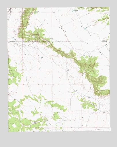
Ortega Tank, NM USGS Topographic Map
Click on map above to begin viewing in our Map Viewer.

This topographic map contains these locations and features:
Feature Name Type Latitude Longitude GNIS ID View Map
Amy WindmillLocaleN35.1439°W104.1903°885729View Map
Aragon DamDamN35.2284°W104.1539°924210View Map
Aragon TankReservoirN35.2288°W104.1544°885865View Map
Benavidez TankReservoirN35.1593°W104.1494°886203View Map
Benavidez WindmillLocaleN35.1464°W104.1389°886204View Map
Blue TankReservoirN35.2000°W104.1501°886526View Map
Corralitos TankReservoirN35.2465°W104.1687°887882View Map
Correo Post Office (historical)Post OfficeN35.2473°W104.1678°937497View Map
Kelly TankReservoirN35.2061°W104.1724°890656View Map
La Munyan TankReservoirN35.2453°W104.2153°890831View Map
Mesa RicaSummitN35.2328°W104.2239°898039View Map
Mitchell WindmillLocaleN35.2095°W104.2178°892128View Map
Morris WindmillsLocaleN35.1303°W104.1550°892241View Map
Ortega TankReservoirN35.1865°W104.1772°892942View Map
Ortega WindmillsLocaleN35.1656°W104.1678°892943View Map
Oso TankReservoirN35.2113°W104.1304°892957View Map
Padilla TankReservoirN35.1997°W104.2100°893010View Map
Smith TankReservoirN35.2183°W104.1985°894947View Map
Tarkington WindmillLocaleN35.1359°W104.2044°895519View Map

Note: Coordinates in the location and feature list above are referenced to NAD83 datum.


Copyright (C) 2008-2024 Ryan Niemi / Sunset Dynamics ... All Rights Reserved