TopoQuest Logo
Do you find TopoQuest useful?
Help keep TopoQuest running and adding new maps/features by donating!
Bitcoin:  19c7KJd3qBynnjoSw5npx9KScwjBe4ifkT
Litecoin:  LXs6TkuXGGXo1vDsWCkWVdjQX94eUKd6ui
Home View Maps Find Maps Find Places Resources & Links


Otterville, Illinois Topographic Map

USGS Map Title: Otterville, IL
USGS Map MRC: 39090A4
DRG (GeoTIFF) Download: o39090a4.tif


Neighboring USGS Topographic Map Quads:


  Hardin, IL  
39090B5
 

  Boyer Creek, IL  
39090B4
 

  Jerseyville North, IL  
39090B3
 

  Nutwood, IL  
39090A5
 

  Otterville, IL  
39090A4
 

  Jerseyville South, IL  
39090A3
 

  Brussels, IL  
38090H5
 

  Grafton, IL  
38090H4
 

  Elsah, IL  
38090H3


Map MRC Location:

N40°
W91°
N40°
W90°
H8 H7 H6 H5 H4 H3 H2 H1
G8 G7 G6 G5 G4 G3 G2 G1
F8 F7 F6 F5 F4 F3 F2 F1
E8 E7 E6 E5 E4 E3 E2 E1
D8 D7 D6 D5 D4 D3 D2 D1
C8 C7 C6 C5 C4 C3 C2 C1
B8 B7 B6 B5 B4 B3 B2 B1
A8 A7 A6 A5 A4 A3 A2 A1
N39°
W91°
N39°
W90°

Otterville, IL USGS 1:24K Topographic Map Preview:
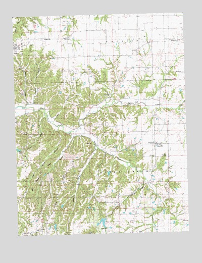
Otterville, IL USGS Topographic Map
Click on map above to begin viewing in our Map Viewer.

This topographic map contains these locations and features:
Feature Name Type Latitude Longitude GNIS ID View Map
Armstrong CemeteryCemeteryN39.1214°W90.4637°1747797View Map
Bear HollowValleyN39.0561°W90.4582°404029View Map
Beaver LakeLakeN39.0491°W90.4983°1747798View Map
Brown CemeteryCemeteryN39.1092°W90.3848°1747803View Map
Buckeye School (historical)SchoolN39.0578°W90.4501°405116View Map
Buena Vista School (historical)SchoolN39.1106°W90.3898°405154View Map
Dabbs CemeteryCemeteryN39.0514°W90.4446°1747807View Map
Davenport CemeteryCemeteryN39.0492°W90.4293°1747808View Map
Democrat SpringPopulated PlaceN39.0839°W90.4837°422616View Map
Dougherty CemeteryCemeteryN39.0434°W90.3901°1747809View Map
Douglas School (historical)SchoolN39.0831°W90.3909°407344View Map
Edsall CemeteryCemeteryN39.0031°W90.4351°1747810View Map
Falkner CemeteryCemeteryN39.0912°W90.3821°1747814View Map
FieldonPopulated PlaceN39.1087°W90.4985°408359View Map
Fieldon HollowValleyN39.0752°W90.4901°408360View Map
Fieldon Post OfficePost OfficeN39.1076°W90.4984°2788648View Map
Franklin School (historical)SchoolN39.1017°W90.4596°408681View Map
Goat Ranch HollowValleyN39.0599°W90.4691°424153View Map
Goat Ranch RidgeRidgeN39.0395°W90.4773°424152View Map
Grant School (historical)SchoolN39.0795°W90.4296°409297View Map
Grimes CemeteryCemeteryN39.1156°W90.4026°1747816View Map
Hamilton CemeteryCemeteryN39.0512°W90.3987°1747818View Map
Hamilton Memorial School (historical)SchoolN39.0509°W90.3971°1815740View Map
Heitzig CemeteryCemeteryN39.1006°W90.4696°1747820View Map
Hinson CemeteryCemeteryN39.0870°W90.4037°1747822View Map
Lewis CemeteryCemeteryN39.0006°W90.4121°1747831View Map
Liberty School (historical)SchoolN39.0173°W90.4698°412014View Map
McDowell CemeteryCemeteryN39.0434°W90.3987°1747836View Map
Noble Family CemeteryCemeteryN39.0575°W90.4040°1773482View Map
Nugent-Schpanski Number 4 DamDamN39.0150°W90.4484°1692092View Map
Nugent-Schpanski Number 4 LakeReservoirN39.0152°W90.4474°1692093View Map
OttervillePopulated PlaceN39.0506°W90.3984°415234View Map
Pleasant Grove School (historical)SchoolN39.0214°W90.3843°415799View Map
Reddish CemeteryCemeteryN39.1087°W90.4879°1747850View Map
Rowden CemeteryCemeteryN39.1156°W90.4040°1773489View Map
Saint Marys Catholic CemeteryCemeteryN39.1117°W90.4604°1747858View Map
Saint Marys ChurchChurchN39.1123°W90.4735°1747857View Map
Saint Marys School (historical)SchoolN39.1125°W90.4737°417606View Map
Sandy CreekStreamN39.0706°W90.3807°417994View Map
Schaaf HollowValleyN39.0752°W90.4869°418067View Map
Shiloh HollowValleyN39.0305°W90.4057°418422View Map
Shiloh School (historical)SchoolN39.0175°W90.4257°418424View Map
Simpson HollowValleyN39.0686°W90.4787°418535View Map
South Fork Otter CreekStreamN39.0584°W90.4604°418769View Map
Sugar HollowValleyN39.0499°W90.4407°419315View Map
Town of OttervilleCivilN39.0508°W90.3984°2396842View Map
Township of Otter CreekCivilN39.0434°W90.4264°429514View Map
Union Forest ChurchChurchN39.0792°W90.4309°1747865View Map
Village of FieldonCivilN39.1087°W90.4996°2398874View Map
White CemeteryCemeteryN39.0778°W90.4198°1747868View Map
Zahn HollowValleyN39.0664°W90.4721°421608View Map

Note: Coordinates in the location and feature list above are referenced to NAD83 datum.


Copyright (C) 2008-2025 Ryan Niemi / Sunset Dynamics ... All Rights Reserved