TopoQuest Logo
Do you find TopoQuest useful?
Help keep TopoQuest running and adding new maps/features by donating!
Bitcoin:  19c7KJd3qBynnjoSw5npx9KScwjBe4ifkT
Litecoin:  LXs6TkuXGGXo1vDsWCkWVdjQX94eUKd6ui
Home View Maps Find Maps Find Places Resources & Links


Oxford, Pennsylvania Topographic Map

USGS Map Title: Oxford, PA
USGS Map MRC: 39075G8
DRG (GeoTIFF) Download: o39075g8.tif


Neighboring USGS Topographic Map Quads:


  Gap, PA  
39076H1
 

  Parkesburg, PA  
39075H8
 

  Coatesville, PA  
39075H7
 

  Kirkwood, PA  
39076G1
 

  Oxford, PA  
39075G8
 

  West Grove, PA  
39075G7
 

  Rising Sun, MD  
39076F1
 

  Bay View, MD  
39075F8
 

  Newark West, DE  
39075F7


Map MRC Location:

N40°
W76°
N40°
W75°
H8 H7 H6 H5 H4 H3 H2 H1
G8 G7 G6 G5 G4 G3 G2 G1
F8 F7 F6 F5 F4 F3 F2 F1
E8 E7 E6 E5 E4 E3 E2 E1
D8 D7 D6 D5 D4 D3 D2 D1
C8 C7 C6 C5 C4 C3 C2 C1
B8 B7 B6 B5 B4 B3 B2 B1
A8 A7 A6 A5 A4 A3 A2 A1
N39°
W76°
N39°
W75°

Oxford, PA USGS 1:24K Topographic Map Preview:
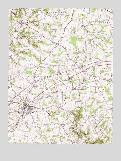
Oxford, PA USGS Topographic Map
Click on map above to begin viewing in our Map Viewer.

This topographic map contains these locations and features:
Feature Name Type Latitude Longitude GNIS ID View Map
Amos HallBuildingN39.8100°W75.9267°2114257View Map
BarnsleyPopulated PlaceN39.7657°W75.9888°1203024View Map
Beulah ChurchChurchN39.8429°W75.9447°1169449View Map
Borough of OxfordCivilN39.7858°W75.9800°1215074View Map
Buena Vista SchoolSchoolN39.8482°W75.9349°1170597View Map
Camp SaginawLocaleN39.7704°W75.9186°1171085View Map
Cannon HouseBuildingN39.8097°W75.9247°2114259View Map
Charlton SchoolSchoolN39.8343°W75.8758°1171592View Map
Chestnut Grove SchoolSchoolN39.8021°W75.9697°1171714View Map
Collamer Post Office (historical)Post OfficeN39.8609°W75.9866°1197582View Map
Cream SchoolSchoolN39.8371°W75.9705°1214543View Map
DalevillePopulated PlaceN39.8643°W75.8849°1203388View Map
East Branch Big Elk CreekStreamN39.7732°W75.9191°1173729View Map
EdentonPopulated PlaceN39.8568°W75.9324°1203493View Map
ElkdalePopulated PlaceN39.7904°W75.9149°1994624View Map
Elkridge CemeteryCemeteryN39.7835°W75.9169°1174140View Map
ElkviewPopulated PlaceN39.8084°W75.8952°1203509View Map
Elkview SchoolSchoolN39.8123°W75.8958°1174141View Map
Elliot Cresson HallBuildingN39.8103°W75.9261°2114260View Map
Faggs ManorPopulated PlaceN39.8579°W75.9094°1203595View Map
ForestvillePopulated PlaceN39.8171°W75.9108°1203604View Map
Frederick Douglass HallBuildingN39.8089°W75.9289°2114261View Map
Grim HallBuildingN39.8081°W75.9256°2114262View Map
Guest HouseBuildingN39.8108°W75.9253°2114263View Map
Harris AirportAirportN39.8210°W75.9257°2442831View Map
HayesvillePopulated PlaceN39.8204°W75.9647°1203763View Map
Henry Howard Houston HallBuildingN39.8094°W75.9264°2114264View Map
Hickory Hill SchoolSchoolN39.7615°W75.9308°1214546View Map
HomevillePopulated PlaceN39.8609°W75.9866°1177329View Map
Hozannah ChurchChurchN39.8112°W75.9255°1177531View Map
Isaac Norton and John Ballard Rendall HallBuildingN39.8092°W75.9275°2114265View Map
Jehudi Ashmun HallBuildingN39.8086°W75.9283°2114266View Map
Jennersville Regional HospitalHospitalN39.8221°W75.8877°2718044View Map
John Miller Dickey HallBuildingN39.8075°W75.9258°2114267View Map
Jordan Bank Hopewell Elementary SchoolSchoolN39.7809°W75.9730°1207410View Map
KeltonPopulated PlaceN39.8087°W75.8780°1203925View Map
Kelton Post OfficePost OfficeN39.8094°W75.8764°2780066View Map
Langston Hughes Memorial LibraryBuildingN39.8078°W75.9264°2114268View Map
Lincoln UniversitySchoolN39.8087°W75.9269°1179400View Map
Lincoln University Census Designated PlaceCensusN39.8064°W75.9278°2633701View Map
Lincoln University Post OfficePost OfficeN39.8013°W75.9229°2779740View Map
Londonderry Post Office (historical)Post OfficeN39.8643°W75.8849°1197581View Map
Lorraine Hansberry HallBuildingN39.8072°W75.9286°2114271View Map
Lucy Laney HallBuildingN39.8081°W75.9269°2114272View Map
Manuel Rivero HallBuildingN39.8083°W75.9308°2114273View Map
Maple GrovePopulated PlaceN39.7690°W75.9386°1204094View Map
Mary Dod Brown Memorial ChapelChurchN39.8089°W75.9244°2114274View Map
McDonald RunStreamN39.7832°W75.9347°1180690View Map
Media SchoolSchoolN39.7593°W75.9733°1214545View Map
New LondonPopulated PlaceN39.7826°W75.8755°1182347View Map
New London Airport (historical)AirportN39.7834°W75.8830°1193737View Map
New London Post OfficePost OfficeN39.7823°W75.8752°2768354View Map
Nottingham Elementary SchoolSchoolN39.7793°W75.9691°1207413View Map
Oak Grove SchoolSchoolN39.8532°W75.9936°1182753View Map
OxfordPopulated PlaceN39.7854°W75.9788°1183166View Map
Oxford Area High SchoolSchoolN39.7796°W75.9730°1207411View Map
Oxford Area Middle SchoolSchoolN39.7782°W75.9705°1207412View Map
Oxford Borough Police DepartmentBuildingN39.7851°W75.9771°2777259View Map
Oxford MallLocaleN39.7943°W75.9747°1214544View Map
Oxford Post OfficePost OfficeN39.7845°W75.9799°2779757View Map
Oxford Press Church SpirePillarN39.7848°W75.9852°1212612View Map
Penns Grove ChurchChurchN39.8226°W75.9199°1183515View Map
Penns Grove SchoolSchoolN39.8251°W75.9191°1183516View Map
Pleasant View SchoolSchoolN39.8340°W75.9499°1184094View Map
President's House - Lincoln UniversityBuildingN39.8092°W75.9244°2114277View Map
Rattlesnake RunStreamN39.8621°W75.9761°1184679View Map
Rattlesnake Run SchoolSchoolN39.8690°W75.9558°1214542View Map
Robert Baxter McRary HallBuildingN39.8092°W75.9283°2114278View Map
RussellvillePopulated PlaceN39.8423°W75.9413°1185658View Map
Southern Chester County Emergency Medical Services Medic 94BuildingN39.8225°W75.8876°2722232View Map
Thurgood Marshall Living Learning Center NorthBuildingN39.8081°W75.9294°2114279View Map
Thurgood Marshall Living Learning Center SouthBuildingN39.8078°W75.9292°2114280View Map
Township of East NottinghamCivilN39.7622°W75.9706°1216154View Map
Township of LondonderryCivilN39.8736°W75.8791°1216165View Map
Township of Lower OxfordCivilN39.8057°W75.9900°1216167View Map
Township of New LondonCivilN39.7743°W75.8797°1216169View Map
Township of Upper OxfordCivilN39.8426°W75.9533°1216179View Map
Union Fire Company 1 Mid - Town Station 21BuildingN39.7853°W75.9780°2652945View Map
Vail Memorial HallBuildingN39.8153°W75.9264°2114282View Map
West Branch Big Elk CreekStreamN39.7732°W75.9191°1190887View Map
West Grove Fire Company Station 22 New LondonBuildingN39.7844°W75.8764°2652845View Map
WLIU-FM (Lincoln University)TowerN39.8101°W75.9261°1200143View Map

Note: Coordinates in the location and feature list above are referenced to NAD83 datum.


Copyright (C) 2008-2024 Ryan Niemi / Sunset Dynamics ... All Rights Reserved