TopoQuest Logo
Do you find TopoQuest useful?
Help keep TopoQuest running and adding new maps/features by donating!
Bitcoin:  19c7KJd3qBynnjoSw5npx9KScwjBe4ifkT
Litecoin:  LXs6TkuXGGXo1vDsWCkWVdjQX94eUKd6ui
Home View Maps Find Maps Find Places Resources & Links


P K Ranch, Montana Topographic Map

USGS Map Title: P K Ranch, MT
USGS Map MRC: 46108B2
DRG (GeoTIFF) Download: o46108b2.tif


Neighboring USGS Topographic Map Quads:


  Dunn Mountain North, MT  
46108C3
 

  Cherry Spring, MT  
46108C2
 

  Steamboat Butte, MT  
46108C1
 

  Dunn Mountain South, MT  
46108B3
 

  P K Ranch, MT  
46108B2
 

  P K Ranch NE, MT  
46108B1
 

  Cotton Creek, MT  
46108A3
 

  P K Ranch SW, MT  
46108A2
 

  P K Ranch SE, MT  
46108A1


Map MRC Location:

N47°
W109°
N47°
W108°
H8 H7 H6 H5 H4 H3 H2 H1
G8 G7 G6 G5 G4 G3 G2 G1
F8 F7 F6 F5 F4 F3 F2 F1
E8 E7 E6 E5 E4 E3 E2 E1
D8 D7 D6 D5 D4 D3 D2 D1
C8 C7 C6 C5 C4 C3 C2 C1
B8 B7 B6 B5 B4 B3 B2 B1
A8 A7 A6 A5 A4 A3 A2 A1
N46°
W109°
N46°
W108°

P K Ranch, MT USGS 1:24K Topographic Map Preview:
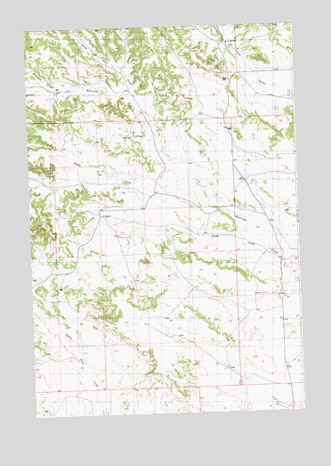
P K Ranch, MT USGS Topographic Map
Click on map above to begin viewing in our Map Viewer.

This topographic map contains these locations and features:
Feature Name Type Latitude Longitude GNIS ID View Map
05N28E04CBAA01 WellWellN46.2114°W108.2346°814605View Map
05N28E09BCDC01 WellWellN46.1994°W108.2351°814546View Map
05N28E12D___01 WellWellN46.1950°W108.1590°814519View Map
05N28E16C___01 WellWellN46.1805°W108.2257°814446View Map
05N28E26DCAC01 WellWellN46.1500°W108.1826°814251View Map
06N28E25ACA_01 SpringSpringN46.2447°W108.1562°814758View Map
06N28E32ADCD01 WellWellN46.2277°W108.2407°814682View Map
06N28E32BAD_01 WellWellN46.2316°W108.2479°814702View Map
06N28E32BDD_01 WellWellN46.2291°W108.2493°814689View Map
06N28E33ABB_01 WellWellN46.2336°W108.2246°814710View Map
06N28E33BCBB01 WellWellN46.2311°W108.2362°814701View Map
06N28E33BCDA01 WellWellN46.2286°W108.2326°814687View Map
Bullhead CreekStreamN46.2300°W108.2276°805578View Map
C A SpringSpringN46.2447°W108.1565°805579View Map
Dutch Oven CreekStreamN46.2272°W108.2004°770933View Map
P K RanchLocaleN46.1894°W108.2160°805581View Map
South Fork Railroad CreekStreamN46.1714°W108.1346°776860View Map

Note: Coordinates in the location and feature list above are referenced to NAD83 datum.


Copyright (C) 2008-2024 Ryan Niemi / Sunset Dynamics ... All Rights Reserved