TopoQuest Logo
Do you find TopoQuest useful?
Help keep TopoQuest running and adding new maps/features by donating!
Bitcoin:  19c7KJd3qBynnjoSw5npx9KScwjBe4ifkT
Litecoin:  LXs6TkuXGGXo1vDsWCkWVdjQX94eUKd6ui
Home View Maps Find Maps Find Places Resources & Links


Palco, Kansas Topographic Map

USGS Map Title: Palco, KS
USGS Map MRC: 39099C5
DRG (GeoTIFF) Download: o39099c5.tif


Neighboring USGS Topographic Map Quads:


  Bogue NW, KS  
39099D6
 

  Nicodemus, KS  
39099D5
 

  Webster Dam, KS  
39099D4
 

  Bogue, KS  
39099C6
 

  Palco, KS  
39099C5
 

  Stockton SW, KS  
39099C4
 

  Redline Church, KS  
39099B6
 

  Wild Horse Creek, KS  
39099B5
 

  Zurich, KS  
39099B4


Map MRC Location:

N40°
W100°
N40°
W99°
H8 H7 H6 H5 H4 H3 H2 H1
G8 G7 G6 G5 G4 G3 G2 G1
F8 F7 F6 F5 F4 F3 F2 F1
E8 E7 E6 E5 E4 E3 E2 E1
D8 D7 D6 D5 D4 D3 D2 D1
C8 C7 C6 C5 C4 C3 C2 C1
B8 B7 B6 B5 B4 B3 B2 B1
A8 A7 A6 A5 A4 A3 A2 A1
N39°
W100°
N39°
W99°

Palco, KS USGS 1:24K Topographic Map Preview:
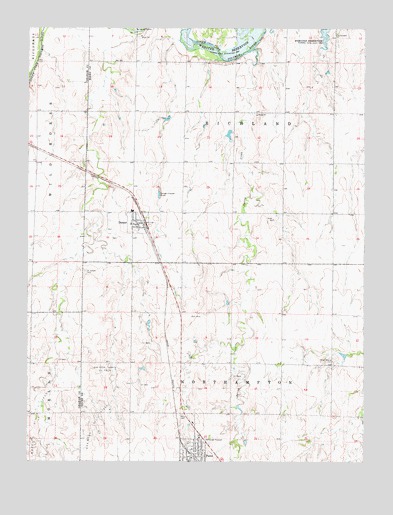
Palco, KS USGS Topographic Map
Click on map above to begin viewing in our Map Viewer.

This topographic map contains these locations and features:
Feature Name Type Latitude Longitude GNIS ID View Map
Benoits Dusty CreekStreamN39.3303°W99.5981°2420612View Map
City of DamarCivilN39.3192°W99.5847°2393710View Map
City of PalcoCivilN39.2532°W99.5636°2396127View Map
Cresson (historical)LocaleN39.2778°W99.5854°482530View Map
DamarPopulated PlaceN39.3189°W99.5826°472364View Map
Damar Fire DepartmentBuildingN39.3186°W99.5831°2111249View Map
Damar Junior High SchoolSchoolN39.3222°W99.5865°480303View Map
Damar Middle SchoolSchoolN39.3222°W99.5865°2497438View Map
Damar Post OfficePost OfficeN39.3186°W99.5854°2693684View Map
Damar Wastewater PlantLocaleN39.3273°W99.5766°2693422View Map
Dusty CreekStreamN39.3736°W99.5847°2420613View Map
Gra-Rook North Oil FieldOilfieldN39.2756°W99.5976°472368View Map
Gra-Rook Oil FieldOilfieldN39.2611°W99.6004°472370View Map
Green Mound CemeteryCemeteryN39.2790°W99.5119°472367View Map
Morel Oil FieldOilfieldN39.2625°W99.6212°472371View Map
PalcoPopulated PlaceN39.2522°W99.5629°485295View Map
Palco CemeteryCemeteryN39.2636°W99.5677°472369View Map
Palco City HallBuildingN39.2540°W99.5626°2693071View Map
Palco Fire DepartmentBuildingN39.2542°W99.5627°2111716View Map
Palco Post OfficePost OfficeN39.2532°W99.5633°2693904View Map
Palco Public LibraryBuildingN39.2522°W99.5633°2694864View Map
Palco United Methodist ChurchChurchN39.2570°W99.5613°2689515View Map
Palco Wastewater PlantLocaleN39.2553°W99.5542°2691894View Map
Saint Joseph CemeteryCemeteryN39.3045°W99.6041°472366View Map
Saint Joseph's ChurchChurchN39.3184°W99.5870°2692604View Map
Spring CreekStreamN39.3686°W99.5421°472365View Map
Township 7CivilN39.3506°W99.5482°472217View Map
Township 8CivilN39.2635°W99.5494°485294View Map

Note: Coordinates in the location and feature list above are referenced to NAD83 datum.


Copyright (C) 2008-2024 Ryan Niemi / Sunset Dynamics ... All Rights Reserved