TopoQuest Logo
Do you find TopoQuest useful?
Help keep TopoQuest running and adding new maps/features by donating!
Bitcoin:  19c7KJd3qBynnjoSw5npx9KScwjBe4ifkT
Litecoin:  LXs6TkuXGGXo1vDsWCkWVdjQX94eUKd6ui
Home View Maps Find Maps Find Places Resources & Links


Palisade, Nevada Topographic Map

USGS Map Title: Palisade, NV
USGS Map MRC: 40116E2
DRG (GeoTIFF) Download: o40116e2.tif


Neighboring USGS Topographic Map Quads:


  Emigrant Pass, NV  
40116F3
 

  Carlin West, NV  
40116F2
 

  Carlin East, NV  
40116F1
 

  Scotts Gulch, NV  
40116E3
 

  Palisade, NV  
40116E2
 

  Ravens Nest, NV  
40116E1
 

  Frenchie Flat, NV  
40116D3
 

  McCormack Spring, NV  
40116D2
 

  Papoose Canyon, NV  
40116D1


Map MRC Location:

N41°
W117°
N41°
W116°
H8 H7 H6 H5 H4 H3 H2 H1
G8 G7 G6 G5 G4 G3 G2 G1
F8 F7 F6 F5 F4 F3 F2 F1
E8 E7 E6 E5 E4 E3 E2 E1
D8 D7 D6 D5 D4 D3 D2 D1
C8 C7 C6 C5 C4 C3 C2 C1
B8 B7 B6 B5 B4 B3 B2 B1
A8 A7 A6 A5 A4 A3 A2 A1
N40°
W117°
N40°
W116°

Palisade, NV USGS 1:24K Topographic Map Preview:
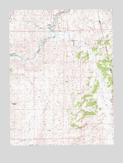
Palisade, NV USGS Topographic Map
Click on map above to begin viewing in our Map Viewer.

This topographic map contains these locations and features:
Feature Name Type Latitude Longitude GNIS ID View Map
Cole CreekStreamN40.5841°W116.1531°839628View Map
Duggan SpurLocaleN40.5844°W116.2481°849565View Map
Emigrant SpringSpringN40.5574°W116.1815°840358View Map
Ferdelford CreekStreamN40.5388°W116.1387°840439View Map
Gerald (historical)Populated PlaceN40.5835°W116.2495°856030View Map
Gerald Post Office (historical)Post OfficeN40.5835°W116.2495°864745View Map
Iron Blossom MountainSummitN40.5388°W116.2426°841302View Map
Mill CreekStreamN40.5199°W116.1315°842123View Map
PalisadePopulated PlaceN40.6102°W116.1987°847450View Map
Palisade Post Office (historical)Post OfficeN40.6102°W116.1987°864749View Map
Palisades Four DamDamN40.5499°W116.2209°863580View Map
Palisades Three DamDamN40.5216°W116.2242°863579View Map
Palisades Two DamDamN40.5816°W116.2026°863578View Map
Pine CreekStreamN40.6005°W116.1942°847455View Map
Pine ValleyValleyN40.5949°W116.1734°856342View Map
Raine RanchLocaleN40.5924°W116.1592°843068View Map
Raine Ranch SpringsSpringN40.5919°W116.1565°857403View Map
Raines (historical)LocaleN40.5394°W116.1309°847074View Map
Rock SpringSpringN40.5136°W116.2018°843304View Map
Rock Spring CanyonValleyN40.5246°W116.1365°847471View Map
Stumps (historical)LocaleN40.5119°W116.1287°857425View Map
Thomas PlacePopulated PlaceN40.5010°W116.2279°856151View Map
Tomera RanchLocaleN40.5410°W116.1304°844355View Map

Note: Coordinates in the location and feature list above are referenced to NAD83 datum.


Copyright (C) 2008-2025 Ryan Niemi / Sunset Dynamics ... All Rights Reserved