TopoQuest Logo
Do you find TopoQuest useful?
Help keep TopoQuest running and adding new maps/features by donating!
Bitcoin:  19c7KJd3qBynnjoSw5npx9KScwjBe4ifkT
Litecoin:  LXs6TkuXGGXo1vDsWCkWVdjQX94eUKd6ui
Home View Maps Find Maps Find Places Resources & Links


Palmetto, Georgia Topographic Map

USGS Map Title: Palmetto, GA
USGS Map MRC: 33084E6
DRG (GeoTIFF) Download: o33084e6.tif


Neighboring USGS Topographic Map Quads:


  Winston, GA  
33084F7
 

  Campbellton, GA  
33084F6
 

  Ben Hill, GA  
33084F5
 

  Rico, GA  
33084E7
 

  Palmetto, GA  
33084E6
 

  Fairburn, GA  
33084E5
 

  Newnan North, GA  
33084D7
 

  Madras, GA  
33084D6
 

  Tyrone, GA  
33084D5


Map MRC Location:

N34°
W85°
N34°
W84°
H8 H7 H6 H5 H4 H3 H2 H1
G8 G7 G6 G5 G4 G3 G2 G1
F8 F7 F6 F5 F4 F3 F2 F1
E8 E7 E6 E5 E4 E3 E2 E1
D8 D7 D6 D5 D4 D3 D2 D1
C8 C7 C6 C5 C4 C3 C2 C1
B8 B7 B6 B5 B4 B3 B2 B1
A8 A7 A6 A5 A4 A3 A2 A1
N33°
W85°
N33°
W84°

Palmetto, GA USGS 1:24K Topographic Map Preview:
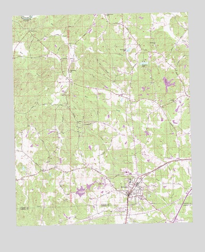
Palmetto, GA USGS Topographic Map
Click on map above to begin viewing in our Map Viewer.

This topographic map contains these locations and features:
Feature Name Type Latitude Longitude GNIS ID View Map
Antioch ChurchChurchN33.5721°W84.6360°310580View Map
Bear Creek EstatesPopulated PlaceN33.5537°W84.6333°1704464View Map
Bear Creek Middle SchoolSchoolN33.5562°W84.6264°2345977View Map
Bethlehem ChurchChurchN33.6057°W84.6485°311253View Map
Cackle CornerPopulated PlaceN33.5859°W84.7102°1704474View Map
Calvary ChurchChurchN33.5515°W84.6255°1704887View Map
Carlton WoodsPopulated PlaceN33.5307°W84.6741°1704477View Map
Cedar BranchStreamN33.5751°W84.7166°312446View Map
Cedar Grove ChurchChurchN33.6190°W84.6638°1704889View Map
Cedar Grove DamDamN33.5868°W84.6433°338277View Map
Cedar Grove LakeReservoirN33.5832°W84.6418°338278View Map
Cedar Grove ParkParkN33.5765°W84.6305°1704479View Map
Cedar LakeReservoirN33.5235°W84.6967°338244View Map
Cedar Lake DamDamN33.5234°W84.6999°338243View Map
City of PalmettoCivilN33.5311°W84.6679°2404466View Map
Cochran CemeteryCemeteryN33.6059°W84.7269°1704884View Map
Cochrane Mill ParkParkN33.5746°W84.7152°1704483View Map
Creekside High SchoolSchoolN33.5584°W84.6277°2545882View Map
Fox Den BranchStreamN33.6026°W84.6919°314334View Map
Friendship ChurchChurchN33.5907°W84.7094°314423View Map
Fulton County Fire Department Station 17BuildingN33.6197°W84.6706°2604191View Map
Georgia Baptist Childrens HomeLocaleN33.5237°W84.6866°1704520View Map
GoodesPopulated PlaceN33.5326°W84.7283°326305View Map
Goodes LakeReservoirN33.5389°W84.7176°338961View Map
Goodes Lake DamDamN33.5401°W84.7183°338960View Map
Green SpringsPopulated PlaceN33.5182°W84.6538°1704524View Map
Horsehead LakeReservoirN33.6038°W84.6675°315705View Map
Horsehead Lake DamDamN33.6023°W84.6680°338281View Map
Interchange ElevenCrossingN33.5004°W84.6388°348517View Map
Langston Hughes High SchoolSchoolN33.6117°W84.6311°2546184View Map
LesterPopulated PlaceN33.5993°W84.6435°1730666View Map
Little Bear CreekStreamN33.5754°W84.7155°316937View Map
Little Pea CreekStreamN33.6118°W84.7141°317143View Map
New Hope ChurchChurchN33.5429°W84.7238°1704883View Map
Ono Road LakeReservoirN33.5539°W84.6561°338959View Map
Ono Road Lake DamDamN33.5551°W84.6566°338958View Map
PalmettoPopulated PlaceN33.5179°W84.6697°332596View Map
Palmetto DivisionCivilN33.5568°W84.7261°1936458View Map
Palmetto Elementary SchoolSchoolN33.5306°W84.6710°1704544View Map
Palmetto Fire Department Station 31BuildingN33.5190°W84.6691°2603892View Map
Palmetto High SchoolSchoolN33.5307°W84.6713°1704545View Map
Palmetto Police DepartmentBuildingN33.5296°W84.6639°2733934View Map
Palmetto Post OfficePost OfficeN33.5207°W84.6677°1704546View Map
Pea CreekStreamN33.6246°W84.7352°320303View Map
Piney Grove ChurchChurchN33.5540°W84.6310°1704888View Map
Ramah ChurchChurchN33.5148°W84.6613°1704557View Map
Ramah ChurchChurchN33.5271°W84.6613°1704886View Map
Redding LakeReservoirN33.5674°W84.6342°338957View Map
Redding Lake DamDamN33.5668°W84.6349°338956View Map
Renaissance Elementary SchoolSchoolN33.6144°W84.6287°2546182View Map
Riley SchoolSchoolN33.5251°W84.6688°321613View Map
RivertownPopulated PlaceN33.6157°W84.7374°326490View Map
Rivertown ChurchChurchN33.5809°W84.6922°1704885View Map
Saint Pauls ChurchChurchN33.5601°W84.7052°322281View Map
Smith Ferry (historical)CrossingN33.6237°W84.7377°1730663View Map
South Fulton AirportAirportN33.5376°W84.6378°351873View Map
South Oak Mobile Home ParkPopulated PlaceN33.5087°W84.6363°348616View Map
Sweet Briar Mobile Home ParkPopulated PlaceN33.5048°W84.6397°348624View Map
Telephone LakeReservoirN33.5952°W84.6570°323971View Map
Telephone Lake DamDamN33.6023°W84.6680°338279View Map
Victory Charter Elementary SchoolSchoolN33.6245°W84.6837°312478View Map

Note: Coordinates in the location and feature list above are referenced to NAD83 datum.


Copyright (C) 2008-2025 Ryan Niemi / Sunset Dynamics ... All Rights Reserved