TopoQuest Logo
Do you find TopoQuest useful?
Help keep TopoQuest running and adding new maps/features by donating!
Bitcoin:  19c7KJd3qBynnjoSw5npx9KScwjBe4ifkT
Litecoin:  LXs6TkuXGGXo1vDsWCkWVdjQX94eUKd6ui
Home View Maps Find Maps Find Places Resources & Links


Beowawe, Nevada Topographic Map

USGS Map Title: Beowawe, NV
USGS Map MRC: 40116E4
DRG (GeoTIFF) Download: o40116e4.tif


Neighboring USGS Topographic Map Quads:


  Dunphy, NV  
40116F5
 

  Bobs Flat, NV  
40116F4
 

  Emigrant Pass, NV  
40116F3
 

  The Geysers, NV  
40116E5
 

  Beowawe, NV  
40116E4
 

  Scotts Gulch, NV  
40116E3
 

  Crescent Valley, NV  
40116D5
 

  Tumbleweed Flat, NV  
40116D4
 

  Frenchie Flat, NV  
40116D3


Map MRC Location:

N41°
W117°
N41°
W116°
H8 H7 H6 H5 H4 H3 H2 H1
G8 G7 G6 G5 G4 G3 G2 G1
F8 F7 F6 F5 F4 F3 F2 F1
E8 E7 E6 E5 E4 E3 E2 E1
D8 D7 D6 D5 D4 D3 D2 D1
C8 C7 C6 C5 C4 C3 C2 C1
B8 B7 B6 B5 B4 B3 B2 B1
A8 A7 A6 A5 A4 A3 A2 A1
N40°
W117°
N40°
W116°

Beowawe, NV USGS 1:24K Topographic Map Preview:
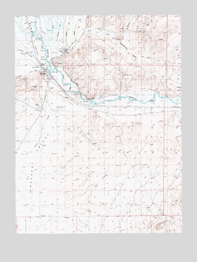
Beowawe, NV USGS Topographic Map
Click on map above to begin viewing in our Map Viewer.

This topographic map contains these locations and features:
Feature Name Type Latitude Longitude GNIS ID View Map
Anderson CanalCanalN40.6196°W116.4595°838446View Map
Beaowawe GateGapN40.5941°W116.4748°847081View Map
BeowawePopulated PlaceN40.5927°W116.4773°856191View Map
Beowawe Elementary SchoolSchoolN40.5888°W116.4762°855074View Map
Beowawe Indian CemeteryCemeteryN40.5571°W116.4469°841245View Map
Beowawe Mining DistrictCivilN40.5855°W116.4879°853587View Map
Beowawe Post OfficePost OfficeN40.5927°W116.4773°864620View Map
Beowawe Volunteer Fire DepartmentBuildingN40.5911°W116.4773°2581425View Map
Bob CreekStreamN40.6149°W116.4487°847250View Map
Corbett CanalCanalN40.5832°W116.4731°847408View Map
Dwyer DamDamN40.6210°W116.4845°840232View Map
Gravelly FordLocaleN40.5796°W116.3934°858004View Map
Gravelly Ford Post Office (historical)Post OfficeN40.5816°W116.3948°864788View Map
Highline CanalCanalN40.5894°W116.4593°847358View Map
Horseshoe RanchLocaleN40.6041°W116.4629°841123View Map
Horseshoe Ranch SpringsSpringN40.6060°W116.4634°858600View Map
Horseshoe StationLocaleN40.5905°W116.4745°856860View Map
Johnson RanchLocaleN40.5796°W116.4665°841404View Map
Long DrawValleyN40.6169°W116.4154°841804View Map
Maidens Grave CemeteryCemeteryN40.5694°W116.4401°841912View Map
Pioneers GraveCemeteryN40.5816°W116.3940°842865View Map
Red Devil MineMineN40.5835°W116.4870°843139View Map

Note: Coordinates in the location and feature list above are referenced to NAD83 datum.


Copyright (C) 2008-2025 Ryan Niemi / Sunset Dynamics ... All Rights Reserved