TopoQuest Logo
Do you find TopoQuest useful?
Help keep TopoQuest running and adding new maps/features by donating!
Bitcoin:  19c7KJd3qBynnjoSw5npx9KScwjBe4ifkT
Litecoin:  LXs6TkuXGGXo1vDsWCkWVdjQX94eUKd6ui
Home View Maps Find Maps Find Places Resources & Links


Panther Rock, California Topographic Map

USGS Map Title: Panther Rock, CA
USGS Map MRC: 41122G2
DRG (GeoTIFF) Download: o41122g2.tif


Neighboring USGS Topographic Map Quads:


  Copco, CA  
41122H3
 

  Secret Spring Mountain, CA  
41122H2
 

  Sams Neck, CA  
41122H1
 

  Dewey Gulch, CA  
41122G3
 

  Panther Rock, CA  
41122G2
 

  MacDoel, CA  
41122G1
 

  Solomons Temple, CA  
41122F3
 

  Grass Lake, CA  
41122F2
 

  Penoyar, CA  
41122F1


Map MRC Location:

N42°
W123°
N42°
W122°
H8 H7 H6 H5 H4 H3 H2 H1
G8 G7 G6 G5 G4 G3 G2 G1
F8 F7 F6 F5 F4 F3 F2 F1
E8 E7 E6 E5 E4 E3 E2 E1
D8 D7 D6 D5 D4 D3 D2 D1
C8 C7 C6 C5 C4 C3 C2 C1
B8 B7 B6 B5 B4 B3 B2 B1
A8 A7 A6 A5 A4 A3 A2 A1
N41°
W123°
N41°
W122°

Panther Rock, CA USGS 1:24K Topographic Map Preview:
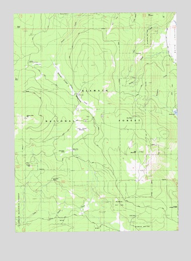
Panther Rock, CA USGS Topographic Map
Click on map above to begin viewing in our Map Viewer.

This topographic map contains these locations and features:
Feature Name Type Latitude Longitude GNIS ID View Map
Ball MountainSummitN41.7951°W122.1556°256482View Map
Bear WallowSpringN41.8146°W122.1608°256729View Map
Black RockPillarN41.8674°W122.2489°266461View Map
Burnt CampLocaleN41.8282°W122.2017°1657367View Map
Burnt Camp TrailTrailN41.8393°W122.1853°257723View Map
Butte MountainSummitN41.8449°W122.1914°276890View Map
Cold Bottle SpringSpringN41.7782°W122.2231°258554View Map
Garvey GladeFlatN41.8713°W122.2136°260495View Map
Harris CreekStreamN41.8518°W122.1306°261107View Map
Ikes CreekStreamN41.8624°W122.1308°261686View Map
Ikes FlatFlatN41.8718°W122.1381°261687View Map
Ikes MountainSummitN41.8729°W122.1489°261688View Map
Kucks CabinLocaleN41.8451°W122.2350°262244View Map
Little Shasta MeadowFlatN41.8079°W122.2006°262722View Map
Little Shasta Ranger Station (historical)LocaleN41.8115°W122.2033°1682308View Map
Little Shasta SpringSpringN41.7949°W122.2120°262724View Map
Lodgepole Forest StationLocaleN41.8468°W122.2395°276889View Map
Martin DairyLocaleN41.7957°W122.2075°263236View Map
Martin Dairy CampgroundLocaleN41.7974°W122.2083°276888View Map
Mills RanchLocaleN41.7613°W122.1975°263653View Map
Muskgrave CreekStreamN41.8446°W122.1264°263989View Map
Panther CreekStreamN41.7571°W122.2472°276887View Map
Panther RockPillarN41.7879°W122.2389°264489View Map
Seikel CreekStreamN41.8385°W122.1339°265987View Map
Shovel Creek MeadowsSwampN41.8387°W122.2193°266144View Map
Smith SpringSpringN41.7596°W122.1592°267268View Map
Willow Creek MountainSummitN41.8160°W122.2395°269161View Map
Willow Creek Mountain TrailTrailN41.8140°W122.2128°269162View Map

Note: Coordinates in the location and feature list above are referenced to NAD83 datum.


Copyright (C) 2008-2025 Ryan Niemi / Sunset Dynamics ... All Rights Reserved