TopoQuest Logo
Do you find TopoQuest useful?
Help keep TopoQuest running and adding new maps/features by donating!
Bitcoin:  19c7KJd3qBynnjoSw5npx9KScwjBe4ifkT
Litecoin:  LXs6TkuXGGXo1vDsWCkWVdjQX94eUKd6ui
Home View Maps Find Maps Find Places Resources & Links


Paradise West, California Topographic Map

USGS Map Title: Paradise West, CA
USGS Map MRC: 39121G6
DRG (GeoTIFF) Download: o39121g6.tif


Neighboring USGS Topographic Map Quads:


  Campbell Mound, CA  
39121H7
 

  Cohasset, CA  
39121H6
 

  Stirling City, CA  
39121H5
 

  Richardson Springs, CA  
39121G7
 

  Paradise West, CA  
39121G6
 

  Paradise East, CA  
39121G5
 

  Chico, CA  
39121F7
 

  Hamlin Canyon, CA  
39121F6
 

  Cherokee, CA  
39121F5


Map MRC Location:

N40°
W122°
N40°
W121°
H8 H7 H6 H5 H4 H3 H2 H1
G8 G7 G6 G5 G4 G3 G2 G1
F8 F7 F6 F5 F4 F3 F2 F1
E8 E7 E6 E5 E4 E3 E2 E1
D8 D7 D6 D5 D4 D3 D2 D1
C8 C7 C6 C5 C4 C3 C2 C1
B8 B7 B6 B5 B4 B3 B2 B1
A8 A7 A6 A5 A4 A3 A2 A1
N39°
W122°
N39°
W121°

Paradise West, CA USGS 1:24K Topographic Map Preview:
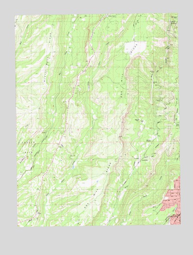
Paradise West, CA USGS Topographic Map
Click on map above to begin viewing in our Map Viewer.

This topographic map contains these locations and features:
Feature Name Type Latitude Longitude GNIS ID View Map
Bille ParkParkN39.7716°W121.6341°1723846View Map
Butte County Fire Department Station 27BuildingN39.7809°W121.6627°2622272View Map
CentervillePopulated PlaceN39.7877°W121.6553°1658249View Map
Centerville CemeteryCemeteryN39.7993°W121.6472°1666434View Map
Chimney RockPillarN39.8404°W121.6450°1666435View Map
Christian CenterChurchN39.7677°W121.6336°1723851View Map
De Sabla PowerhouseBuildingN39.8696°W121.6322°1666440View Map
Doe Mill RidgeRidgeN39.8352°W121.6661°266651View Map
First Responder Emergency Medical Services Station 14BuildingN39.7528°W121.6293°2662249View Map
Forest Ranch Post OfficePost OfficeN39.8745°W121.6818°2783796View Map
Fourteenmile HouseLocaleN39.8482°W121.6953°223765View Map
HelltownPopulated PlaceN39.8116°W121.6597°1658734View Map
Hog SpringSpringN39.7578°W121.7357°225416View Map
Indian Spring MineMineN39.8724°W121.6266°1666451View Map
Irish TownPopulated PlaceN39.8124°W121.6258°276050View Map
KCHH-FM (Paradise)TowerN39.8068°W121.6275°1663006View Map
KNVR-FM (Paradise)TowerN39.7835°W121.6780°1663005View Map
KZFR-FM (Chico)TowerN39.8068°W121.6275°1662833View Map
Lone Pine LookoutLocaleN39.8657°W121.6908°227509View Map
Middle Butte CreekStreamN39.7868°W121.6272°263498View Map
Musty Buck RidgeRidgeN39.8532°W121.7244°267052View Map
Nicholl CemeteryCemeteryN39.8107°W121.6552°1666456View Map
Tenmile HouseLocaleN39.8057°W121.7130°236109View Map
Whiskey FlatFlatN39.8341°W121.6461°1666464View Map

Note: Coordinates in the location and feature list above are referenced to NAD83 datum.


Copyright (C) 2008-2025 Ryan Niemi / Sunset Dynamics ... All Rights Reserved