TopoQuest Logo
Do you find TopoQuest useful?
Help keep TopoQuest running and adding new maps/features by donating!
Bitcoin:  19c7KJd3qBynnjoSw5npx9KScwjBe4ifkT
Litecoin:  LXs6TkuXGGXo1vDsWCkWVdjQX94eUKd6ui
Home View Maps Find Maps Find Places Resources & Links


Park Coulee, Montana Topographic Map

USGS Map Title: Park Coulee, MT
USGS Map MRC: 46108B4
DRG (GeoTIFF) Download: o46108b4.tif


Neighboring USGS Topographic Map Quads:


  Harper Coulee, MT  
46108C5
 

  Signal Mountain, MT  
46108C4
 

  Dunn Mountain North, MT  
46108C3
 

  Hay Basin NE, MT  
46108B5
 

  Park Coulee, MT  
46108B4
 

  Dunn Mountain South, MT  
46108B3
 

  North Fork Crooked Creek West, MT  
46108A5
 

  North Fork Crooked Creek East, MT  
46108A4
 

  Cotton Creek, MT  
46108A3


Map MRC Location:

N47°
W109°
N47°
W108°
H8 H7 H6 H5 H4 H3 H2 H1
G8 G7 G6 G5 G4 G3 G2 G1
F8 F7 F6 F5 F4 F3 F2 F1
E8 E7 E6 E5 E4 E3 E2 E1
D8 D7 D6 D5 D4 D3 D2 D1
C8 C7 C6 C5 C4 C3 C2 C1
B8 B7 B6 B5 B4 B3 B2 B1
A8 A7 A6 A5 A4 A3 A2 A1
N46°
W109°
N46°
W108°

Park Coulee, MT USGS 1:24K Topographic Map Preview:
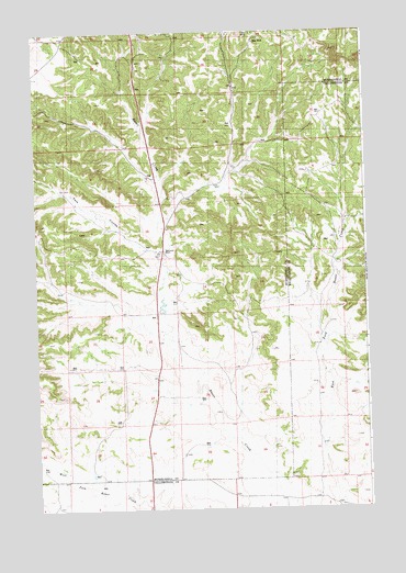
Park Coulee, MT USGS Topographic Map
Click on map above to begin viewing in our Map Viewer.

This topographic map contains these locations and features:
Feature Name Type Latitude Longitude GNIS ID View Map
04N27E03ABCA01 WellWellN46.1277°W108.3896°814114View Map
05N26E01AAA_01 SpringSpringN46.2194°W108.4051°814639View Map
05N26E03BDDD01 WellWellN46.2130°W108.4571°814612View Map
05N26E03DDAA01 WellWellN46.2077°W108.4479°814594View Map
05N26E22ABBD01 WellWellN46.1755°W108.4549°814407View Map
05N26E22BBBB01 WellWellN46.1622°W108.4676°814321View Map
05N26E32DCBB01 WellWellN46.1363°W108.4987°814169View Map
05N27E06CAD_01 WellWellN46.2130°W108.3974°814611View Map
05N27E06DBAA01 WellWellN46.2130°W108.3890°814610View Map
05N27E07DCDD01 WellWellN46.1947°W108.3893°814516View Map
05N27E08BCC_01 WellWellN46.2008°W108.3826°814553View Map
05N27E18AADD01 WellWellN46.1889°W108.3849°814493View Map
05N27E29CCDA01 WellWellN46.1497°W108.3790°814247View Map
06N26E26AACD01 WellWellN46.2455°W108.4279°814764View Map
06N26E26ACAA01 WellWellN46.2450°W108.4304°814761View Map
06N26E26ACC_01 WellWellN46.2427°W108.4318°814751View Map
06N26E26ADBB01 WellWellN46.2450°W108.4282°814760View Map
06N26E27ADAD01 WellWellN46.2436°W108.4465°814753View Map
06N26E27CBDC01 WellWellN46.2380°W108.4624°814726View Map
06N26E35AAAD01 WellWellN46.2333°W108.4243°814706View Map
06N26E35DAAA01 WellWellN46.2261°W108.4249°814674View Map
06N26E36CCBA01 WellWellN46.2236°W108.4218°814660View Map
06N26E36DCC_01 WellWellN46.2208°W108.4132°814646View Map
06N27E31DBAB01 WellWellN46.2286°W108.3910°814688View Map
06N27E32CCAD01 WellWellN46.2239°W108.3793°814662View Map
Buckey Post Office (historical)Post OfficeN46.1930°W108.4518°1723111View Map
Park CouleeValleyN46.1905°W108.4526°775082View Map
Summit Post Office (historical)Post OfficeN46.1930°W108.4518°1723193View Map
Thirty Mile (historical)LocaleN46.1930°W108.4518°1723110View Map
Thirtymile RanchLocaleN46.1930°W108.4518°777566View Map

Note: Coordinates in the location and feature list above are referenced to NAD83 datum.


Copyright (C) 2008-2024 Ryan Niemi / Sunset Dynamics ... All Rights Reserved