TopoQuest Logo
Do you find TopoQuest useful?
Help keep TopoQuest running and adding new maps/features by donating!
Bitcoin:  19c7KJd3qBynnjoSw5npx9KScwjBe4ifkT
Litecoin:  LXs6TkuXGGXo1vDsWCkWVdjQX94eUKd6ui
Home View Maps Find Maps Find Places Resources & Links


Parkton, North Carolina Topographic Map

USGS Map Title: Parkton, NC
USGS Map MRC: 34079H1
DRG (GeoTIFF) Download: o34079h1.tif


Neighboring USGS Topographic Map Quads:


  Nicholson Creek, NC  
35079A2
 

  Clifdale, NC  
35079A1
 

  Fayetteville, NC  
35078A8
 

  Raeford, NC  
34079H2
 

  Parkton, NC  
34079H1
 

  Hope Mills, NC  
34078H8
 

  Red Springs, NC  
34079G2
 

  Rennert, NC  
34079G1
 

  Saint Pauls, NC  
34078G8


Map MRC Location:

N35°
W80°
N35°
W79°
H8 H7 H6 H5 H4 H3 H2 H1
G8 G7 G6 G5 G4 G3 G2 G1
F8 F7 F6 F5 F4 F3 F2 F1
E8 E7 E6 E5 E4 E3 E2 E1
D8 D7 D6 D5 D4 D3 D2 D1
C8 C7 C6 C5 C4 C3 C2 C1
B8 B7 B6 B5 B4 B3 B2 B1
A8 A7 A6 A5 A4 A3 A2 A1
N34°
W80°
N34°
W79°

Parkton, NC USGS 1:24K Topographic Map Preview:
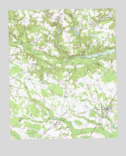
Parkton, NC USGS Topographic Map
Click on map above to begin viewing in our Map Viewer.

This topographic map contains these locations and features:
Feature Name Type Latitude Longitude GNIS ID View Map
Barbours LakeReservoirN34.9752°W79.0148°998259View Map
Barbours Lake DamDamN34.9752°W79.0148°998260View Map
Bashan ChurchChurchN34.9877°W79.0303°980594View Map
Beaver CreekStreamN34.9696°W79.1131°980790View Map
Big BranchStreamN34.9502°W79.0573°981325View Map
Bogue SwampStreamN34.8799°W79.0159°981686View Map
E T FieldAirportN34.9181°W79.0519°2679237View Map
E T FieldBuildingN34.9182°W79.0524°2506026View Map
Frazier BranchStreamN34.8768°W79.0103°985373View Map
Georges MarshStreamN34.8946°W79.0739°985632View Map
Goose PondSwampN34.8810°W79.1009°985830View Map
Gully BranchStreamN34.9516°W79.0561°986203View Map
Hall FieldAirportN34.8910°W79.0400°2679238View Map
Hickman CreekStreamN34.9656°W79.0361°2439614View Map
Hickory Grove ChurchChurchN34.9996°W79.0425°986700View Map
Hughes PondReservoirN34.8854°W79.0036°987234View Map
Irongate Golf Course Lake DamDamN34.9935°W79.0064°998277View Map
James D McGougan DamDamN34.9318°W79.0864°998216View Map
Kings PondReservoirN34.9776°W79.0460°998261View Map
Kings Pond DamDamN34.9752°W79.0431°998262View Map
Knapdale PondReservoirN34.8869°W79.0187°988038View Map
Laurel Hill ChurchChurchN34.9274°W79.1245°988198View Map
Lumber BridgePopulated PlaceN34.8885°W79.0723°989126View Map
Lumber Bridge Post OfficePost OfficeN34.8885°W79.0729°2774014View Map
Lumber Bridge Volunteer Fire DepartmentBuildingN34.8899°W79.0731°2638516View Map
McGougan CemeteryCemeteryN34.9334°W79.1018°989583View Map
McNatts StationLocaleN34.9113°W79.0370°989631View Map
Mount Calvary ChurchChurchN34.9849°W79.0289°990328View Map
Mount Sinai ChurchChurchN34.9477°W79.0975°990570View Map
ParktonPopulated PlaceN34.9027°W79.0117°991877View Map
Parkton K-12 SchoolSchoolN34.9041°W79.0064°1006801View Map
Parkton Lookout TowerTowerN34.9038°W79.0250°991878View Map
Parkton Police DepartmentBuildingN34.9034°W79.0122°2769625View Map
Parkton Post OfficePost OfficeN34.9019°W79.0114°2773998View Map
Parkton Rescue SquadBuildingN34.9035°W79.0122°2720388View Map
Parkton Volunteer Fire DepartmentBuildingN34.8989°W79.0035°2638073View Map
Pittman Grove ChurchChurchN34.9685°W79.0970°992433View Map
Puppy CreekStreamN34.9710°W79.1136°992915View Map
Robeson County SchoolSchoolN34.8788°W79.0614°993459View Map
Rock Grove ChurchChurchN34.9663°W79.0845°993503View Map
RockfishPopulated PlaceN34.9927°W79.0661°993535View Map
Rockfish CampLocaleN34.9535°W79.0384°993536View Map
Rockfish Census Designated PlaceCensusN34.9903°W79.0696°2403488View Map
Rockfish Fire Department - Station 2BuildingN34.9918°W79.0658°2638572View Map
Saint Peters ChurchChurchN34.9852°W79.0711°994111View Map
Sandy GrovePopulated PlaceN34.9479°W79.0992°1022490View Map
Sandy Grove ChurchChurchN34.9160°W79.0606°994277View Map
Sassfrass BranchStreamN34.8868°W79.0542°994360View Map
Stewarts CreekStreamN34.9554°W79.0359°995502View Map
Stoney Point Fire Department - Lake Upchurch StationBuildingN34.9532°W79.0231°2639042View Map
Stoney Point Fire Department - Station 13BuildingN34.9841°W79.0217°2639721View Map
Summerwinds Mobile Home ParkPopulated PlaceN34.8892°W79.0369°2505667View Map
Tabernacle ChurchChurchN34.9949°W79.0650°995807View Map
The Holy Center ChurchChurchN34.9241°W79.0598°995983View Map
Town of Lumber BridgeCivilN34.8899°W79.0724°2406058View Map
Town of ParktonCivilN34.9028°W79.0098°2407074View Map
Township of Lumber BridgeCivilN34.8812°W79.0657°1027108View Map
Upchurch Boy Scout CampLocaleN34.9616°W79.0045°996541View Map
Upchurches PondReservoirN34.9562°W79.0183°996543View Map
Upchurches Pond DamDamN34.9593°W79.0009°998233View Map
Whispering Pines ChurchChurchN34.9641°W79.0300°997122View Map
Wood CemeteryCemeteryN34.9824°W79.0603°997563View Map

Note: Coordinates in the location and feature list above are referenced to NAD83 datum.


Copyright (C) 2008-2024 Ryan Niemi / Sunset Dynamics ... All Rights Reserved