TopoQuest Logo
Do you find TopoQuest useful?
Help keep TopoQuest running and adding new maps/features by donating!
Bitcoin:  19c7KJd3qBynnjoSw5npx9KScwjBe4ifkT
Litecoin:  LXs6TkuXGGXo1vDsWCkWVdjQX94eUKd6ui
Home View Maps Find Maps Find Places Resources & Links


Parrilla Creek SW, Texas Topographic Map

USGS Map Title: Parrilla Creek SW, TX
USGS Map MRC: 27098E6
DRG (GeoTIFF) Download: o27098e6.tif


Neighboring USGS Topographic Map Quads:


  Mills Bennett, TX  
27098F7
 

  Parrilla Creek NW, TX  
27098F6
 

  Parrilla Creek NE, TX  
27098F5
 

  San Pablo, TX  
27098E7
 

  Parrilla Creek SW, TX  
27098E6
 

  Parrilla Creek SE, TX  
27098E5
 

  Bruni, TX  
27098D7
 

  Hebbronville NW, TX  
27098D6
 

  Realitos, TX  
27098D5


Map MRC Location:

N28°
W99°
N28°
W98°
H8 H7 H6 H5 H4 H3 H2 H1
G8 G7 G6 G5 G4 G3 G2 G1
F8 F7 F6 F5 F4 F3 F2 F1
E8 E7 E6 E5 E4 E3 E2 E1
D8 D7 D6 D5 D4 D3 D2 D1
C8 C7 C6 C5 C4 C3 C2 C1
B8 B7 B6 B5 B4 B3 B2 B1
A8 A7 A6 A5 A4 A3 A2 A1
N27°
W99°
N27°
W98°

Parrilla Creek SW, TX USGS 1:24K Topographic Map Preview:
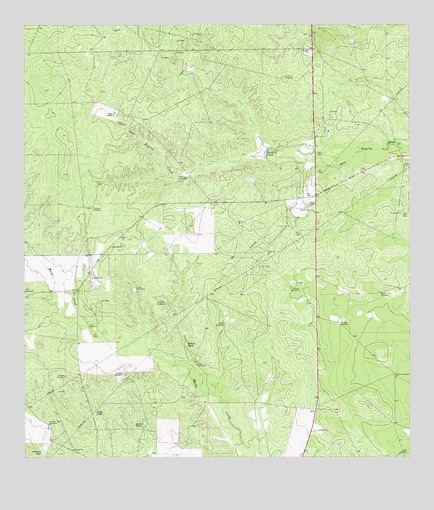
Parrilla Creek SW, TX USGS Topographic Map
Click on map above to begin viewing in our Map Viewer.

This topographic map contains these locations and features:
Feature Name Type Latitude Longitude GNIS ID View Map
Artesian Pen WindmillLocaleN27.5095°W98.7422°1329782View Map
Artesian TankReservoirN27.5021°W98.7445°1329784View Map
Benado WindmillLocaleN27.5236°W98.6300°1330407View Map
Bivora TankReservoirN27.5328°W98.6978°1330728View Map
Callejon WindmillLocaleN27.5723°W98.7286°1331902View Map
Canejo WindmillLocaleN27.5242°W98.7184°1332066View Map
Chapote WindmillLocaleN27.5236°W98.7370°1332672View Map
Dog WindmillLocaleN27.5270°W98.6939°1334451View Map
Down WindmillLocaleN27.5973°W98.7197°1334583View Map
Hamilton Ranch AirportAirportN27.5546°W98.7350°1386306View Map
Javalina WindmillLocaleN27.5450°W98.7047°1338659View Map
Javalina WindmillLocaleN27.6100°W98.6656°1338660View Map
Leona TankReservoirN27.5097°W98.7113°1339827View Map
Lina WindmillLocaleN27.5492°W98.7136°1339936View Map
Melones WindmillLocaleN27.5809°W98.6975°1341354View Map
North WindmillLocaleN27.5384°W98.6856°1342831View Map
Presa TankReservoirN27.5131°W98.7272°1344541View Map
Savage WindmillLocaleN27.5386°W98.6475°1346728View Map
Solo RanchLocaleN27.5998°W98.7209°1347371View Map
Valders TankReservoirN27.5881°W98.6721°1349149View Map
Venada WindmillLocaleN27.5484°W98.6608°1349228View Map

Note: Coordinates in the location and feature list above are referenced to NAD83 datum.


Copyright (C) 2008-2025 Ryan Niemi / Sunset Dynamics ... All Rights Reserved