TopoQuest Logo
Do you find TopoQuest useful?
Help keep TopoQuest running and adding new maps/features by donating!
Bitcoin:  19c7KJd3qBynnjoSw5npx9KScwjBe4ifkT
Litecoin:  LXs6TkuXGGXo1vDsWCkWVdjQX94eUKd6ui
Home View Maps Find Maps Find Places Resources & Links


Payne Creek, Oregon Topographic Map

USGS Map Title: Payne Creek, OR
USGS Map MRC: 42118A1
DRG (GeoTIFF) Download: o42118a1.tif


Neighboring USGS Topographic Map Quads:


  Little Whitehorse Creek, OR  
42118B2
 

  Doolittle Creek, OR  
42118B1
 

  Oregon Canyon Ranch, OR  
42117B8
 

  Chicken Spring, OR  
42118A2
 

  Payne Creek, OR  
42118A1
 

  Bretz Mine, OR  
42117A8
 

  Disaster Peak, NV  
41118H2
 

  Washburn Basin, NV  
41118H1
 

  Jordan Meadow NW, NV  
41117H8


Map MRC Location:

N43°
W119°
N43°
W118°
H8 H7 H6 H5 H4 H3 H2 H1
G8 G7 G6 G5 G4 G3 G2 G1
F8 F7 F6 F5 F4 F3 F2 F1
E8 E7 E6 E5 E4 E3 E2 E1
D8 D7 D6 D5 D4 D3 D2 D1
C8 C7 C6 C5 C4 C3 C2 C1
B8 B7 B6 B5 B4 B3 B2 B1
A8 A7 A6 A5 A4 A3 A2 A1
N42°
W119°
N42°
W118°

Payne Creek, OR USGS 1:24K Topographic Map Preview:
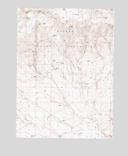
Payne Creek, OR USGS Topographic Map
Click on map above to begin viewing in our Map Viewer.

This topographic map contains these locations and features:
Feature Name Type Latitude Longitude GNIS ID View Map
Beaver Log SpringSpringN42.1156°W118.0122°1134196View Map
Beaver ReservoirReservoirN42.0745°W118.0782°1134184View Map
Cherokee CanyonValleyN42.0907°W118.0996°1134194View Map
Cherokee CreekStreamN42.0054°W118.0174°1118846View Map
Cow CampLocaleN42.1202°W118.0910°1160577View Map
Dry CreekStreamN42.0218°W118.1190°1134198View Map
Dry DrawValleyN42.0318°W118.0593°1134193View Map
Dry Draw ReservoirReservoirN42.0320°W118.0664°1134202View Map
East Mine CreekStreamN42.0596°W118.0452°1133197View Map
Fifteenmile ReservoirReservoirN42.1147°W118.1093°1134188View Map
Gopher SpringSpringN42.1241°W118.0999°1134191View Map
Grove SpringSpringN42.1147°W118.0740°1133160View Map
Hot CreekStreamN42.0438°W118.0779°1130435View Map
Lasa CanyonValleyN42.0832°W118.0054°1134197View Map
Lasa CreekStreamN42.0563°W118.0196°1134215View Map
Lasa PlaceLocaleN42.0777°W118.0024°1160578View Map
Long Ridge ReservoirReservoirN42.0691°W118.1099°1134186View Map
Mahogany SpringSpringN42.1102°W118.0919°1134189View Map
McDermitt Creek ReservoirReservoirN42.0016°W118.1057°1134179View Map
Mine CreekStreamN42.0227°W118.0302°1133199View Map
Opal ReservoirReservoirN42.0602°W118.1029°1160576View Map
Opalite MineMineN42.0524°W118.0352°1134181View Map
Payne CreekStreamN42.0060°W118.0310°1125248View Map
Rattlesnake CanyonValleyN42.0471°W118.0446°1134195View Map
Riser CreekStreamN42.0079°W118.0843°1126047View Map
Riser CreekStreamN42.0054°W118.0171°847468View Map
Rose Spring Number 1SpringN42.0671°W118.0743°1134182View Map
Rose Spring Number 2SpringN42.0664°W118.0773°1134183View Map
Sage CreekStreamN42.0027°W118.0552°861223View Map
Sheepline Canyon SpringSpringN42.1190°W118.0458°1134192View Map
Turner CreekStreamN42.0163°W118.1085°1134199View Map
Turner RanchLocaleN42.0141°W118.1093°1134201View Map
West Cherokee ReservoirReservoirN42.0985°W118.0794°1134190View Map
West Mine CreekStreamN42.0596°W118.0452°1133201View Map
West Mine ReservoirReservoirN42.0726°W118.0642°1134185View Map
Zimmerman RanchLocaleN42.0013°W118.0696°1134180View Map

Note: Coordinates in the location and feature list above are referenced to NAD83 datum.


Copyright (C) 2008-2025 Ryan Niemi / Sunset Dynamics ... All Rights Reserved