TopoQuest Logo
Do you find TopoQuest useful?
Help keep TopoQuest running and adding new maps/features by donating!
Bitcoin:  19c7KJd3qBynnjoSw5npx9KScwjBe4ifkT
Litecoin:  LXs6TkuXGGXo1vDsWCkWVdjQX94eUKd6ui
Home View Maps Find Maps Find Places Resources & Links


Peach Orchard Flat, Wyoming Topographic Map

USGS Map Title: Peach Orchard Flat, WY
USGS Map MRC: 41107B6
DRG (GeoTIFF) Download: o41107b6.tif


Neighboring USGS Topographic Map Quads:


  Mexican Flats, WY  
41107C7
 

  Blue Gap, WY  
41107C6
 

  Garden Gulch, WY  
41107C5
 

  Flat Top Mountain, WY  
41107B7
 

  Peach Orchard Flat, WY  
41107B6
 

  Smiley Draw, WY  
41107B5
 

  Poison Basin, WY  
41107A7
 

  Baggs, WY  
41107A6
 

  Dixon, WY  
41107A5


Map MRC Location:

N42°
W108°
N42°
W107°
H8 H7 H6 H5 H4 H3 H2 H1
G8 G7 G6 G5 G4 G3 G2 G1
F8 F7 F6 F5 F4 F3 F2 F1
E8 E7 E6 E5 E4 E3 E2 E1
D8 D7 D6 D5 D4 D3 D2 D1
C8 C7 C6 C5 C4 C3 C2 C1
B8 B7 B6 B5 B4 B3 B2 B1
A8 A7 A6 A5 A4 A3 A2 A1
N41°
W108°
N41°
W107°

Peach Orchard Flat, WY USGS 1:24K Topographic Map Preview:
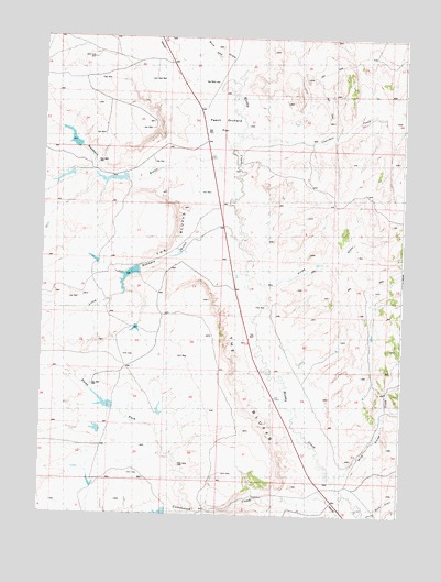
Peach Orchard Flat, WY USGS Topographic Map
Click on map above to begin viewing in our Map Viewer.

This topographic map contains these locations and features:
Feature Name Type Latitude Longitude GNIS ID View Map
Blue Gap DrawValleyN41.2419°W107.6820°1585678View Map
Cherokee CreekStreamN41.2241°W107.6823°1586601View Map
Cottonwood CreekStreamN41.1291°W107.6445°1587027View Map
Detention Dam 1392 Number 2ReservoirN41.1253°W107.7082°1608345View Map
Detention Dam 1492 Number 3DamN41.1516°W107.7090°1608350View Map
Detention Dam 1492 Number 3ReservoirN41.1521°W107.7089°1608351View Map
Detention Dam 1492 Number 4DamN41.1466°W107.7290°1608352View Map
Detention Dam 1492 Number 4ReservoirN41.1471°W107.7303°1608353View Map
Detention Dam 1492 Number 6DamN41.2133°W107.7406°1608356View Map
Detention Dam 1492 Number 6ReservoirN41.2131°W107.7427°1608357View Map
Detention Dam 1592 Number 1DamN41.2200°W107.7373°1608364View Map
Detention Dam 1592 Number 1ReservoirN41.2232°W107.7401°1608365View Map
Detention Reservoir 1492 Number 2ReservoirN41.1540°W107.7280°1608349View Map
Detention Reservoir 1492 Number 2 DamDamN41.1516°W107.7256°1608348View Map
Little Robber Detention DamDamN41.1883°W107.7173°1608374View Map
Little Robber Detention DamReservoirN41.1873°W107.7202°1608375View Map
Little Robbers GulchValleyN41.1969°W107.6845°1590859View Map
North Fork Cottonwood CreekStreamN41.1258°W107.6976°1592161View Map
Peach Orchard FlatFlatN41.2297°W107.6901°1592636View Map
Pines DrawValleyN41.1869°W107.6703°1592821View Map
Robbers GulchValleyN41.2005°W107.6826°1593517View Map
White Rock DrawValleyN41.1264°W107.6337°1596317View Map
Wild Horse DrawValleyN41.1375°W107.6445°1596366View Map

Note: Coordinates in the location and feature list above are referenced to NAD83 datum.


Copyright (C) 2008-2025 Ryan Niemi / Sunset Dynamics ... All Rights Reserved