TopoQuest Logo
Do you find TopoQuest useful?
Help keep TopoQuest running and adding new maps/features by donating!
Bitcoin:  19c7KJd3qBynnjoSw5npx9KScwjBe4ifkT
Litecoin:  LXs6TkuXGGXo1vDsWCkWVdjQX94eUKd6ui
Home View Maps Find Maps Find Places Resources & Links


Pecatonica, Illinois Topographic Map

USGS Map Title: Pecatonica, IL
USGS Map MRC: 42089C3
DRG (GeoTIFF) Download: o42089c3.tif


Neighboring USGS Topographic Map Quads:


  Davis, IL  
42089D4
 

  Durand, IL  
42089D3
 

  Shirland, IL  
42089D2
 

  Ridott, IL  
42089C4
 

  Pecatonica, IL  
42089C3
 

  Winnebago, IL  
42089C2
 

  German Valley, IL  
42089B4
 

  Seward, IL  
42089B3
 

  Kishwaukee, IL  
42089B2


Map MRC Location:

N43°
W90°
N43°
W89°
H8 H7 H6 H5 H4 H3 H2 H1
G8 G7 G6 G5 G4 G3 G2 G1
F8 F7 F6 F5 F4 F3 F2 F1
E8 E7 E6 E5 E4 E3 E2 E1
D8 D7 D6 D5 D4 D3 D2 D1
C8 C7 C6 C5 C4 C3 C2 C1
B8 B7 B6 B5 B4 B3 B2 B1
A8 A7 A6 A5 A4 A3 A2 A1
N42°
W90°
N42°
W89°

Pecatonica, IL USGS 1:24K Topographic Map Preview:
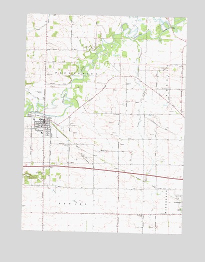
Pecatonica, IL USGS Topographic Map
Click on map above to begin viewing in our Map Viewer.

This topographic map contains these locations and features:
Feature Name Type Latitude Longitude GNIS ID View Map
Bailey School (historical)SchoolN42.3322°W89.2729°423916View Map
Brick School (historical)SchoolN42.3545°W89.3593°423921View Map
Burch School (historical)SchoolN42.2764°W89.3590°423922View Map
Carlson RLA AirportAirportN42.3358°W89.3210°2679076View Map
Coolidge CreekStreamN42.3609°W89.2923°406513View Map
Elton School (historical)SchoolN42.3745°W89.3304°423933View Map
First Baptist ChurchChurchN42.3092°W89.3582°1967808View Map
First Congregational ChurchChurchN42.3109°W89.3612°1967809View Map
First Lutheran ChurchChurchN42.3109°W89.3568°1967810View Map
Illinois State Police District 16BuildingN42.2866°W89.3581°1811277View Map
John Eaton QuarryMineN42.3125°W89.3362°1968173View Map
O'Connor FieldAirportN42.3686°W89.3530°2679075View Map
PecatonicaPopulated PlaceN42.3139°W89.3593°415501View Map
Pecatonica Bottoms Nature PreserveParkN42.3561°W89.3187°2054039View Map
Pecatonica Elementary SchoolSchoolN42.3103°W89.3615°1811312View Map
Pecatonica Fire Protection DistrictBuildingN42.3041°W89.3598°2640345View Map
Pecatonica High SchoolSchoolN42.3064°W89.3612°1811314View Map
Pecatonica Police DepartmentBuildingN42.3137°W89.3597°2757027View Map
Pecatonica Post OfficePost OfficeN42.3142°W89.3586°1967807View Map
Pecatonica Public LibraryBuildingN42.3136°W89.3598°1967811View Map
Pecatonica United Methodist ChurchChurchN42.3120°W89.3579°1967812View Map
Saint Marys Catholic ChurchChurchN42.3117°W89.3604°1967813View Map
Saunders School (historical)SchoolN42.3114°W89.3012°423960View Map
Seward Forest PreserveParkN42.2809°W89.3668°1811330View Map
Sheldon School (historical)SchoolN42.2611°W89.2998°423961View Map
Shiloh Quarry Number 125MineN42.3070°W89.3362°1968237View Map
Smith School (historical)SchoolN42.3045°W89.2621°423962View Map
Sumner ParkParkN42.3164°W89.3643°1967814View Map
Thompson CemeteryCemeteryN42.3359°W89.2965°419670View Map
Township of PecatonicaCivilN42.3324°W89.3396°429540View Map
Trask BridgeBridgeN42.3692°W89.2623°425565View Map
Trask Bridge Forest PreserveParkN42.3683°W89.2654°1811338View Map
Twelve Mile Grove CemeteryCemeteryN42.2834°W89.3582°419970View Map
Twelvemile Grove Church (historical)ChurchN42.2820°W89.3593°423967View Map
Village of PecatonicaCivilN42.3086°W89.3579°2399642View Map
Watson School (historical)SchoolN42.3400°W89.2959°423970View Map
Winnebago County FairgroundsLocaleN42.3167°W89.3690°1967815View Map
Wright School (historical)SchoolN42.2750°W89.3098°423975View Map

Note: Coordinates in the location and feature list above are referenced to NAD83 datum.


Copyright (C) 2008-2025 Ryan Niemi / Sunset Dynamics ... All Rights Reserved