TopoQuest Logo
Do you find TopoQuest useful?
Help keep TopoQuest running and adding new maps/features by donating!
Bitcoin:  19c7KJd3qBynnjoSw5npx9KScwjBe4ifkT
Litecoin:  LXs6TkuXGGXo1vDsWCkWVdjQX94eUKd6ui
Home View Maps Find Maps Find Places Resources & Links


Pelican Pass, Louisiana Topographic Map

USGS Map Title: Pelican Pass, LA
USGS Map MRC: 29090B3
DRG (GeoTIFF) Download: o29090b3.tif


Neighboring USGS Topographic Map Quads:


  Lake Felicity, LA  
29090C4
 

  Bay Courant, LA  
29090C3
 

  Mink Bayou, LA  
29090C2
 

  Jacko Bay, LA  
29090B4
 

  Pelican Pass, LA  
29090B3
 

  Leeville, LA  
29090B2
 

  Timbalier Island, LA  
29090A4
 

  Calumet Island, LA  
29090A3
 

  Belle Pass, LA  
29090A2


Map MRC Location:

N30°
W91°
N30°
W90°
H8 H7 H6 H5 H4 H3 H2 H1
G8 G7 G6 G5 G4 G3 G2 G1
F8 F7 F6 F5 F4 F3 F2 F1
E8 E7 E6 E5 E4 E3 E2 E1
D8 D7 D6 D5 D4 D3 D2 D1
C8 C7 C6 C5 C4 C3 C2 C1
B8 B7 B6 B5 B4 B3 B2 B1
A8 A7 A6 A5 A4 A3 A2 A1
N29°
W91°
N29°
W90°

Pelican Pass, LA USGS 1:24K Topographic Map Preview:
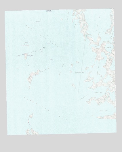
Pelican Pass, LA USGS Topographic Map
Click on map above to begin viewing in our Map Viewer.

This topographic map contains these locations and features:
Feature Name Type Latitude Longitude GNIS ID View Map
Bayou BlueBayN29.2132°W90.2702°532453View Map
Bayou RosaBayN29.2393°W90.2909°532756View Map
Capon PointCapeN29.1888°W90.3226°533761View Map
Coal Tar BayBayN29.2491°W90.3037°534011View Map
Deep BayouGutN29.2227°W90.2820°534444View Map
Deep BayouBayN29.2212°W90.2815°534445View Map
Devils BayBayN29.1496°W90.2638°534515View Map
Devils IslandIslandN29.1427°W90.2781°534518View Map
Jacko Camp BayBayN29.1852°W90.2901°535981View Map
Lake Barre Oil and Gas FieldOilfieldN29.2075°W90.3426°2013797View Map
Lake RaccourciBayN29.2327°W90.3504°536295View Map
Landry BayBayN29.1886°W90.2687°536320View Map
Little LakeBayN29.2405°W90.2691°536570View Map
Northwest IslandIslandN29.2066°W90.3495°537756View Map
Pearl BayouBayN29.1651°W90.2596°538033View Map
Pelican PassChannelN29.1886°W90.3112°538053View Map
Philo Brice IslandsIslandN29.1852°W90.3420°538111View Map
Pickett BayBayN29.2110°W90.2565°538117View Map
Pierle BayBayN29.1664°W90.2698°538123View Map
Rosa BayBayN29.2363°W90.2942°538703View Map
Shallow BayouBayN29.1475°W90.3470°539291View Map
Timbalier BayBayN29.1619°W90.3481°539939View Map
Wrong Name PassChannelN29.1619°W90.2884°540547View Map

Note: Coordinates in the location and feature list above are referenced to NAD83 datum.


Copyright (C) 2008-2024 Ryan Niemi / Sunset Dynamics ... All Rights Reserved