TopoQuest Logo
Do you find TopoQuest useful?
Help keep TopoQuest running and adding new maps/features by donating!
Bitcoin:  19c7KJd3qBynnjoSw5npx9KScwjBe4ifkT
Litecoin:  LXs6TkuXGGXo1vDsWCkWVdjQX94eUKd6ui
Home View Maps Find Maps Find Places Resources & Links


Pembroke, Maine Topographic Map

USGS Map Title: Pembroke, ME
USGS Map MRC: 44067H2
DRG (GeoTIFF) Download: o44067h2.tif


Neighboring USGS Topographic Map Quads:


  Meddybemps Lake East, ME  
45067A3
 

  Red Beach, ME  
45067A2
 

  Robbinston, ME  
45067A1
 

  Porcupine Mountain, ME  
44067H3
 

  Pembroke, ME  
44067H2
 

  Eastport, ME  
44066H8
 

  Long Lake, ME  
44067G3
 

  Whiting, ME  
44067G2
 

  West Lubec, ME  
44067G1


Map MRC Location:

N45°
W68°
N45°
W67°
H8 H7 H6 H5 H4 H3 H2 H1
G8 G7 G6 G5 G4 G3 G2 G1
F8 F7 F6 F5 F4 F3 F2 F1
E8 E7 E6 E5 E4 E3 E2 E1
D8 D7 D6 D5 D4 D3 D2 D1
C8 C7 C6 C5 C4 C3 C2 C1
B8 B7 B6 B5 B4 B3 B2 B1
A8 A7 A6 A5 A4 A3 A2 A1
N44°
W68°
N44°
W67°

Pembroke, ME USGS 1:24K Topographic Map Preview:
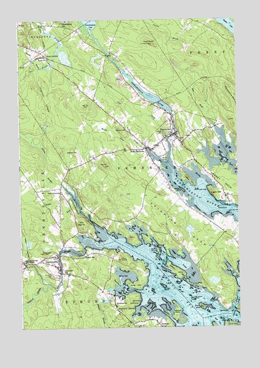
Pembroke, ME USGS Topographic Map
Click on map above to begin viewing in our Map Viewer.

This topographic map contains these locations and features:
Feature Name Type Latitude Longitude GNIS ID View Map
AyersPopulated PlaceN44.9845°W67.2380°579114View Map
Ayers Post OfficePost OfficeN44.9015°W67.2369°1909127View Map
Bellier CoveBayN44.8954°W67.1933°562025View Map
Big HillSummitN44.9646°W67.2116°562178View Map
Burnt IslandIslandN44.9065°W67.1717°563244View Map
Cathance StreamStreamN44.8931°W67.2342°563694View Map
Chandler BrookStreamN44.9809°W67.2380°563816View Map
Clark PointCapeN44.9070°W67.2153°564046View Map
Clarksdale School (historical)SchoolN44.9129°W67.1333°1909109View Map
Cobscook FallsChannelN44.8837°W67.1272°564131View Map
Coggins HeadSummitN44.9287°W67.1394°564167View Map
Crossroad School (historical)SchoolN44.9679°W67.2047°1909126View Map
Crow BrookStreamN44.9520°W67.1655°564588View Map
Dennys BayBayN44.8876°W67.1592°565049View Map
Dennys RiverStreamN44.9098°W67.1980°581318View Map
DennysvillePopulated PlaceN44.9037°W67.2286°565050View Map
Dennysville CemeteryCemeteryN44.8962°W67.2319°565051View Map
Dennysville Historic DistrictParkN44.9009°W67.2278°1909137View Map
Dennysville Post OfficePost OfficeN44.9006°W67.2275°1909138View Map
Dennysville StationLocaleN44.9023°W67.2467°565052View Map
Dennysville Volunteer Fire and Rescue DepartmentBuildingN44.9039°W67.2333°2552727View Map
Dennysville Volunteer RescueBuildingN44.9039°W67.2333°2666747View Map
Dram IslandIslandN44.8834°W67.1469°565277View Map
Duck HarborBayN44.8898°W67.1872°565337View Map
Eastman HillSummitN44.9457°W67.2185°565744View Map
Edmunds Consolidated SchoolSchoolN44.8956°W67.2237°570603View Map
Forest Hill CemeteryCemeteryN44.9537°W67.1670°568080View Map
Hardscrabble RiverStreamN44.9029°W67.1778°581433View Map
Hardy PointCapeN44.9426°W67.1669°567636View Map
Hersey CoveBayN44.9345°W67.1455°567975View Map
Hersey NeckCapeN44.9301°W67.1278°567980View Map
Hersey PointCapeN44.9342°W67.1528°567981View Map
Herseys Upper LedgeBarN44.9309°W67.1483°567983View Map
Hobart StreamStreamN44.8884°W67.1964°568119View Map
Hunkley PointCapeN44.9112°W67.2064°580782View Map
Hurley PointCapeN44.8915°W67.1847°568497View Map
Imnarkuan (historical)Populated PlaceN44.9537°W67.1619°1909211View Map
Ironworks MountainSummitN44.9902°W67.1732°568680View Map
King David HillSummitN44.9051°W67.2366°569197View Map
Knowltons Seashore CampgroundLocaleN44.9401°W67.1258°1909226View Map
Leighton LedgesSummitN44.9679°W67.2347°569468View Map
Leighton NeckCapeN44.9037°W67.1355°569469View Map
Lincoln Memorial LibraryBuildingN44.9041°W67.2290°2738495View Map
Little Dram IslandIslandN44.8865°W67.1522°569751View Map
Lower DennysvillePopulated PlaceN44.9298°W67.2269°570493View Map
Lower River DamDamN44.9611°W67.1612°1774057View Map
Mahar PointCapeN44.8820°W67.1325°570658View Map
Meadow BrookStreamN44.9520°W67.1861°571061View Map
Meadow BrookStreamN44.9284°W67.2205°571090View Map
Meadow MountainSummitN44.9560°W67.1927°571096View Map
Middle GroundBarN44.9237°W67.1355°571243View Map
Mount DorcasSummitN44.9029°W67.1922°565212View Map
Oak HillSummitN44.9409°W67.2009°572592View Map
Ox CoveBayN44.9141°W67.1826°572891View Map
Page HillSummitN44.9180°W67.2159°572920View Map
PembrokePopulated PlaceN44.9537°W67.1619°573149View Map
Pembroke Cottage DamDamN44.9626°W67.1615°1774715View Map
Pembroke Elementary SchoolSchoolN44.9413°W67.2186°1909298View Map
Pembroke Library AssociationBuildingN44.9511°W67.1670°2738503View Map
Pembroke Post OfficePost OfficeN44.9496°W67.1782°1909299View Map
Pembroke Volunteer Fire DepartmentBuildingN44.9539°W67.1623°2552750View Map
Pennamaquan LakeReservoirN44.9851°W67.1974°581369View Map
Pennamaquan River DamDamN44.9851°W67.1974°1774235View Map
Preston SchoolSchoolN44.9037°W67.2136°573798View Map
Reversing Falls ParkParkN44.8917°W67.1272°1909322View Map
Reynolds PointCapeN44.8920°W67.1947°574152View Map
Sal Seal IslandIslandN44.8915°W67.1683°574755View Map
Sipp BrookStreamN44.9559°W67.1369°575495View Map
Smalls IslandIslandN44.9306°W67.1572°575572View Map
Town of PembrokeCivilN44.9419°W67.1722°582667View Map
Township of TrescottCivilN44.8834°W67.1328°1873777View Map
Two Hour RockIslandN44.9217°W67.1297°577505View Map
West PembrokePopulated PlaceN44.9476°W67.1780°578189View Map
Wilbur NeckCapeN44.8979°W67.1608°578462View Map
Williams IslandIslandN44.8806°W67.1605°580778View Map
Willow BrookStreamN44.9462°W67.1761°578532View Map
Wilson StreamStreamN44.9337°W67.2261°581509View Map
Youngs CoveBayN44.8979°W67.1542°578801View Map

Note: Coordinates in the location and feature list above are referenced to NAD83 datum.


Copyright (C) 2008-2025 Ryan Niemi / Sunset Dynamics ... All Rights Reserved