TopoQuest Logo
Do you find TopoQuest useful?
Help keep TopoQuest running and adding new maps/features by donating!
Bitcoin:  19c7KJd3qBynnjoSw5npx9KScwjBe4ifkT
Litecoin:  LXs6TkuXGGXo1vDsWCkWVdjQX94eUKd6ui
Home View Maps Find Maps Find Places Resources & Links


Perrysburg, New York Topographic Map

USGS Map Title: Perrysburg, NY
USGS Map MRC: 42079D1
DRG (GeoTIFF) Download: o42079d1.tif


Neighboring USGS Topographic Map Quads:


  Silver Creek, NY  
42079E2
 

  Farnham, NY  
42079E1
 

  North Collins, NY  
42078E8
 

  Forestville, NY  
42079D2
 

  Perrysburg, NY  
42079D1
 

  Gowanda, NY  
42078D8
 

  Hamlet, NY  
42079C2
 

  Cherry Creek, NY  
42079C1
 

  New Albion, NY  
42078C8


Map MRC Location:

N43°
W80°
N43°
W79°
H8 H7 H6 H5 H4 H3 H2 H1
G8 G7 G6 G5 G4 G3 G2 G1
F8 F7 F6 F5 F4 F3 F2 F1
E8 E7 E6 E5 E4 E3 E2 E1
D8 D7 D6 D5 D4 D3 D2 D1
C8 C7 C6 C5 C4 C3 C2 C1
B8 B7 B6 B5 B4 B3 B2 B1
A8 A7 A6 A5 A4 A3 A2 A1
N42°
W80°
N42°
W79°

Perrysburg, NY USGS 1:24K Topographic Map Preview:
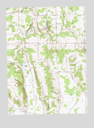
Perrysburg, NY USGS Topographic Map
Click on map above to begin viewing in our Map Viewer.

This topographic map contains these locations and features:
Feature Name Type Latitude Longitude GNIS ID View Map
BalltownPopulated PlaceN42.4906°W79.0764°942937View Map
Balltown CemeteryCemeteryN42.4908°W79.0753°2554259View Map
Blueberry Hill Farm And GreenhouseLocaleN42.4422°W79.0742°2542386View Map
Butcher Crest FarmLocaleN42.3753°W79.1233°2704014View Map
CottagePopulated PlaceN42.4239°W79.0442°947513View Map
Cottage CemeteryCemeteryN42.4241°W79.0350°947514View Map
East Mud LakeLakeN42.4331°W79.0978°949184View Map
H and H Aviation Service Incorporated HeliportAirportN42.4834°W79.0773°978018View Map
Hanova Hill FarmLocaleN42.4347°W79.1094°2516349View Map
Johnson CreekStreamN42.3770°W79.0206°954116View Map
MarkhamsPopulated PlaceN42.3989°W79.0034°956538View Map
NashvillePopulated PlaceN42.4581°W79.0761°958275View Map
Parcells CornersPopulated PlaceN42.4578°W79.0967°959854View Map
PerrysburgPopulated PlaceN42.4564°W79.0020°960215View Map
Perrysburg - Dayton Methodist ChurchChurchN42.4561°W79.0039°2597431View Map
Perrysburg CemeteryCemeteryN42.4572°W79.0538°960213View Map
Perrysburg Census Designated PlaceCensusN42.4589°W79.0008°2745368View Map
Perrysburg Volunteer Fire CompanyBuildingN42.4567°W79.0024°2734677View Map
Rugg Town CemeteryCemeteryN42.4765°W79.0466°2554865View Map
School Number 1 (historical)SchoolN42.3784°W79.0964°974871View Map
School Number 3 (historical)SchoolN42.4909°W79.0764°975247View Map
School Number 4 (historical)SchoolN42.4556°W79.0767°975322View Map
School Number 6SchoolN42.3914°W79.0439°975461View Map
School Number 6SchoolN42.4903°W79.0467°975465View Map
Seventh Day Adventist ChurchChurchN42.4641°W79.0017°2597447View Map
Silver Creek ReservoirReservoirN42.4685°W79.0932°965243View Map
Smith MillsPopulated PlaceN42.4951°W79.1056°965496View Map
Town of DaytonCivilN42.3912°W79.0024°978889View Map
Town of PerrysburgCivilN42.4740°W79.0125°979355View Map
Town of VillenovaCivilN42.3918°W79.1195°979587View Map
Tri County Country ClubLocaleN42.4605°W79.1033°2615076View Map
Village of PerrysburgCivilN42.4589°W79.0008°2391059View Map
Villenova CemeteryCemeteryN42.3764°W79.0970°968557View Map
WangoPopulated PlaceN42.4192°W79.0962°968759View Map
West PerrysburgPopulated PlaceN42.4798°W79.0467°973248View Map
Wheeler BrookStreamN42.4953°W79.0761°970997View Map
Wrights CornersLocaleN42.3787°W79.0989°971759View Map

Note: Coordinates in the location and feature list above are referenced to NAD83 datum.


Copyright (C) 2008-2025 Ryan Niemi / Sunset Dynamics ... All Rights Reserved