TopoQuest Logo
Do you find TopoQuest useful?
Help keep TopoQuest running and adding new maps/features by donating!
Bitcoin:  19c7KJd3qBynnjoSw5npx9KScwjBe4ifkT
Litecoin:  LXs6TkuXGGXo1vDsWCkWVdjQX94eUKd6ui
Home View Maps Find Maps Find Places Resources & Links


Perryton, Texas Topographic Map

USGS Map Title: Perryton, TX
USGS Map MRC: 36100D7
DRG (GeoTIFF) Download: o36100d7.tif


Neighboring USGS Topographic Map Quads:


  Bryans Corner SW, OK  
36100E8
 

  Bryans Corner, OK  
36100E7
 

  Balko SW, OK  
36100E6
 

  Perryton NW, TX  
36100D8
 

  Perryton, TX  
36100D7
 

  Huntoon, TX  
36100D6
 

  Farnsworth, TX  
36100C8
 

  Perryton SE, TX  
36100C7
 

  Booker SW, TX  
36100C6


Map MRC Location:

N37°
W101°
N37°
W100°
H8 H7 H6 H5 H4 H3 H2 H1
G8 G7 G6 G5 G4 G3 G2 G1
F8 F7 F6 F5 F4 F3 F2 F1
E8 E7 E6 E5 E4 E3 E2 E1
D8 D7 D6 D5 D4 D3 D2 D1
C8 C7 C6 C5 C4 C3 C2 C1
B8 B7 B6 B5 B4 B3 B2 B1
A8 A7 A6 A5 A4 A3 A2 A1
N36°
W101°
N36°
W100°

Perryton, TX USGS 1:24K Topographic Map Preview:
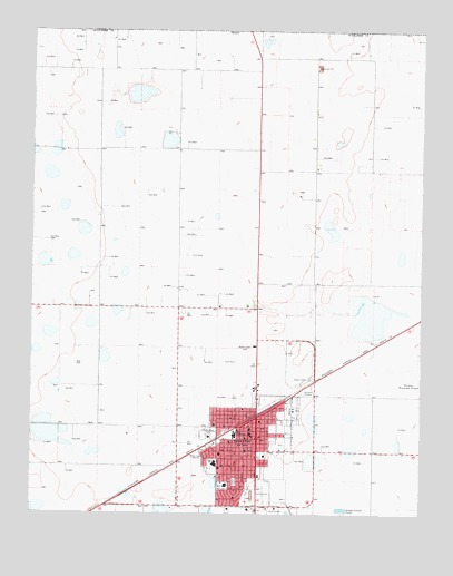
Perryton, TX USGS Topographic Map
Click on map above to begin viewing in our Map Viewer.

This topographic map contains these locations and features:
Feature Name Type Latitude Longitude GNIS ID View Map
Central Junior High SchoolSchoolN36.3956°W100.8063°1354225View Map
Church of ChristChurchN36.3873°W100.8154°2022919View Map
Church of the NazareneChurchN36.3953°W100.8040°2022920View Map
City of PerrytonCivilN36.3931°W100.7974°2411406View Map
First Baptist ChurchChurchN36.3884°W100.8196°2022916View Map
James L Wright Elementary SchoolSchoolN36.3825°W100.8123°2008180View Map
Key Heights Baptist ChurchChurchN36.3984°W100.8165°2022917View Map
KEYE-AM (Perryton)TowerN36.3889°W100.8274°1385658View Map
Leatherman ParkParkN36.3948°W100.8182°1361027View Map
Museum of the PlainsBuildingN36.4139°W100.8029°2014514View Map
Ochiltree County CourthouseBuildingN36.3953°W100.8032°2030566View Map
Ochiltree County JailBuildingN36.3946°W100.8017°2738809View Map
Ochiltree County Sheriffs OfficeBuildingN36.3947°W100.8017°2750480View Map
PerrytonPopulated PlaceN36.4000°W100.8027°1365089View Map
Perryton City HallBuildingN36.3989°W100.8017°2754039View Map
Perryton Fire and Emergency Medical ServicesBuildingN36.3988°W100.8018°2552118View Map
Perryton High SchoolSchoolN36.3882°W100.8162°2008181View Map
Perryton Junior High SchoolSchoolN36.3952°W100.8098°2008182View Map
Perryton Kinder SchoolSchoolN36.3963°W100.8099°2008179View Map
Perryton Police DepartmentBuildingN36.3988°W100.8016°2750306View Map
Plainview Hardware Company BuildingBuildingN36.3981°W100.8032°2031727View Map
Southside Baptist ChurchChurchN36.3792°W100.8090°2022918View Map
Stark ParkParkN36.3831°W100.8102°1369122View Map
United Pentecostal ChurchChurchN36.4006°W100.7965°2022921View Map

Note: Coordinates in the location and feature list above are referenced to NAD83 datum.


Copyright (C) 2008-2025 Ryan Niemi / Sunset Dynamics ... All Rights Reserved