TopoQuest Logo
Do you find TopoQuest useful?
Help keep TopoQuest running and adding new maps/features by donating!
Bitcoin:  19c7KJd3qBynnjoSw5npx9KScwjBe4ifkT
Litecoin:  LXs6TkuXGGXo1vDsWCkWVdjQX94eUKd6ui
Home View Maps Find Maps Find Places Resources & Links


Petersburg, Nebraska Topographic Map

USGS Map Title: Petersburg, NE
USGS Map MRC: 41098G1
DRG (GeoTIFF) Download: o41098g1.tif


Neighboring USGS Topographic Map Quads:


  Elgin NW, NE  
41098H2
 

  Elgin, NE  
41098H1
 

  Closter, NE  
41097H8
 

  Elgin SW, NE  
41098G2
 

  Petersburg, NE  
41098G1
 

  Closter SW, NE  
41097G8
 

  Akron, NE  
41098F2
 

  Albion West, NE  
41098F1
 

  Albion East, NE  
41097F8


Map MRC Location:

N42°
W99°
N42°
W98°
H8 H7 H6 H5 H4 H3 H2 H1
G8 G7 G6 G5 G4 G3 G2 G1
F8 F7 F6 F5 F4 F3 F2 F1
E8 E7 E6 E5 E4 E3 E2 E1
D8 D7 D6 D5 D4 D3 D2 D1
C8 C7 C6 C5 C4 C3 C2 C1
B8 B7 B6 B5 B4 B3 B2 B1
A8 A7 A6 A5 A4 A3 A2 A1
N41°
W99°
N41°
W98°

Petersburg, NE USGS 1:24K Topographic Map Preview:
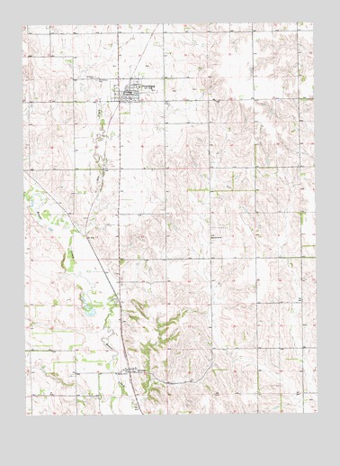
Petersburg, NE USGS Topographic Map
Click on map above to begin viewing in our Map Viewer.

This topographic map contains these locations and features:
Feature Name Type Latitude Longitude GNIS ID View Map
Central Farmers Cooperative ElevatorLocaleN41.8533°W98.0787°1880795View Map
Logan Fontenelle Historical MarkerParkN41.8564°W98.0820°1880792View Map
LorettoPopulated PlaceN41.7647°W98.0806°830894View Map
Loretto (historical)LocaleN41.7647°W98.0806°1880711View Map
Loretto Census Designated PlaceCensusN41.7634°W98.0817°2612512View Map
Loretto Post Office (historical)Post OfficeN41.7647°W98.0806°1880712View Map
Mount Pleasant CemeteryCemeteryN41.8569°W98.0928°831478View Map
North Manchester Election PrecinctCivilN41.7517°W98.0122°1929105View Map
PetersburgPopulated PlaceN41.8533°W98.0787°832053View Map
Petersburg (historical)LocaleN41.8536°W98.0817°1880801View Map
Petersburg City ParkParkN41.8564°W98.0820°1880803View Map
Petersburg ElevatorLocaleN41.8533°W98.0809°1880796View Map
Petersburg Police DepartmentBuildingN41.8533°W98.0787°1880793View Map
Petersburg Post OfficePost OfficeN41.8537°W98.0804°1880802View Map
Petersburg Public LibraryBuildingN41.8533°W98.0787°1880794View Map
Petersburg Public SchoolsSchoolN41.8511°W98.0790°1880798View Map
Petersburg Volunteer Fire DepartmentBuildingN41.8533°W98.0791°1880797View Map
Rae CreekStreamN41.8100°W98.1015°832436View Map
Saint John the Baptist Catholic ChurchChurchN41.8545°W98.0745°1880799View Map
Saint John the Baptist Elementary SchoolSchoolN41.8547°W98.0762°1880800View Map
Saint Johns CemeteryCemeteryN41.8581°W98.0942°832905View Map
School Number 56 (historical)SchoolN41.8064°W98.0445°836883View Map
Spieker DamDamN41.8217°W98.0970°1767117View Map
Spieker ReservoirReservoirN41.8217°W98.0970°1767118View Map
Village of PetersburgCivilN41.8536°W98.0811°2399659View Map

Note: Coordinates in the location and feature list above are referenced to NAD83 datum.


Copyright (C) 2008-2025 Ryan Niemi / Sunset Dynamics ... All Rights Reserved