TopoQuest Logo
Do you find TopoQuest useful?
Help keep TopoQuest running and adding new maps/features by donating!
Bitcoin:  19c7KJd3qBynnjoSw5npx9KScwjBe4ifkT
Litecoin:  LXs6TkuXGGXo1vDsWCkWVdjQX94eUKd6ui
Home View Maps Find Maps Find Places Resources & Links


Phippsburg, Maine Topographic Map

USGS Map Title: Phippsburg, ME
USGS Map MRC: 43069G7
DRG (GeoTIFF) Download: o43069g7.tif


Neighboring USGS Topographic Map Quads:


  Brunswick, ME  
43069H8
 

  Bath, ME  
43069H7
 

  Westport, ME  
43069H6
 

  Orrs Island, ME  
43069G8
 

  Phippsburg, ME  
43069G7
 

  Boothbay Harbor, ME  
43069G6
 

  Bailey Island, ME  
43069F8
 

  Small Point, ME  
43069F7


Map MRC Location:

N44°
W70°
N44°
W69°
H8 H7 H6 H5 H4 H3 H2 H1
G8 G7 G6 G5 G4 G3 G2 G1
F8 F7 F6 F5 F4 F3 F2 F1
E8 E7 E6 E5 E4 E3 E2 E1
D8 D7 D6 D5 D4 D3 D2 D1
C8 C7 C6 C5 C4 C3 C2 C1
B8 B7 B6 B5 B4 B3 B2 B1
A8 A7 A6 A5 A4 A3 A2 A1
N43°
W70°
N43°
W69°

Phippsburg, ME USGS 1:24K Topographic Map Preview:
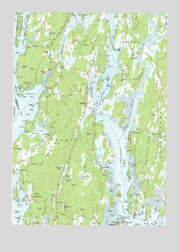
Phippsburg, ME USGS Topographic Map
Click on map above to begin viewing in our Map Viewer.

This topographic map contains these locations and features:
Feature Name Type Latitude Longitude GNIS ID View Map
Albert F Totman LibraryBuildingN43.8199°W69.8129°2738433View Map
ArrowsicPopulated PlaceN43.8498°W69.7781°579106View Map
Arrowsic-Georgetown BridgeBridgeN43.8348°W69.7717°1907756View Map
AshdalePopulated PlaceN43.7676°W69.8389°561323View Map
Atkins BayBayN43.7545°W69.7950°561332View Map
Back CoveBayN43.8723°W69.8734°561405View Map
Back RiverStreamN43.8015°W69.7864°561414View Map
Bald HeadCapeN43.8084°W69.7873°561495View Map
Barlett CemeteryCemeteryN43.7876°W69.8678°561612View Map
Basin IslandIslandN43.8029°W69.8653°1907758View Map
Basin PointCapeN43.8112°W69.8631°561690View Map
Batchelder HillSummitN43.8015°W69.8459°561716View Map
Bay CreekStreamN43.7723°W69.7537°1907770View Map
Bay PointPopulated PlaceN43.7565°W69.7748°561746View Map
Birch PointCapeN43.8265°W69.8698°562325View Map
Birchwood PondLakeN43.8337°W69.8616°562361View Map
Blaisdell PondLakeN43.7765°W69.8316°562544View Map
Bluff HeadCapeN43.8542°W69.7937°562613View Map
Bowie HillSummitN43.7593°W69.8159°562800View Map
Bowker CemeteryCemeteryN43.8273°W69.8379°2736970View Map
Bragdon RockBarN43.8506°W69.8728°562875View Map
Bridge HillSummitN43.8036°W69.8110°562952View Map
Brighams CoveBayN43.8367°W69.8467°562966View Map
Brighams CovePopulated PlaceN43.8395°W69.8478°562967View Map
BrightwaterPopulated PlaceN43.8051°W69.8603°579153View Map
Burnt Coat IslandIslandN43.7540°W69.8678°563225View Map
Bushy IslandIslandN43.8204°W69.8581°563287View Map
Butler CemeteryCemeteryN43.8361°W69.8151°2736973View Map
Campbell PondLakeN43.8514°W69.8461°563440View Map
Clark CemeteryCemeteryN43.7604°W69.7795°2736974View Map
Clifford CemeteryCemeteryN43.8578°W69.8232°2736975View Map
Cox HeadSummitN43.7674°W69.7875°564434View Map
Crow IslandsIslandN43.8065°W69.7831°579959View Map
Cushman HillSummitN43.7595°W69.8503°580295View Map
Cutting CemeteryCemeteryN43.8409°W69.8129°2736976View Map
Cutting CreekStreamN43.8365°W69.8106°564715View Map
Dam CoveBayN43.8579°W69.8634°564747View Map
Dam Cove CreekStreamN43.8584°W69.8595°564748View Map
Denny Reed PointCapeN43.8031°W69.8537°565048View Map
Dix IslandIslandN43.7740°W69.7895°565130View Map
Dromore CemeteryCemeteryN43.8389°W69.8138°2736977View Map
Drummond CemeteryCemeteryN43.8095°W69.8095°565301View Map
Drummore BayBayN43.8323°W69.8092°565304View Map
Dry LedgesBarN43.7576°W69.8714°565314View Map
Duley PondLakeN43.7786°W69.8274°565392View Map
Eaton CemeteryCemeteryN43.8539°W69.8260°2736979View Map
Elbow HillSummitN43.8415°W69.8578°565826View Map
Elwell PointCapeN43.8079°W69.8659°565887View Map
Fisher EddyBayN43.8534°W69.7884°566230View Map
Fort Baldwin State Historic SiteParkN43.7509°W69.7906°1907802View Map
Fort PophamPopulated PlaceN43.7551°W69.7834°579320View Map
Fort Popham (historical)MilitaryN43.7547°W69.7839°1907804View Map
Fort Popham LighthouseLocaleN43.7548°W69.7823°1907805View Map
Fort Popham State Historic SiteParkN43.7548°W69.7834°1907806View Map
Fuller MountainSummitN43.8142°W69.8373°566648View Map
Georgetown Central SchoolSchoolN43.8009°W69.7562°1907808View Map
Georgetown Historical Society LibraryBuildingN43.8031°W69.7557°2738357View Map
Georgetown IslandIslandN43.8312°W69.7545°566751View Map
Georgetown Post OfficePost OfficeN43.8058°W69.7570°1907809View Map
Georgetown Volunteer Central Fire StationBuildingN43.8049°W69.7566°2552898View Map
Gilbert HeadCapeN43.7593°W69.7798°566780View Map
Gilman and Bliston CemeteryCemeteryN43.7706°W69.8384°1907810View Map
Goat IslandIslandN43.8215°W69.8059°566855View Map
Green PointCapeN43.8384°W69.7926°580294View Map
Hall HillSummitN43.8501°W69.7562°1907812View Map
Harbor IslandIslandN43.7690°W69.8706°567586View Map
Harbor Island PointCapeN43.7648°W69.8706°567593View Map
Harris CemeteryCemeteryN43.7918°W69.8648°567686View Map
Hatch PointCapeN43.7876°W69.7856°578912View Map
Heal EddyBayN43.7595°W69.7687°567855View Map
Hen IslandIslandN43.8176°W69.8589°567929View Map
Hen Island LedgeBarN43.8151°W69.8634°567935View Map
Higgins MountainSummitN43.8151°W69.7598°568007View Map
Hillside CemeteryCemeteryN43.7799°W69.8012°568069View Map
Houghton PondReservoirN43.8417°W69.8687°568347View Map
Houghton Pond DamDamN43.8441°W69.8689°1774360View Map
Hunnewell PointCapeN43.7551°W69.7839°581442View Map
Hutchins CemeteryCemeteryN43.8141°W69.8474°2736984View Map
Hutchins Small CemeteryCemeteryN43.8309°W69.8414°2736985View Map
Indian PointCapeN43.7529°W69.7570°568588View Map
Indian PointCapeN43.8437°W69.7973°568589View Map
Jack RockBarN43.7501°W69.7714°581788View Map
Jennys NubbleIslandN43.8254°W69.8667°568800View Map
Kelley Family CemeteryCemeteryN43.7817°W69.7981°2724904View Map
Kennebec PointCapeN43.7531°W69.7653°569109View Map
Lamb IslandIslandN43.7856°W69.7770°569338View Map
Lee CemeteryCemeteryN43.8553°W69.7999°2736988View Map
Lee Farm CemeteryCemeteryN43.8545°W69.7986°2736989View Map
Lee IslandIslandN43.8317°W69.8048°569454View Map
Lithgow Morse CemeteryCemeteryN43.8735°W69.8054°2736993View Map
Lithgow RockBarN43.8740°W69.7964°581802View Map
Little Cox HeadCapeN43.7590°W69.7934°569742View Map
Lombard CemeteryCemeteryN43.8727°W69.8512°2736994View Map
Long IslandIslandN43.7651°W69.7784°570211View Map
Long Island NarrowsChannelN43.7620°W69.7767°570223View Map
Marine CemeteryCemeteryN43.7834°W69.8303°570771View Map
Marr IslandIslandN43.7801°W69.7792°570792View Map
MarrtownPopulated PlaceN43.7945°W69.7814°579500View Map
MeadowbrookPopulated PlaceN43.8306°W69.8484°579516View Map
Meadowbrook Camping AreaLocaleN43.8401°W69.8412°1907830View Map
Meetinghouse HillSummitN43.7942°W69.8662°571123View Map
Meetinghouse PondLakeN43.7599°W69.8331°571125View Map
Merritt IslandIslandN43.8573°W69.8720°571176View Map
Merritt MountainSummitN43.7679°W69.8528°571177View Map
Merry CoveBayN43.8306°W69.8695°571179View Map
Mill CoveBayN43.8726°W69.8656°571326View Map
Mill PondBayN43.7920°W69.8035°571336View Map
Minot CreekStreamN43.8248°W69.7875°571445View Map
Morse CoveBayN43.8712°W69.7987°571699View Map
Newtown CreekStreamN43.8273°W69.7842°572153View Map
Newtown HillSummitN43.8354°W69.7879°572154View Map
North CreekStreamN43.7548°W69.8437°572323View Map
North Sugarloaf IslandIslandN43.7506°W69.7756°572412View Map
Oak CemeteryCemeteryN43.8012°W69.7578°572562View Map
Old Mica MineMineN43.8079°W69.8412°572714View Map
Old Mill PondReservoirN43.8745°W69.8131°1907839View Map
Old Mill PondBayN43.8730°W69.8146°580299View Map
Old West Bath Meeting House (historical)ChurchN43.8638°W69.8474°2746492View Map
Parker FlatsBarN43.8015°W69.7975°572973View Map
Parker HeadPopulated PlaceN43.7845°W69.8025°572976View Map
Parker HeadSummitN43.7906°W69.7934°572977View Map
Parker Head CreekStreamN43.7929°W69.8056°572978View Map
Parker Head SwampSwampN43.7781°W69.8173°572979View Map
Pasture BrookStreamN43.8279°W69.8478°573047View Map
Pasture RidgeRidgeN43.7854°W69.8509°573049View Map
Perkins IslandIslandN43.7868°W69.7837°573205View Map
Perkins Island LedgeBarN43.7809°W69.7862°581856View Map
Perkins Island Light StationLocaleN43.7854°W69.7845°1907845View Map
Perry CovePopulated PlaceN43.8398°W69.8442°573216View Map
Perry HillSummitN43.8426°W69.8370°573218View Map
Pettis RocksIslandN43.8323°W69.7978°573250View Map
PhippsburgPopulated PlaceN43.8206°W69.8148°573274View Map
Phippsburg Elementary SchoolSchoolN43.8090°W69.8214°1907846View Map
Phippsburg Fire Station Rescue DepartmentBuildingN43.8081°W69.8204°2552926View Map
Phippsburg Historical MuseumBuildingN43.7879°W69.8039°1907847View Map
Phippsburg Police DepartmentBuildingN43.8093°W69.8203°2735848View Map
Phippsburg Post OfficePost OfficeN43.8442°W69.8117°1907848View Map
Phippsburg Town OfficeBuildingN43.8034°W69.8223°1907849View Map
Pitchpine HillSummitN43.8558°W69.8148°573462View Map
Popham BeachPopulated PlaceN43.7520°W69.7845°573634View Map
Ram IslandIslandN43.8359°W69.7978°573988View Map
Ram Island LightLocaleN43.8362°W69.7967°1907854View Map
Reges HillBuildingN43.8473°W69.8031°1907855View Map
Rich HillSummitN43.8698°W69.8700°574164View Map
Rogers CemeteryCemeteryN43.8526°W69.8311°2736999View Map
Rogers NeckSummitN43.8474°W69.8039°574424View Map
Rogers Neck PondReservoirN43.8435°W69.8040°1774357View Map
Rogers Neck Pond DamDamN43.8419°W69.8045°1774356View Map
Rollins CemeteryCemeteryN43.7887°W69.8070°2737000View Map
SabinoPopulated PlaceN43.8548°W69.8631°574635View Map
Sabino HeadCapeN43.7520°W69.7914°574636View Map
Sagadahoc BayBayN43.7629°W69.7567°574679View Map
Sam Day HillSummitN43.7768°W69.8261°574797View Map
Seal IslandIslandN43.8137°W69.7800°575107View Map
Seal RocksBarN43.8090°W69.7998°581895View Map
SebascoPopulated PlaceN43.7818°W69.8678°575159View Map
Sebasco EstatesPopulated PlaceN43.7668°W69.8595°575160View Map
Sebasco HarborBayN43.7615°W69.8684°575161View Map
Sebasco SchoolSchoolN43.7859°W69.8595°575162View Map
Sebasco School CemeteryCemeteryN43.7857°W69.8600°2737001View Map
Sewell PondLakeN43.8701°W69.7810°575261View Map
Small CemeteryCemeteryN43.8157°W69.8529°2737003View Map
Small Point ChurchChurchN43.7631°W69.8381°575563View Map
Sprague PondLakeN43.7843°W69.8344°576079View Map
Squirrel PointCapeN43.8156°W69.8003°576210View Map
Squirrel Point Light StationLocaleN43.7998°W69.8014°1907879View Map
Striped Bass PassageChannelN43.8042°W69.7931°1907882View Map
Swett MarshSwampN43.8592°W69.7567°576613View Map
Tarrs MountainSummitN43.8359°W69.7737°576664View Map
The BasinBayN43.8056°W69.8537°576750View Map
The ReachRidgeN43.8681°W69.8070°576911View Map
Todd BayBayN43.7784°W69.7764°577142View Map
Tottman CoveBayN43.7506°W69.8481°577218View Map
Town of ArrowsicCivilN43.8617°W69.7854°582329View Map
Traffton MeadowSwampN43.8034°W69.7625°577262View Map
Wah-Tuh LakeReservoirN43.7707°W69.8605°1774365View Map
Wah-Tuh Lake DamDamN43.7684°W69.8634°1774364View Map
Weasel PointCapeN43.8112°W69.8031°577915View Map
West Bath ChurchChurchN43.8623°W69.8453°578023View Map
West GeorgetownPopulated PlaceN43.8070°W69.7731°578145View Map
West Georgetown HillSummitN43.8001°W69.7784°578146View Map
West Point CemeteryCemeteryN43.7542°W69.8564°578201View Map
West Point ChurchChurchN43.7512°W69.8575°578202View Map
West Point School (historical)SchoolN43.7512°W69.8578°1907896View Map
West Side HillSummitN43.8706°W69.8367°1907897View Map
WinnegancePopulated PlaceN43.8723°W69.8192°578586View Map
Winnegance BayBayN43.8259°W69.8595°578587View Map
Work Lee CemeteryCemeteryN43.8536°W69.8440°2724941View Map
Wyman BayBayN43.7706°W69.7937°578722View Map
Wyman CemeteryCemeteryN43.7565°W69.8173°2737009View Map
Wyman CemeteryCemeteryN43.7746°W69.8008°2737010View Map
Wynburg (historical)Populated PlaceN43.8156°W69.8531°1907909View Map

Note: Coordinates in the location and feature list above are referenced to NAD83 datum.


Copyright (C) 2008-2024 Ryan Niemi / Sunset Dynamics ... All Rights Reserved