TopoQuest Logo
Do you find TopoQuest useful?
Help keep TopoQuest running and adding new maps/features by donating!
Bitcoin:  19c7KJd3qBynnjoSw5npx9KScwjBe4ifkT
Litecoin:  LXs6TkuXGGXo1vDsWCkWVdjQX94eUKd6ui
Home View Maps Find Maps Find Places Resources & Links


Berwick, Illinois Topographic Map

USGS Map Title: Berwick, IL
USGS Map MRC: 40090G5
DRG (GeoTIFF) Download: o40090g5.tif


Neighboring USGS Topographic Map Quads:


  Monmouth, IL  
40090H6
 

  Cameron, IL  
40090H5
 

  Galesburg West, IL  
40090H4
 

  Kirkwood East, IL  
40090G6
 

  Berwick, IL  
40090G5
 

  Abingdon, IL  
40090G4
 

  Roseville, IL  
40090F6
 

  Greenbush, IL  
40090F5
 

  Avon, IL  
40090F4


Map MRC Location:

N41°
W91°
N41°
W90°
H8 H7 H6 H5 H4 H3 H2 H1
G8 G7 G6 G5 G4 G3 G2 G1
F8 F7 F6 F5 F4 F3 F2 F1
E8 E7 E6 E5 E4 E3 E2 E1
D8 D7 D6 D5 D4 D3 D2 D1
C8 C7 C6 C5 C4 C3 C2 C1
B8 B7 B6 B5 B4 B3 B2 B1
A8 A7 A6 A5 A4 A3 A2 A1
N40°
W91°
N40°
W90°

Berwick, IL USGS 1:24K Topographic Map Preview:
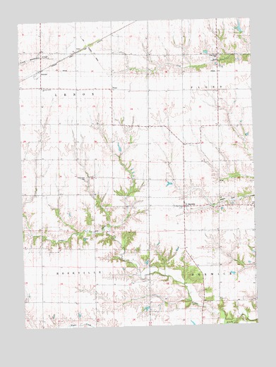
Berwick, IL USGS Topographic Map
Click on map above to begin viewing in our Map Viewer.

This topographic map contains these locations and features:
Feature Name Type Latitude Longitude GNIS ID View Map
Abingdon Fire Protection District Station 2BuildingN40.7986°W90.5388°2640565View Map
BerwickPopulated PlaceN40.7992°W90.5385°404232View Map
Berwick CemeteryCemeteryN40.8017°W90.5371°1968298View Map
Berwick Post OfficePost OfficeN40.7991°W90.5388°1823683View Map
Carr School (historical)SchoolN40.7675°W90.5874°405630View Map
Center School (historical)SchoolN40.7600°W90.5018°405823View Map
Central School (historical)SchoolN40.7609°W90.6149°405889View Map
Fairview Center ChurchChurchN40.8481°W90.6132°1719289View Map
Lenox Union CemeteryCemeteryN40.8112°W90.5904°1719301View Map
Massasauga Prairie Nature PreserveParkN40.7603°W90.5687°2009651View Map
Means School (historical)SchoolN40.8700°W90.5362°413357View Map
Mud Corners School (historical)SchoolN40.8248°W90.5387°414163View Map
OrmondePopulated PlaceN40.8550°W90.6132°415182View Map
PhelpsPopulated PlaceN40.8486°W90.5749°423066View Map
Pleasant Hill School (historical)SchoolN40.7898°W90.6143°415855View Map
Richey School (historical)SchoolN40.8164°W90.5012°416596View Map
Shortsville School (historical)SchoolN40.8467°W90.5101°418472View Map
Silent Home CemeteryCemeteryN40.8599°W90.5174°1719317View Map
Township of BerwickCivilN40.7587°W90.5007°428665View Map
Township of LenoxCivilN40.8478°W90.6141°429245View Map
Township of RosevilleCivilN40.7608°W90.6157°429674View Map
Union School (historical)SchoolN40.7909°W90.5871°420123View Map
Warren CountyCivilN40.8488°W90.6150°1785134View Map
West Prairie School (historical)SchoolN40.8200°W90.6151°420901View Map
Windy Ridge School (historical)SchoolN40.8209°W90.5760°421321View Map
Youngquist LakeReservoirN40.7817°W90.5101°1691541View Map
Youngquist Lake DamDamN40.7817°W90.5101°1691540View Map

Note: Coordinates in the location and feature list above are referenced to NAD83 datum.


Copyright (C) 2008-2025 Ryan Niemi / Sunset Dynamics ... All Rights Reserved