TopoQuest Logo
Do you find TopoQuest useful?
Help keep TopoQuest running and adding new maps/features by donating!
Bitcoin:  19c7KJd3qBynnjoSw5npx9KScwjBe4ifkT
Litecoin:  LXs6TkuXGGXo1vDsWCkWVdjQX94eUKd6ui
Home View Maps Find Maps Find Places Resources & Links


Piedmont Reservoir, Wyoming Topographic Map

USGS Map Title: Piedmont Reservoir, WY
USGS Map MRC: 41110B6
DRG (GeoTIFF) Download: o41110b6.tif


Neighboring USGS Topographic Map Quads:


  Guild Hollow, WY  
41110C7
 

  Ragan, WY  
41110C6
 

  Leroy, WY  
41110C5
 

  Sulphur Creek Reservoir, WY  
41110B7
 

  Piedmont Reservoir, WY  
41110B6
 

  Hague Creek, WY  
41110B5
 

  Pine Knoll, WY  
41110A7
 

  Moslander Reservoir, WY  
41110A6
 

  Meeks Cabin Reservoir, WY  
41110A5


Map MRC Location:

N42°
W111°
N42°
W110°
H8 H7 H6 H5 H4 H3 H2 H1
G8 G7 G6 G5 G4 G3 G2 G1
F8 F7 F6 F5 F4 F3 F2 F1
E8 E7 E6 E5 E4 E3 E2 E1
D8 D7 D6 D5 D4 D3 D2 D1
C8 C7 C6 C5 C4 C3 C2 C1
B8 B7 B6 B5 B4 B3 B2 B1
A8 A7 A6 A5 A4 A3 A2 A1
N41°
W111°
N41°
W110°

Piedmont Reservoir, WY USGS 1:24K Topographic Map Preview:
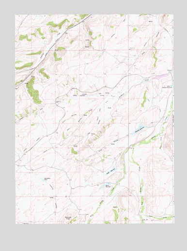
Piedmont Reservoir, WY USGS Topographic Map
Click on map above to begin viewing in our Map Viewer.

This topographic map contains these locations and features:
Feature Name Type Latitude Longitude GNIS ID View Map
Big HollowValleyN41.1958°W110.6760°1585469View Map
Byrne DamDamN41.1466°W110.6757°1607962View Map
Byrne ReservoirReservoirN41.1479°W110.6795°1586231View Map
Carter MineMineN41.2397°W110.7132°1726496View Map
Clear CreekStreamN41.1266°W110.6496°1586760View Map
East Branch Silver Springs CreekStreamN41.1902°W110.6960°1588025View Map
East Muddy CreekStreamN41.1713°W110.6571°1588116View Map
Eight SpringSpringN41.1251°W110.7438°1588188View Map
Fish CreekStreamN41.1330°W110.6502°1588503View Map
Grassy DrawValleyN41.2013°W110.6721°1589069View Map
Guild and Dean DamDamN41.2116°W110.6291°1607950View Map
Guild and Dean ReservoirReservoirN41.2116°W110.6291°1607951View Map
Guild CemeteryCemeteryN41.1656°W110.6556°2774422View Map
Guild DamDamN41.1549°W110.6691°1607927View Map
Guild HollowValleyN41.1877°W110.6349°1589184View Map
Guild ReservoirReservoirN41.1569°W110.6737°1589186View Map
Horseshoe BendBendN41.1980°W110.7185°1597357View Map
Little Peidmont DamDamN41.2049°W110.6257°1607931View Map
Little Piedmont ReservoirReservoirN41.2071°W110.6267°1590840View Map
Moslander RidgeRidgeN41.1302°W110.7077°1591784View Map
Moss CreekStreamN41.1799°W110.6338°1591795View Map
Outlet Cross DitchCanalN41.1949°W110.6807°1592507View Map
PiedmontPopulated PlaceN41.2161°W110.6274°1609138View Map
Piedmont DamDamN41.1816°W110.6474°1607960View Map
Piedmont ReservoirReservoirN41.1815°W110.6520°1592740View Map
Silver Springs CreekStreamN41.1947°W110.6829°1594349View Map
Spring Valley MineMineN41.2411°W110.7060°1726497View Map
Thirtythree PondReservoirN41.1516°W110.7281°1595494View Map
Twomile HollowValleyN41.1677°W110.7379°1596983View Map
West Muddy CreekStreamN41.1713°W110.6574°1597005View Map
West Muddy CreekStreamN41.1713°W110.6571°1447167View Map

Note: Coordinates in the location and feature list above are referenced to NAD83 datum.


Copyright (C) 2008-2024 Ryan Niemi / Sunset Dynamics ... All Rights Reserved