TopoQuest Logo
Do you find TopoQuest useful?
Help keep TopoQuest running and adding new maps/features by donating!
Bitcoin:  19c7KJd3qBynnjoSw5npx9KScwjBe4ifkT
Litecoin:  LXs6TkuXGGXo1vDsWCkWVdjQX94eUKd6ui
Home View Maps Find Maps Find Places Resources & Links


Piedra De La Aguila, New Mexico Topographic Map

USGS Map Title: Piedra De La Aguila, NM
USGS Map MRC: 35107E6
DRG (GeoTIFF) Download: o35107e6.tif


Neighboring USGS Topographic Map Quads:


  Orphan Annie Rock, NM  
35107F7
 

  Hospah, NM  
35107F6
 

  Mesita Americana, NM  
35107F5
 

  Mesa De Los Toros, NM  
35107E7
 

  Piedra De La Aguila, NM  
35107E6
 

  El Dado, NM  
35107E5
 

  Ambrosia Lake, NM  
35107D7
 

  San Lucas Dam, NM  
35107D6
 

  Cerro Alesna, NM  
35107D5


Map MRC Location:

N36°
W108°
N36°
W107°
H8 H7 H6 H5 H4 H3 H2 H1
G8 G7 G6 G5 G4 G3 G2 G1
F8 F7 F6 F5 F4 F3 F2 F1
E8 E7 E6 E5 E4 E3 E2 E1
D8 D7 D6 D5 D4 D3 D2 D1
C8 C7 C6 C5 C4 C3 C2 C1
B8 B7 B6 B5 B4 B3 B2 B1
A8 A7 A6 A5 A4 A3 A2 A1
N35°
W108°
N35°
W107°

Piedra De La Aguila, NM USGS 1:24K Topographic Map Preview:
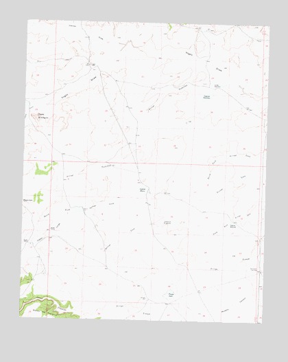
Piedra De La Aguila, NM USGS Topographic Map
Click on map above to begin viewing in our Map Viewer.

This topographic map contains these locations and features:
Feature Name Type Latitude Longitude GNIS ID View Map
Arroyo TechillasStreamN35.5992°W107.6398°897680View Map
Caņada del CaminoStreamN35.5897°W107.7426°885471View Map
Caņada MarcelinaStreamN35.5895°W107.7426°897731View Map
Caņon ChamisoValleyN35.5020°W107.7134°904638View Map
Caņon LargoValleyN35.5442°W107.7237°904659View Map
Four Corners Cow CampLocaleN35.5211°W107.6276°889175View Map
Huero WellWellN35.5534°W107.6759°890249View Map
Inditos DrawValleyN35.6153°W107.6989°890337View Map
Laguna EduardoReservoirN35.5418°W107.6427°897973View Map
Laguna HueroReservoirN35.5545°W107.6887°897980View Map
Laguna TechillasReservoirN35.5950°W107.6567°897993View Map
Laguna TrujilloReservoirN35.5416°W107.6718°897996View Map
Little TechillasReservoirN35.5994°W107.6491°891187View Map
Mesita GatoSummitN35.5486°W107.7498°891902View Map
New WellWellN35.5095°W107.6853°892505View Map
PeņaLocaleN35.5309°W107.7484°928377View Map
Piedra de la AguilaPopulated PlaceN35.5845°W107.7439°898585View Map
Railroad DikeLeveeN35.5459°W107.7192°893615View Map
Rancho EufeliaLocaleN35.5375°W107.7356°893656View Map
Rancho FelizLocaleN35.5320°W107.7473°893657View Map
Tinaja LakeLakeN35.5111°W107.6738°895685View Map
Voght PlaceLocaleN35.6067°W107.7167°899982View Map

Note: Coordinates in the location and feature list above are referenced to NAD83 datum.


Copyright (C) 2008-2025 Ryan Niemi / Sunset Dynamics ... All Rights Reserved