TopoQuest Logo
Do you find TopoQuest useful?
Help keep TopoQuest running and adding new maps/features by donating!
Bitcoin:  19c7KJd3qBynnjoSw5npx9KScwjBe4ifkT
Litecoin:  LXs6TkuXGGXo1vDsWCkWVdjQX94eUKd6ui
Home View Maps Find Maps Find Places Resources & Links


Pierz Lake, Minnesota Topographic Map

USGS Map Title: Pierz Lake, MN
USGS Map MRC: 45094H2
DRG (GeoTIFF) Download: o45094h2.tif


Neighboring USGS Topographic Map Quads:


  Belle Prairie, MN  
46094A3
 

  Freedhem, MN  
46094A2
 

  Lastrup, MN  
46094A1
 

  Little Falls East, MN  
45094H3
 

  Pierz Lake, MN  
45094H2
 

  Pierz, MN  
45094H1
 

  Royalton, MN  
45094G3
 

  Rice, MN  
45094G2
 

  Little Rock, MN  
45094G1


Map MRC Location:

N46°
W95°
N46°
W94°
H8 H7 H6 H5 H4 H3 H2 H1
G8 G7 G6 G5 G4 G3 G2 G1
F8 F7 F6 F5 F4 F3 F2 F1
E8 E7 E6 E5 E4 E3 E2 E1
D8 D7 D6 D5 D4 D3 D2 D1
C8 C7 C6 C5 C4 C3 C2 C1
B8 B7 B6 B5 B4 B3 B2 B1
A8 A7 A6 A5 A4 A3 A2 A1
N45°
W95°
N45°
W94°

Pierz Lake, MN USGS 1:24K Topographic Map Preview:
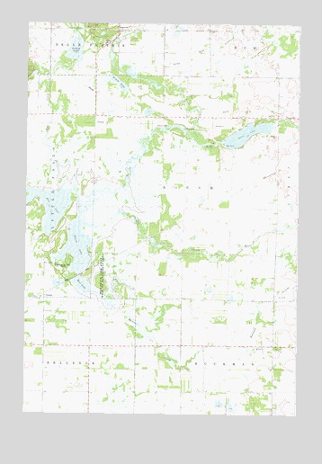
Pierz Lake, MN USGS Topographic Map
Click on map above to begin viewing in our Map Viewer.

This topographic map contains these locations and features:
Feature Name Type Latitude Longitude GNIS ID View Map
Buckman CreekStreamN45.9141°W94.2200°640596View Map
Frieze LakeLakeN45.9811°W94.2082°643963View Map
Kuntz CreekStreamN45.9000°W94.1547°646275View Map
Little Mink CreekStreamN45.9822°W94.1956°646858View Map
Mischke CreekStreamN45.9141°W94.1322°639451View Map
Mud LakeLakeN45.9165°W94.2241°648267View Map
Pelkey LakeLakeN45.9917°W94.2281°649250View Map
Pierz LakeReservoirN45.9616°W94.1647°649395View Map
Pierz Lake DamDamN45.9616°W94.1669°1777036View Map
Rice CreekStreamN45.9469°W94.2339°649972View Map
Rice LakeReservoirN45.9397°W94.2371°650029View Map
Rice-Skunk Lake State Wildlife Management AParkN45.9194°W94.2131°650056View Map
Skunk LakeLakeN45.9397°W94.2371°652133View Map
Skunk RiverStreamN45.9358°W94.2233°652139View Map
Township of AgramCivilN45.9476°W94.1769°663387View Map
VawterPopulated PlaceN45.9122°W94.2450°654984View Map
Vawter Post Office (historical)Post OfficeN45.9122°W94.2447°2068700View Map

Note: Coordinates in the location and feature list above are referenced to NAD83 datum.


Copyright (C) 2008-2025 Ryan Niemi / Sunset Dynamics ... All Rights Reserved