TopoQuest Logo
Do you find TopoQuest useful?
Help keep TopoQuest running and adding new maps/features by donating!
Bitcoin:  19c7KJd3qBynnjoSw5npx9KScwjBe4ifkT
Litecoin:  LXs6TkuXGGXo1vDsWCkWVdjQX94eUKd6ui
Home View Maps Find Maps Find Places Resources & Links


Pigeon Point, Minnesota Topographic Map

USGS Map Title: Pigeon Point, MN
USGS Map MRC: 47089H5
DRG (GeoTIFF) Download: o47089h5.tif


Neighboring USGS Topographic Map Quads:


  Pigeon Point, MN  
47089H5


Map MRC Location:

N48°
W90°
N48°
W89°
H8 H7 H6 H5 H4 H3 H2 H1
G8 G7 G6 G5 G4 G3 G2 G1
F8 F7 F6 F5 F4 F3 F2 F1
E8 E7 E6 E5 E4 E3 E2 E1
D8 D7 D6 D5 D4 D3 D2 D1
C8 C7 C6 C5 C4 C3 C2 C1
B8 B7 B6 B5 B4 B3 B2 B1
A8 A7 A6 A5 A4 A3 A2 A1
N47°
W90°
N47°
W89°

Pigeon Point, MN USGS 1:24K Topographic Map Preview:
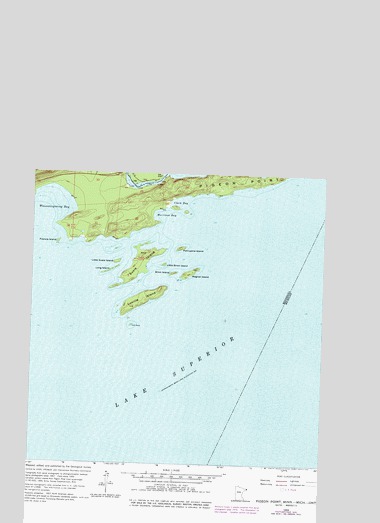
Pigeon Point, MN USGS Topographic Map
Click on map above to begin viewing in our Map Viewer.

This topographic map contains these locations and features:
Feature Name Type Latitude Longitude GNIS ID View Map
Brick IslandIslandN47.9713°W89.5645°640472View Map
Clark BayBayN47.9921°W89.5615°641243View Map
Francis IslandIslandN47.9804°W89.6145°643873View Map
Grand Portage State ParkParkN48.0102°W89.6120°1877507View Map
Gull RockIslandN47.9563°W89.5820°644531View Map
Little Brick IslandIslandN47.9738°W89.5684°646770View Map
Little Portage BayBayN48.0010°W89.5143°646892View Map
Little Susie IslandIslandN47.9746°W89.5887°646941View Map
Long IslandIslandN47.9721°W89.5915°647029View Map
Lucille IslandIslandN47.9641°W89.5776°647279View Map
Magnet IslandIslandN47.9716°W89.5570°647375View Map
Middle FallsFallsN48.0127°W89.6159°647808View Map
Minnesota's Northern Border Historical MarkerParkN48.0006°W89.5883°2073055View Map
Morrison BayBayN47.9885°W89.5693°648119View Map
Pigeon BayBayN48.0166°W89.5168°649398View Map
Pigeon FallsFallsN48.0046°W89.5979°649399View Map
Pigeon PointCapeN47.9979°W89.5381°649402View Map
Pigeon RiverStreamN47.9992°W89.5694°657824View Map
Porcupine IslandIslandN47.9785°W89.5612°649661View Map
Susie IslandIslandN47.9738°W89.5790°659767View Map
The Hole in the WallBayN48.0057°W89.5120°653108View Map
The NarrowsGapN48.0016°W89.5151°653115View Map
United States Customs and Border Protection - Port of Entry - Grand PortageBuildingN47.9999°W89.5889°2758658View Map

Note: Coordinates in the location and feature list above are referenced to NAD83 datum.


Copyright (C) 2008-2025 Ryan Niemi / Sunset Dynamics ... All Rights Reserved