TopoQuest Logo
Do you find TopoQuest useful?
Help keep TopoQuest running and adding new maps/features by donating!
Bitcoin:  19c7KJd3qBynnjoSw5npx9KScwjBe4ifkT
Litecoin:  LXs6TkuXGGXo1vDsWCkWVdjQX94eUKd6ui
Home View Maps Find Maps Find Places Resources & Links


Pilot Grove South, Missouri Topographic Map

USGS Map Title: Pilot Grove South, MO
USGS Map MRC: 38092G8
DRG (GeoTIFF) Download: o38092g8.tif


Neighboring USGS Topographic Map Quads:


  Nelson, MO  
38093H1
 

  Pilot Grove North, MO  
38092H8
 

  Billingsville, MO  
38092H7
 

  Clifton City, MO  
38093G1
 

  Pilot Grove South, MO  
38092G8
 

  Bunceton, MO  
38092G7
 

  Otterville West, MO  
38093F1
 

  Otterville East, MO  
38092F8
 

  Tipton, MO  
38092F7


Map MRC Location:

N39°
W93°
N39°
W92°
H8 H7 H6 H5 H4 H3 H2 H1
G8 G7 G6 G5 G4 G3 G2 G1
F8 F7 F6 F5 F4 F3 F2 F1
E8 E7 E6 E5 E4 E3 E2 E1
D8 D7 D6 D5 D4 D3 D2 D1
C8 C7 C6 C5 C4 C3 C2 C1
B8 B7 B6 B5 B4 B3 B2 B1
A8 A7 A6 A5 A4 A3 A2 A1
N38°
W93°
N38°
W92°

Pilot Grove South, MO USGS 1:24K Topographic Map Preview:
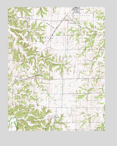
Pilot Grove South, MO USGS Topographic Map
Click on map above to begin viewing in our Map Viewer.

This topographic map contains these locations and features:
Feature Name Type Latitude Longitude GNIS ID View Map
City of Pilot GroveCivilN38.8736°W92.9126°2396204View Map
City of Pilot Grove Fire DepartmentBuildingN38.8745°W92.9128°2621759View Map
Cotton Wood School (historical)SchoolN38.8317°W92.9002°743873View Map
HarristonPopulated PlaceN38.8345°W92.9483°740035View Map
Harriston School (historical)SchoolN38.8339°W92.9462°743874View Map
HoffmanPopulated PlaceN38.8436°W92.9452°740935View Map
Honey CreekStreamN38.7631°W92.9896°719753View Map
Lebanon School (historical)SchoolN38.7639°W92.9391°743870View Map
Mount Nebo ChurchChurchN38.8034°W92.8896°722796View Map
Mount Nebo School (historical)SchoolN38.8034°W92.8902°743872View Map
Mount Vernon BranchStreamN38.8542°W92.9049°722910View Map
Mount Vernon CemeteryCemeteryN38.8586°W92.9152°722911View Map
Murphy CreekStreamN38.7650°W92.8927°723073View Map
New LebanonPopulated PlaceN38.7639°W92.9394°729357View Map
Oak Hill School (historical)SchoolN38.7756°W92.9896°743869View Map
Phillips Lake DamDamN38.7967°W92.9902°762257View Map
Pilot GrovePopulated PlaceN38.8747°W92.9116°724345View Map
Pilot Grove Elementary SchoolSchoolN38.8750°W92.9076°2571140View Map
Pilot Grove Police DepartmentBuildingN38.8738°W92.9130°2752314View Map
Pilot Grove Post OfficePost OfficeN38.8743°W92.9117°2782979View Map
Pilot Grove Rural Fire DepartmentBuildingN38.8745°W92.9128°2621758View Map
Pleasant GreenPopulated PlaceN38.8061°W92.9627°724474View Map
Pleasant Green ChurchChurchN38.8014°W92.9905°724475View Map
Pleasant Green School (historical)SchoolN38.8027°W92.9702°743868View Map
Saint Johns School (historical)SchoolN38.8606°W92.9760°725792View Map
Saint Joseph CemeteryCemeteryN38.8636°W92.9091°725798View Map
Saint Pauls ChurchChurchN38.8639°W92.9727°725883View Map
Skull CreekStreamN38.8547°W92.9994°729393View Map
Taylor BranchStreamN38.8239°W92.9652°727486View Map
Township of Clear CreekCivilN38.8469°W92.9918°766529View Map
Wesley ChapelChurchN38.8617°W92.9230°728515View Map
West Fork Petite Saline CreekStreamN38.7686°W92.8796°728573View Map
West Fork School (historical)SchoolN38.7667°W92.8983°743871View Map
West Oakland School (historical)SchoolN38.8628°W92.9721°743875View Map

Note: Coordinates in the location and feature list above are referenced to NAD83 datum.


Copyright (C) 2008-2025 Ryan Niemi / Sunset Dynamics ... All Rights Reserved