TopoQuest Logo
Do you find TopoQuest useful?
Help keep TopoQuest running and adding new maps/features by donating!
Bitcoin:  19c7KJd3qBynnjoSw5npx9KScwjBe4ifkT
Litecoin:  LXs6TkuXGGXo1vDsWCkWVdjQX94eUKd6ui
Home View Maps Find Maps Find Places Resources & Links


Pilot Mountain, North Carolina Topographic Map

USGS Map Title: Pilot Mountain, NC
USGS Map MRC: 36080D4
DRG (GeoTIFF) Download: o36080d4.tif


Neighboring USGS Topographic Map Quads:


  Mount Airy North, NC  
36080E5
 

  Claudville, VA  
36080E4
 

  Stuart SE, VA  
36080E3
 

  Mount Airy South, NC  
36080D5
 

  Pilot Mountain, NC  
36080D4
 

  Hanging Rock, NC  
36080D3
 

  Siloam, NC  
36080C5
 

  Pinnacle, NC  
36080C4
 

  King, NC  
36080C3


Map MRC Location:

N37°
W81°
N37°
W80°
H8 H7 H6 H5 H4 H3 H2 H1
G8 G7 G6 G5 G4 G3 G2 G1
F8 F7 F6 F5 F4 F3 F2 F1
E8 E7 E6 E5 E4 E3 E2 E1
D8 D7 D6 D5 D4 D3 D2 D1
C8 C7 C6 C5 C4 C3 C2 C1
B8 B7 B6 B5 B4 B3 B2 B1
A8 A7 A6 A5 A4 A3 A2 A1
N36°
W81°
N36°
W80°

Pilot Mountain, NC USGS 1:24K Topographic Map Preview:
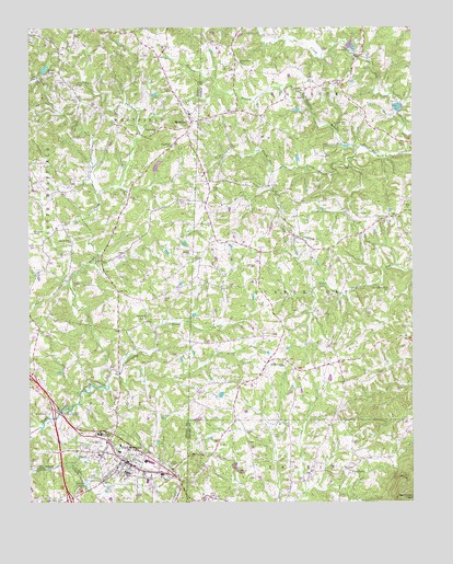
Pilot Mountain, NC USGS Topographic Map
Click on map above to begin viewing in our Map Viewer.

This topographic map contains these locations and features:
Feature Name Type Latitude Longitude GNIS ID View Map
Bales Mill (historical)LocaleN36.4726°W80.4634°1731519View Map
Balls Mill (historical)LocaleN36.4749°W80.4642°1731520View Map
Beasley CemeteryCemeteryN36.4832°W80.4042°980771View Map
Bennett CemeteryCemeteryN36.3990°W80.4956°980996View Map
Brims GrovePopulated PlaceN36.4124°W80.4156°1952642View Map
Brims Grove Baptist ChurchChurchN36.4110°W80.4170°981908View Map
Brims Grove CemeteryCemeteryN36.4104°W80.4170°1952643View Map
Bryants ForkStreamN36.4318°W80.4862°1731541View Map
Chinquapin CreekStreamN36.4057°W80.4739°983152View Map
Cobler CemeteryCemeteryN36.4982°W80.4853°983319View Map
Denny CemeteryCemeteryN36.3757°W80.4909°984135View Map
Double Creek Volunteer Fire and RescueBuildingN36.4121°W80.3940°2638382View Map
Durham CemeteryCemeteryN36.4751°W80.3962°984446View Map
East Surry High SchoolSchoolN36.3929°W80.4770°984540View Map
Flat RockPopulated PlaceN36.3835°W80.3953°985175View Map
Flat Rock School (historical)SchoolN36.3832°W80.3973°1952663View Map
Hills Bloomery Forge (historical)LocaleN36.4565°W80.4773°1731580View Map
Hills Chapel CemeteryCemeteryN36.4235°W80.4620°1731581View Map
Hills ChurchChurchN36.4240°W80.4620°986821View Map
Hills GrovePopulated PlaceN36.4229°W80.4614°1731582View Map
Hunter CemeteryCemeteryN36.4568°W80.4698°987251View Map
Inman CemeteryCemeteryN36.4835°W80.4531°987385View Map
Jessup CemeteryCemeteryN36.4285°W80.4562°987594View Map
Jessups Grove Baptist ChurchChurchN36.4435°W80.4859°987596View Map
Jessups Grove CemeteryCemeteryN36.4435°W80.4864°1731594View Map
JohnstownPopulated PlaceN36.4859°W80.3990°2681291View Map
Joyce CemeteryCemeteryN36.4171°W80.4042°987790View Map
Joyce CemeteryCemeteryN36.4274°W80.4231°987791View Map
Locust Grove ChurchChurchN36.4910°W80.4314°988846View Map
Loves LakeReservoirN36.4892°W80.4945°989070View Map
Loves Pond DamDamN36.4885°W80.4956°1000684View Map
Meadow BranchStreamN36.4687°W80.3920°989666View Map
Mica PitBasinN36.4537°W80.3762°989755View Map
Mills CemeteryCemeteryN36.4574°W80.4401°990022View Map
Nunn CemeteryCemeteryN36.4693°W80.3770°991329View Map
Old Westfield AcademySchoolN36.4774°W80.4484°1007852View Map
Old Westfield AcademySchoolN36.4762°W80.4481°1001993View Map
Owen CemeteryCemeteryN36.3924°W80.4181°991744View Map
Pell LakeReservoirN36.4633°W80.4584°1000661View Map
Pell Lake DamDamN36.4635°W80.4581°1000660View Map
Pilot Elementary SchoolSchoolN36.3901°W80.4701°1007854View Map
Pilot Elementary SchoolSchoolN36.3901°W80.4706°1001996View Map
Pilot Knob Volunteer Fire DepartmentBuildingN36.3786°W80.4818°2638927View Map
Pilot MountainPopulated PlaceN36.3865°W80.4695°992211View Map
Pilot Mountain CemeteryCemeteryN36.3921°W80.4809°1731632View Map
Pilot Mountain Filtration PlantLocaleN36.3987°W80.4884°992217View Map
Pilot Mountain Police DepartmentBuildingN36.3854°W80.4684°2769666View Map
Pilot Mountain Post OfficePost OfficeN36.3805°W80.4790°2774170View Map
Pilot Mountain Recreation FacilityLocaleN36.3951°W80.4814°1007853View Map
Pilot Mountain Recreation FacilityParkN36.3957°W80.4992°1001997View Map
Pilot Mountain Rescue Squad and Emergency Medical ServicesBuildingN36.3879°W80.4619°2720627View Map
Simmons CemeteryCemeteryN36.4465°W80.4984°994839View Map
Simmons CemeteryCemeteryN36.4812°W80.4834°994840View Map
Surry County Emergency Services Station 4BuildingN36.3786°W80.4817°2720436View Map
Toms Creek ChurchChurchN36.4732°W80.4578°996150View Map
Toms Creek Furnace (historical)LocaleN36.4076°W80.4784°1731674View Map
Town of Pilot MountainCivilN36.3858°W80.4730°2407111View Map
Township of PilotCivilN36.3797°W80.4858°1027218View Map
Venable CemeteryCemeteryN36.3937°W80.4292°996605View Map
Waugh CemeteryCemeteryN36.4415°W80.4478°996877View Map
WestfieldPopulated PlaceN36.4754°W80.4467°1023183View Map
Westfield Baptist ChurchChurchN36.4757°W80.4459°1731683View Map
Westfield CemeteryCemeteryN36.4687°W80.4528°1731684View Map
Westfield ChurchChurchN36.4693°W80.4531°997065View Map
Westfield Elementary SchoolSchoolN36.4774°W80.4470°1007851View Map
Westfield Elementary SchoolSchoolN36.4771°W80.4470°1002009View Map
Westfield High School (historical)SchoolN36.4774°W80.4470°1731685View Map
Westfield Post OfficePost OfficeN36.4770°W80.4478°2773972View Map
Westfield Volunteer Fire DepartmentBuildingN36.4737°W80.4470°2638151View Map
Wilsons Store (historical)LocaleN36.4126°W80.4220°1952745View Map
Worths Forge (historical)LocaleN36.4174°W80.4776°1731700View Map

Note: Coordinates in the location and feature list above are referenced to NAD83 datum.


Copyright (C) 2008-2024 Ryan Niemi / Sunset Dynamics ... All Rights Reserved