TopoQuest Logo
Do you find TopoQuest useful?
Help keep TopoQuest running and adding new maps/features by donating!
Bitcoin:  19c7KJd3qBynnjoSw5npx9KScwjBe4ifkT
Litecoin:  LXs6TkuXGGXo1vDsWCkWVdjQX94eUKd6ui
Home View Maps Find Maps Find Places Resources & Links


Pilot Rock, Oregon Topographic Map

USGS Map Title: Pilot Rock, OR
USGS Map MRC: 45118D7
DRG (GeoTIFF) Download: o45118d7.tif


Neighboring USGS Topographic Map Quads:


  Coombs Canyon, OR  
45118E8
 

  McKay Reservoir, OR  
45118E7
 

  Table Rock, OR  
45118E6
 

  Nye, OR  
45118D8
 

  Pilot Rock, OR  
45118D7
 

  Sevenmile Creek, OR  
45118D6
 

  Carney Butte, OR  
45118C8
 

  Granite Meadows, OR  
45118C7
 

  Tamarack Gulch, OR  
45118C6


Map MRC Location:

N46°
W119°
N46°
W118°
H8 H7 H6 H5 H4 H3 H2 H1
G8 G7 G6 G5 G4 G3 G2 G1
F8 F7 F6 F5 F4 F3 F2 F1
E8 E7 E6 E5 E4 E3 E2 E1
D8 D7 D6 D5 D4 D3 D2 D1
C8 C7 C6 C5 C4 C3 C2 C1
B8 B7 B6 B5 B4 B3 B2 B1
A8 A7 A6 A5 A4 A3 A2 A1
N45°
W119°
N45°
W118°

Pilot Rock, OR USGS 1:24K Topographic Map Preview:
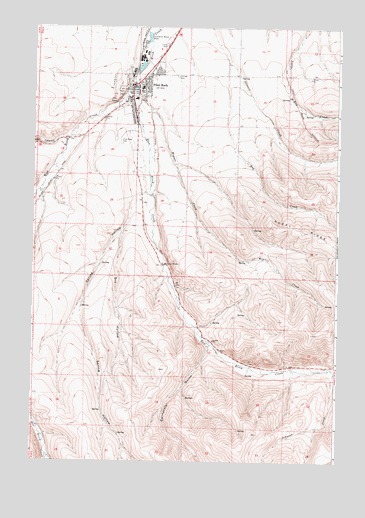
Pilot Rock, OR USGS Topographic Map
Click on map above to begin viewing in our Map Viewer.

This topographic map contains these locations and features:
Feature Name Type Latitude Longitude GNIS ID View Map
California GulchValleyN45.4085°W118.8022°1139160View Map
Dry HollowValleyN45.4421°W118.8380°1120166View Map
East Birch CreekStreamN45.4851°W118.8344°1141505View Map
Jack CanyonValleyN45.4679°W118.8614°1122317View Map
Johnson CreekStreamN45.4004°W118.7514°1144347View Map
Pilot RockPopulated PlaceN45.4832°W118.8300°1125381View Map
Pilot RockSummitN45.4790°W118.8414°1161477View Map
Pilot Rock CemeteryCemeteryN45.4673°W118.8397°1125382View Map
Pilot Rock City HallBuildingN45.4829°W118.8334°2700395View Map
Pilot Rock Elementary SchoolSchoolN45.4793°W118.8335°2490561View Map
Pilot Rock High SchoolSchoolN45.4825°W118.8310°2490562View Map
Pilot Rock Municipal CourtBuildingN45.4829°W118.8334°2700394View Map
Pilot Rock Police DepartmentBuildingN45.4833°W118.8330°2737651View Map
Pilot Rock Post OfficePost OfficeN45.4830°W118.8329°1165785View Map
Pilot Rock Public LibraryBuildingN45.4829°W118.8334°2700397View Map
Pilot Rock Public Works DepartmentBuildingN45.4829°W118.8334°2700396View Map
Pilot Rock Rural Fire Protection District 7BuildingN45.4864°W118.8285°2576730View Map
Ray CreekStreamN45.4896°W118.7964°1125853View Map
Rugg Ranches AirportAirportN45.4733°W118.7936°2770601View Map
Spring HollowValleyN45.4532°W118.8278°1150190View Map
Stanley CreekStreamN45.3768°W118.8678°1150341View Map
Wegner CreekStreamN45.4790°W118.8317°1128775View Map
West Birch CreekStreamN45.4851°W118.8342°1158546View Map

Note: Coordinates in the location and feature list above are referenced to NAD83 datum.


Copyright (C) 2008-2025 Ryan Niemi / Sunset Dynamics ... All Rights Reserved