TopoQuest Logo
Do you find TopoQuest useful?
Help keep TopoQuest running and adding new maps/features by donating!
Bitcoin:  19c7KJd3qBynnjoSw5npx9KScwjBe4ifkT
Litecoin:  LXs6TkuXGGXo1vDsWCkWVdjQX94eUKd6ui
Home View Maps Find Maps Find Places Resources & Links


Pine Lake West, Minnesota Topographic Map

USGS Map Title: Pine Lake West, MN
USGS Map MRC: 48090A2
DRG (GeoTIFF) Download: o48090a2.tif


Neighboring USGS Topographic Map Quads:


  Crocodile Lake, MN  
48090A3
 

  Pine Lake West, MN  
48090A2
 

  Pine Lake East, MN  
48090A1
 

  Pine Mountain, MN  
47090H3
 

  Northern Light Lake, MN  
47090H2
 

  Tom Lake, MN  
47090H1


Map MRC Location:

N49°
W91°
N49°
W90°
H8 H7 H6 H5 H4 H3 H2 H1
G8 G7 G6 G5 G4 G3 G2 G1
F8 F7 F6 F5 F4 F3 F2 F1
E8 E7 E6 E5 E4 E3 E2 E1
D8 D7 D6 D5 D4 D3 D2 D1
C8 C7 C6 C5 C4 C3 C2 C1
B8 B7 B6 B5 B4 B3 B2 B1
A8 A7 A6 A5 A4 A3 A2 A1
N48°
W91°
N48°
W90°

Pine Lake West, MN USGS 1:24K Topographic Map Preview:
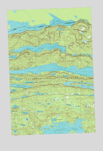
Pine Lake West, MN USGS Topographic Map
Click on map above to begin viewing in our Map Viewer.

This topographic map contains these locations and features:
Feature Name Type Latitude Longitude GNIS ID View Map
Bean LakeLakeN48.0285°W90.2429°655279View Map
Bench LakeLakeN48.0558°W90.2375°655330View Map
Bronco LakeLakeN48.0387°W90.1506°655519View Map
Canuck LakeLakeN48.1002°W90.1405°655627View Map
Carrot LakeLakeN48.0221°W90.2285°655656View Map
Celery LakeLakeN48.0100°W90.2337°655690View Map
Crystal LakeLakeN48.0490°W90.2366°655902View Map
Drag LakeLakeN48.0911°W90.1357°656038View Map
Fan LakeLakeN48.1123°W90.1410°656199View Map
Fan Lily LakesLakeN48.1121°W90.1348°656200View Map
Fault LakeLakeN48.0374°W90.1261°656208View Map
Gadwall LakeLakeN48.0574°W90.1669°656350View Map
Gogebic LakeLakeN48.0782°W90.2437°656397View Map
Great Cherry PortageTrailN48.1079°W90.1276°656445View Map
Greenwood LakeLakeN48.0015°W90.1729°656457View Map
Kiowa LakeLakeN48.0382°W90.2287°656899View Map
Lesser Cherry PortageTrailN48.1116°W90.1448°656993View Map
Lily LakesLakeN48.1124°W90.1376°663189View Map
Long LakeLakeN48.0509°W90.1582°657196View Map
Mirage LakeLakeN48.0285°W90.1637°657415View Map
Moose MountainSummitN48.1066°W90.1456°657472View Map
Mountain LakeLakeN48.1082°W90.2251°657495View Map
North Shady LakeLakeN48.0140°W90.1861°657623View Map
Pea LakeLakeN48.0301°W90.1935°657755View Map
Pemmican LakeLakeN48.1041°W90.1725°657770View Map
Pine LakeLakeN48.0624°W90.1641°657841View Map
Potato LakeLakeN48.0152°W90.2263°657923View Map
Puff CreekStreamN48.0388°W90.1545°657948View Map
Puff LakeLakeN48.0307°W90.2092°657949View Map
Shelf LakeLakeN48.0405°W90.2058°658232View Map
Shoe LakeLakeN48.0039°W90.2444°658245View Map
Spaulding LakeLakeN48.0522°W90.2224°660001View Map
Stump LakeLakeN48.0452°W90.1273°658514View Map
Table LakeLakeN48.0580°W90.2456°658588View Map
Tittle LakeLakeN48.0269°W90.1535°658697View Map
Tomato LakeLakeN48.0227°W90.2071°658711View Map
Vale LakeLakeN48.0594°W90.1846°658832View Map
Vaseux LakeLakeN48.1116°W90.1323°658838View Map
Vaseux PortageTrailN48.1118°W90.1348°658839View Map
West Pike LakeLakeN48.0859°W90.2013°658955View Map

Note: Coordinates in the location and feature list above are referenced to NAD83 datum.


Copyright (C) 2008-2025 Ryan Niemi / Sunset Dynamics ... All Rights Reserved