TopoQuest Logo
Do you find TopoQuest useful?
Help keep TopoQuest running and adding new maps/features by donating!
Bitcoin:  19c7KJd3qBynnjoSw5npx9KScwjBe4ifkT
Litecoin:  LXs6TkuXGGXo1vDsWCkWVdjQX94eUKd6ui
Home View Maps Find Maps Find Places Resources & Links


Pistol Butte, Oregon Topographic Map

USGS Map Title: Pistol Butte, OR
USGS Map MRC: 43121G5
DRG (GeoTIFF) Download: o43121g5.tif


Neighboring USGS Topographic Map Quads:


  Mount Bachelor, OR  
43121H6
 

  Wanoga Butte, OR  
43121H5
 

  Benham Falls, OR  
43121H4
 

  Round Mountain, OR  
43121G6
 

  Pistol Butte, OR  
43121G5
 

  Anns Butte, OR  
43121G4
 

  Wickiup Dam, OR  
43121F6
 

  La Pine, OR  
43121F5
 

  Finley Butte, OR  
43121F4


Map MRC Location:

N44°
W122°
N44°
W121°
H8 H7 H6 H5 H4 H3 H2 H1
G8 G7 G6 G5 G4 G3 G2 G1
F8 F7 F6 F5 F4 F3 F2 F1
E8 E7 E6 E5 E4 E3 E2 E1
D8 D7 D6 D5 D4 D3 D2 D1
C8 C7 C6 C5 C4 C3 C2 C1
B8 B7 B6 B5 B4 B3 B2 B1
A8 A7 A6 A5 A4 A3 A2 A1
N43°
W122°
N43°
W121°

Pistol Butte, OR USGS 1:24K Topographic Map Preview:
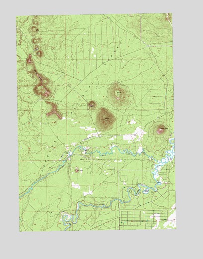
Pistol Butte, OR USGS Topographic Map
Click on map above to begin viewing in our Map Viewer.

This topographic map contains these locations and features:
Feature Name Type Latitude Longitude GNIS ID View Map
Bates ButteSummitN43.8076°W121.5123°1137575View Map
Bates RanchLocaleN43.8035°W121.5045°1155858View Map
Big TreeLocaleN43.7718°W121.5197°1138091View Map
Deschutes National ForestForestN43.8353°W121.5358°1155503View Map
Fall RiverStreamN43.7885°W121.5114°1141996View Map
Fall River FallsFallsN43.7944°W121.5278°1141998View Map
Fall River Fish HatcheryLocaleN43.7971°W121.5742°1163709View Map
Fall River Fish Hatchery Airport (historical)AirportN43.8029°W121.5716°1116607View Map
Fall River LodgeLocaleN43.7957°W121.5855°1142000View Map
Fall River Recreation SiteLocaleN43.7726°W121.6200°1141997View Map
Fall River TrailheadLocaleN43.7910°W121.5913°2563303View Map
Foster RanchLocaleN43.7773°W121.5145°1142344View Map
Indian CreekStreamN43.7935°W121.5853°1144023View Map
Klak ButteSummitN43.8664°W121.6107°1144656View Map
La Pine State ParkParkN43.7762°W121.5289°1161758View Map
Lolo ButteSummitN43.8526°W121.6076°1145347View Map
Pistol ButteSummitN43.8138°W121.5566°1147775View Map
Sitkum ButteSummitN43.8268°W121.5452°1149553View Map
Tetherow Recreation SiteLocaleN43.7657°W121.5761°1167235View Map
The Dead SloughBayN43.7705°W121.5248°1151007View Map
The RockSummitN43.7841°W121.5796°1151042View Map
Wake ButteRidgeN43.8344°W121.6066°1151813View Map
Wake Butte TrailheadLocaleN43.8282°W121.6080°2563302View Map

Note: Coordinates in the location and feature list above are referenced to NAD83 datum.


Copyright (C) 2008-2025 Ryan Niemi / Sunset Dynamics ... All Rights Reserved