TopoQuest Logo
Do you find TopoQuest useful?
Help keep TopoQuest running and adding new maps/features by donating!
Bitcoin:  19c7KJd3qBynnjoSw5npx9KScwjBe4ifkT
Litecoin:  LXs6TkuXGGXo1vDsWCkWVdjQX94eUKd6ui
Home View Maps Find Maps Find Places Resources & Links


Plattville, Illinois Topographic Map

USGS Map Title: Plattville, IL
USGS Map MRC: 41088E4
DRG (GeoTIFF) Download: o41088e4.tif


Neighboring USGS Topographic Map Quads:


  Plano, IL  
41088F5
 

  Yorkville, IL  
41088F4
 

  Aurora South, IL  
41088F3
 

  Newark, IL  
41088E5
 

  Plattville, IL  
41088E4
 

  Yorkville SE, IL  
41088E3
 

  Stavanger, IL  
41088D5
 

  Lisbon, IL  
41088D4
 

  Minooka, IL  
41088D3


Map MRC Location:

N42°
W89°
N42°
W88°
H8 H7 H6 H5 H4 H3 H2 H1
G8 G7 G6 G5 G4 G3 G2 G1
F8 F7 F6 F5 F4 F3 F2 F1
E8 E7 E6 E5 E4 E3 E2 E1
D8 D7 D6 D5 D4 D3 D2 D1
C8 C7 C6 C5 C4 C3 C2 C1
B8 B7 B6 B5 B4 B3 B2 B1
A8 A7 A6 A5 A4 A3 A2 A1
N41°
W89°
N41°
W88°

Plattville, IL USGS 1:24K Topographic Map Preview:
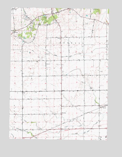
Plattville, IL USGS Topographic Map
Click on map above to begin viewing in our Map Viewer.

This topographic map contains these locations and features:
Feature Name Type Latitude Longitude GNIS ID View Map
Ament CornersPopulated PlaceN41.5973°W88.4359°1802324View Map
Booth School (historical)SchoolN41.5042°W88.3848°1802326View Map
Brown School (historical)SchoolN41.5750°W88.4348°1802320View Map
City of YorkvilleCivilN41.6161°W88.4204°2397394View Map
Cross Lutheran CemeteryCemeteryN41.5956°W88.4370°1808673View Map
Cross Lutheran ChurchChurchN41.5953°W88.4365°1808705View Map
Cross SchoolSchoolN41.5964°W88.4365°406832View Map
Emanuel ChurchChurchN41.5717°W88.4542°407982View Map
Emanuel School (historical)SchoolN41.5723°W88.4540°1802321View Map
FoxPopulated PlaceN41.6231°W88.4951°408611View Map
Harris County Forest PreserveParkN41.6153°W88.4570°1718817View Map
HelmarPopulated PlaceN41.5450°W88.4840°410040View Map
Helmar Lutheran ChurchChurchN41.5453°W88.4842°1998710View Map
Immanuel Lutheran CemeteryCemeteryN41.5816°W88.4542°407979View Map
Kendall CountyCivilN41.5905°W88.4288°424248View Map
Kendall School (historical)SchoolN41.5981°W88.4065°1802325View Map
KentlandPopulated PlaceN41.5464°W88.4340°422871View Map
Knob HillPopulated PlaceN41.6009°W88.4973°411579View Map
Lisbon CenterPopulated PlaceN41.5245°W88.4340°412262View Map
Lisbon CreekStreamN41.5109°W88.3945°412264View Map
Lisbon SchoolSchoolN41.5092°W88.4837°412039View Map
Long GroveWoodsN41.6170°W88.4445°1808719View Map
Martner School (historical)SchoolN41.5925°W88.4751°1802323View Map
Needham School (historical)SchoolN41.5742°W88.4845°1802322View Map
PavillionPopulated PlaceN41.6106°W88.4751°415462View Map
Pavillion CemeteryCemeteryN41.6136°W88.4762°1808676View Map
PlattvillePopulated PlaceN41.5317°W88.3815°415768View Map
Plattville CemeteryCemeteryN41.5335°W88.3865°1808678View Map
Plattville United Methodist ChurchChurchN41.5328°W88.3859°1808732View Map
Plecher SchoolSchoolN41.5623°W88.4059°415945View Map
Specie GroveWoodsN41.6234°W88.3906°1808738View Map
Township of KendallCivilN41.5932°W88.4283°429202View Map
Township of LisbonCivilN41.5030°W88.4242°429263View Map
Village of PlattvilleCivilN41.5345°W88.3840°2399688View Map
WAUR-AM (Sandwich)TowerN41.6073°W88.4531°428083View Map
Weeks School (historical)SchoolN41.5386°W88.4584°1802319View Map

Note: Coordinates in the location and feature list above are referenced to NAD83 datum.


Copyright (C) 2008-2024 Ryan Niemi / Sunset Dynamics ... All Rights Reserved