TopoQuest Logo
Do you find TopoQuest useful?
Help keep TopoQuest running and adding new maps/features by donating!
Bitcoin:  19c7KJd3qBynnjoSw5npx9KScwjBe4ifkT
Litecoin:  LXs6TkuXGGXo1vDsWCkWVdjQX94eUKd6ui
Home View Maps Find Maps Find Places Resources & Links


Pleasant Valley, Texas Topographic Map

USGS Map Title: Pleasant Valley, TX
USGS Map MRC: 35101C7
DRG (GeoTIFF) Download: o35101c7.tif


Neighboring USGS Topographic Map Quads:


  Puente, TX  
35101D8
 

  Chunky, TX  
35101D7
 

  Berry Sand Draw, TX  
35101D6
 

  Cliffside, TX  
35101C8
 

  Pleasant Valley, TX  
35101C7
 

  Mayer, TX  
35101C6
 

  Amarillo West, TX  
35101B8
 

  Amarillo East, TX  
35101B7
 

  Pullman, TX  
35101B6


Map MRC Location:

N36°
W102°
N36°
W101°
H8 H7 H6 H5 H4 H3 H2 H1
G8 G7 G6 G5 G4 G3 G2 G1
F8 F7 F6 F5 F4 F3 F2 F1
E8 E7 E6 E5 E4 E3 E2 E1
D8 D7 D6 D5 D4 D3 D2 D1
C8 C7 C6 C5 C4 C3 C2 C1
B8 B7 B6 B5 B4 B3 B2 B1
A8 A7 A6 A5 A4 A3 A2 A1
N35°
W102°
N35°
W101°

Pleasant Valley, TX USGS 1:24K Topographic Map Preview:
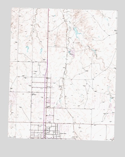
Pleasant Valley, TX USGS Topographic Map
Click on map above to begin viewing in our Map Viewer.

This topographic map contains these locations and features:
Feature Name Type Latitude Longitude GNIS ID View Map
6 Section LakeReservoirN35.3540°W101.7986°1861975View Map
6 Section Lake DamDamN35.3567°W101.8021°1861974View Map
Amarillo Fire Department Station 4BuildingN35.2505°W101.8321°2551244View Map
Amarillo Speed BowlLocaleN35.2528°W101.7963°1384518View Map
Beth El Fellowship ChurchChurchN35.2562°W101.8313°2023722View Map
Bivins RanchLocaleN35.3556°W101.7507°1352276View Map
Caliche QuarryMineN35.2528°W101.7944°1353549View Map
Fairlane Church of ChristChurchN35.2720°W101.8263°2023746View Map
GluckPopulated PlaceN35.3659°W101.8127°1379840View Map
Holiness ChurchChurchN35.2809°W101.8294°1359403View Map
Indian CreekStreamN35.3584°W101.8063°1359928View Map
Irwin Road Baptist ChurchChurchN35.2659°W101.8263°2023785View Map
Jehovahs Witnesses Valley Congregation ChurchChurchN35.2581°W101.8169°2023703View Map
JuilliardPopulated PlaceN35.3187°W101.8096°1380016View Map
KACV-FM (Amarillo)TowerN35.3426°W101.8230°1385747View Map
KACV-TV (Amarillo)TowerN35.3426°W101.8230°1386057View Map
KAKS-FM (Canyon)TowerN35.3426°W101.8230°1385805View Map
KAMR-TV (Amarillo)TowerN35.3145°W101.8469°1386058View Map
KATP-FM (Amarillo)TowerN35.3426°W101.8230°1385748View Map
KBUY-FM (Amarillo)TowerN35.3426°W101.8230°1385749View Map
KBUY-FM (Amarillo)TowerN35.3153°W101.8346°1385756View Map
KCIT-TV (Amarillo)TowerN35.3426°W101.8230°1386061View Map
KFDA-TV (Amarillo)TowerN35.2928°W101.8455°1386060View Map
KLSF-FM (Amarillo)TowerN35.2926°W101.8471°1385755View Map
KMLT-FM (Amarillo)TowerN35.3145°W101.8469°1385753View Map
KQIZ-FM (Amarillo)TowerN35.2926°W101.8471°1385754View Map
KRGN-FM (Amarillo)TowerN35.3153°W101.8346°1385757View Map
Northside Assembly of God ChurchChurchN35.2589°W101.8399°2023758View Map
Pavillard Baptist ChurchChurchN35.2767°W101.8221°2023794View Map
Pleasant ValleyPopulated PlaceN35.2581°W101.8310°1365449View Map
Pleasant Valley Assembly of God ChurchChurchN35.2548°W101.8171°2023759View Map
Pleasant Valley Baptist ChurchChurchN35.2509°W101.8274°2023795View Map
Pleasant Valley Church of ChristChurchN35.2617°W101.8246°2023749View Map
Pleasant Valley Elementary SchoolSchoolN35.2554°W101.8319°2008020View Map
Pleasant Valley Pentecostal Church of GodChurchN35.2598°W101.8099°2023715View Map
Pleasant Valley United Methodist ChurchChurchN35.2617°W101.8307°2023708View Map
Potter County Fire Rescue Station 4BuildingN35.2959°W101.8716°2551363View Map
Potter County Fire Rescue Station 5 Central HeadquartersBuildingN35.2803°W101.8108°2551355View Map
Primitive Baptist ChurchChurchN35.2559°W101.8452°2023796View Map
River Road ChurchChurchN35.2998°W101.8321°1366519View Map
River Road Fellowship ChurchChurchN35.2798°W101.8219°2023727View Map
River Road High SchoolSchoolN35.3073°W101.8351°1366520View Map
Rolling Hills Elementary SchoolSchoolN35.2952°W101.8705°2008025View Map
Ross Rogers Golf Course Lake DamDamN35.2501°W101.8355°1865132View Map
Southwestern Public Service LakeReservoirN35.2867°W101.7621°1865129View Map
Southwestern Public Service Lake DamDamN35.2867°W101.7621°1865128View Map
United Methodist Church Pleasant ValleyChurchN35.2617°W101.8307°2023710View Map
United Pentecostal Church Camp GroundChurchN35.2659°W101.8313°2023716View Map
Willow Vista Elementary SchoolSchoolN35.2848°W101.8219°2008035View Map

Note: Coordinates in the location and feature list above are referenced to NAD83 datum.


Copyright (C) 2008-2024 Ryan Niemi / Sunset Dynamics ... All Rights Reserved