TopoQuest Logo
Do you find TopoQuest useful?
Help keep TopoQuest running and adding new maps/features by donating!
Bitcoin:  19c7KJd3qBynnjoSw5npx9KScwjBe4ifkT
Litecoin:  LXs6TkuXGGXo1vDsWCkWVdjQX94eUKd6ui
Home View Maps Find Maps Find Places Resources & Links


Plug Hat Rock, Colorado Topographic Map

USGS Map Title: Plug Hat Rock, CO
USGS Map MRC: 40108C8
DRG (GeoTIFF) Download: o40108c8.tif


Neighboring USGS Topographic Map Quads:


  Stuntz Reservoir, CO  
40109D1
 

  Hells Canyon, CO  
40108D8
 

  Tanks Peak, CO  
40108D7
 

  Snake John Reef, UT  
40109C1
 

  Plug Hat Rock, CO  
40108C8
 

  Lazy Y Point, CO  
40108C7
 

  Dinosaur, CO  
40109B1
 

  Mellen Hill, CO  
40108B8
 

  Rangely NE, CO  
40108B7


Map MRC Location:

N41°
W109°
N41°
W108°
H8 H7 H6 H5 H4 H3 H2 H1
G8 G7 G6 G5 G4 G3 G2 G1
F8 F7 F6 F5 F4 F3 F2 F1
E8 E7 E6 E5 E4 E3 E2 E1
D8 D7 D6 D5 D4 D3 D2 D1
C8 C7 C6 C5 C4 C3 C2 C1
B8 B7 B6 B5 B4 B3 B2 B1
A8 A7 A6 A5 A4 A3 A2 A1
N40°
W109°
N40°
W108°

Plug Hat Rock, CO USGS 1:24K Topographic Map Preview:
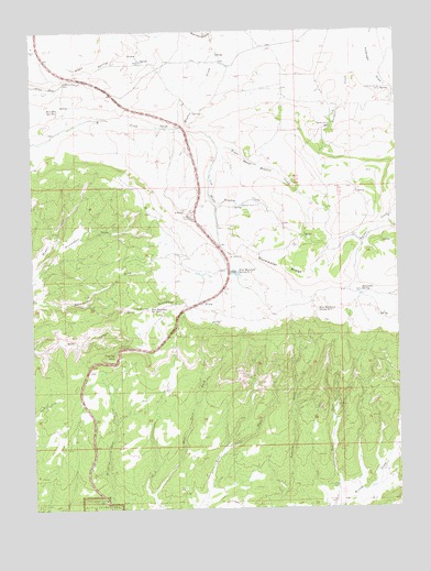
Plug Hat Rock, CO USGS Topographic Map
Click on map above to begin viewing in our Map Viewer.

This topographic map contains these locations and features:
Feature Name Type Latitude Longitude GNIS ID View Map
Antelope Springs CampLocaleN40.3597°W108.8807°170838View Map
Bearwater SpringSpringN40.3064°W108.8879°170842View Map
Blue Mountain Spring Number 1SpringN40.3120°W108.9301°170845View Map
Blue Mountain Spring Number 2SpringN40.3028°W108.9595°170847View Map
Blue Mountain Spring Number 3SpringN40.3022°W108.9032°170843View Map
Blue Mountain Spring Number 4SpringN40.3544°W108.9911°170834View Map
Buckwater RidgeRidgeN40.3019°W108.9046°170844View Map
Escalante OverlookLocaleN40.3261°W108.9457°170943View Map
Fletcher CabinLocaleN40.3505°W108.8984°170837View Map
Gadd CabinLocaleN40.3069°W108.8882°170841View Map
Haslem CabinLocaleN40.3672°W108.9626°170835View Map
K PointCliffN40.3280°W108.9482°170944View Map
Left Hand Meadow CreekStreamN40.3461°W108.9376°170850View Map
Lower Buckwater DrawValleyN40.3033°W108.9816°170846View Map
Meadow CreekStreamN40.3750°W108.9379°170806View Map
Morgan CabinLocaleN40.3294°W108.9284°170839View Map
Plug Hat Picnic AreaLocaleN40.2925°W108.9676°170848View Map
Plug Hat RockSummitN40.2902°W108.9726°170849View Map
Right Hand Meadow CreekStreamN40.3461°W108.9376°170851View Map

Note: Coordinates in the location and feature list above are referenced to NAD83 datum.


Copyright (C) 2008-2025 Ryan Niemi / Sunset Dynamics ... All Rights Reserved