TopoQuest Logo
Do you find TopoQuest useful?
Help keep TopoQuest running and adding new maps/features by donating!
Bitcoin:  19c7KJd3qBynnjoSw5npx9KScwjBe4ifkT
Litecoin:  LXs6TkuXGGXo1vDsWCkWVdjQX94eUKd6ui
Home View Maps Find Maps Find Places Resources & Links


Point of Rocks, Wyoming Topographic Map

USGS Map Title: Point of Rocks, WY
USGS Map MRC: 41108F7
DRG (GeoTIFF) Download: o41108f7.tif


Neighboring USGS Topographic Map Quads:


  South Superior, WY  
41108G8
 

  Black Rock South, WY  
41108G7
 

  Tenmile Rim, WY  
41108G6
 

  Thayer Junction, WY  
41108F8
 

  Point of Rocks, WY  
41108F7
 

  Bitter Creek NW, WY  
41108F6
 

  Point of Rocks SW, WY  
41108E8
 

  Point of Rocks SE, WY  
41108E7
 

  Black Buttes, WY  
41108E6


Map MRC Location:

N42°
W109°
N42°
W108°
H8 H7 H6 H5 H4 H3 H2 H1
G8 G7 G6 G5 G4 G3 G2 G1
F8 F7 F6 F5 F4 F3 F2 F1
E8 E7 E6 E5 E4 E3 E2 E1
D8 D7 D6 D5 D4 D3 D2 D1
C8 C7 C6 C5 C4 C3 C2 C1
B8 B7 B6 B5 B4 B3 B2 B1
A8 A7 A6 A5 A4 A3 A2 A1
N41°
W109°
N41°
W108°

Point of Rocks, WY USGS 1:24K Topographic Map Preview:
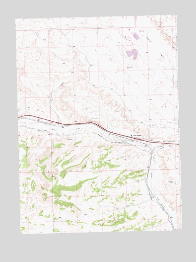
Point of Rocks, WY USGS Topographic Map
Click on map above to begin viewing in our Map Viewer.

This topographic map contains these locations and features:
Feature Name Type Latitude Longitude GNIS ID View Map
Black Butte Coal Company Fire BrigadeBuildingN41.6814°W108.7917°2673622View Map
Bridger Coal Company Emergency Response TeamBuildingN41.7417°W108.7882°2673628View Map
Coon DrawValleyN41.6855°W108.8412°1586955View Map
Deadman WashValleyN41.6733°W108.7690°1596803View Map
Jim Bridger MineMineN41.7339°W108.7871°1747090View Map
Jim Bridger Power Plant Fire BrigadeBuildingN41.7382°W108.7913°2673642View Map
Jim Bridger Power Plant Surge Pond DamDamN41.7300°W108.7840°1608052View Map
Jim Bridger ReservoirReservoirN41.7280°W108.7849°1608053View Map
Lecite Hills MineMineN41.7277°W108.7715°1747091View Map
Point of RocksPopulated PlaceN41.6802°W108.7857°1597462View Map
Point of Rocks Census Designated PlaceCensusN41.6831°W108.7754°2409083View Map
Point of Rocks MineMineN41.6802°W108.7662°1747092View Map
Point of Rocks Post OfficePost OfficeN41.6800°W108.7864°2768548View Map
Point of Rocks Stagecoach StationLocaleN41.6766°W108.7904°1609141View Map
ShiprockSummitN41.6791°W108.8368°1597492View Map

Note: Coordinates in the location and feature list above are referenced to NAD83 datum.


Copyright (C) 2008-2024 Ryan Niemi / Sunset Dynamics ... All Rights Reserved