TopoQuest Logo
Do you find TopoQuest useful?
Help keep TopoQuest running and adding new maps/features by donating!
Bitcoin:  19c7KJd3qBynnjoSw5npx9KScwjBe4ifkT
Litecoin:  LXs6TkuXGGXo1vDsWCkWVdjQX94eUKd6ui
Home View Maps Find Maps Find Places Resources & Links


Polacca, Arizona Topographic Map

USGS Map Title: Polacca, AZ
USGS Map MRC: 35110G4
DRG (GeoTIFF) Download: o35110g4.tif


Neighboring USGS Topographic Map Quads:


  Kykotsmovi, AZ  
35110H5
 

  Onion Spring, AZ  
35110H4
 

  Wepo Village, AZ  
35110H3
 

  Shungopavi, AZ  
35110G5
 

  Polacca, AZ  
35110G4
 

  Sun Altar, AZ  
35110G3
 

  Giants Chair, AZ  
35110F5
 

  Snake Butte, AZ  
35110F4
 

  Star Mountain, AZ  
35110F3


Map MRC Location:

N36°
W111°
N36°
W110°
H8 H7 H6 H5 H4 H3 H2 H1
G8 G7 G6 G5 G4 G3 G2 G1
F8 F7 F6 F5 F4 F3 F2 F1
E8 E7 E6 E5 E4 E3 E2 E1
D8 D7 D6 D5 D4 D3 D2 D1
C8 C7 C6 C5 C4 C3 C2 C1
B8 B7 B6 B5 B4 B3 B2 B1
A8 A7 A6 A5 A4 A3 A2 A1
N35°
W111°
N35°
W110°

Polacca, AZ USGS 1:24K Topographic Map Preview:
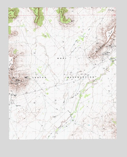
Polacca, AZ USGS Topographic Map
Click on map above to begin viewing in our Map Viewer.

This topographic map contains these locations and features:
Feature Name Type Latitude Longitude GNIS ID View Map
AqpiSpringN35.8215°W110.4954°45577View Map
AsayvaSpringN35.8269°W110.4955°45576View Map
Bean SpringSpringN35.8718°W110.3781°1102View Map
Corn RockSummitN35.7975°W110.4904°23347View Map
Coyote SpringSpringN35.8380°W110.3844°3498View Map
Driftwood SpringSpringN35.8167°W110.4990°4104View Map
First MesaPopulated PlaceN35.8367°W110.3815°1853158View Map
Flower SpringSpringN35.8440°W110.3770°4694View Map
HanoPopulated PlaceN35.8369°W110.3924°5545View Map
Hopi Health Care Center Keams Canyon Service UnitHospitalN35.8112°W110.3992°2667629View Map
Hopi Junior Senior High SchoolSchoolN35.8115°W110.3990°2543587View Map
Hopi Tribal Offices - PolaccaBuildingN35.8367°W110.3812°23374View Map
Horseshoe PointCliffN35.8611°W110.4310°6016View Map
Jucqa-vaSpringN35.8141°W110.4994°6522View Map
Keams Canyon WashStreamN35.8236°W110.3810°6631View Map
LemevaSpringN35.8047°W110.4842°45581View Map
MishongnoviPopulated PlaceN35.8050°W110.4926°8122View Map
Northland Pioneer College Hopi CenterSchoolN35.8110°W110.3996°2543588View Map
PolaccaPopulated PlaceN35.8367°W110.3815°9616View Map
Polacca AirportAirportN35.7934°W110.4206°45477View Map
Polacca Day SchoolSchoolN35.8307°W110.3882°23419View Map
Polacca Post OfficePost OfficeN35.8370°W110.3809°44971View Map
Second Mesa Census Designated PlaceCensusN35.8222°W110.4884°2409299View Map
Second Mesa Post OfficePost OfficeN35.7922°W110.4956°44972View Map
SichomoviPopulated PlaceN35.8353°W110.3943°11267View Map
SipauloviPopulated PlaceN35.8083°W110.4962°11227View Map
Spider SpringSpringN35.8407°W110.3957°11681View Map
Sunlight MissionLocaleN35.8075°W110.4776°11965View Map
Tawapa SpringSpringN35.8306°W110.3890°24008View Map
Tawapa SpringSpringN35.8307°W110.3893°24192View Map
TorevaPopulated PlaceN35.8042°W110.4971°12638View Map
Toreva Post Office (historical)Post OfficeN35.8042°W110.4971°2026810View Map
Toreva SpringSpringN35.8051°W110.4988°23443View Map
Tribal Headstart PreschoolSchoolN35.8050°W110.4985°23444View Map
WalpiPopulated PlaceN35.8322°W110.3979°24679View Map
Wepo ValleyValleyN35.7539°W110.4640°23953View Map
Wepo WashStreamN35.7539°W110.4640°13471View Map

Note: Coordinates in the location and feature list above are referenced to NAD83 datum.


Copyright (C) 2008-2025 Ryan Niemi / Sunset Dynamics ... All Rights Reserved