TopoQuest Logo
Do you find TopoQuest useful?
Help keep TopoQuest running and adding new maps/features by donating!
Bitcoin:  19c7KJd3qBynnjoSw5npx9KScwjBe4ifkT
Litecoin:  LXs6TkuXGGXo1vDsWCkWVdjQX94eUKd6ui
Home View Maps Find Maps Find Places Resources & Links


Bevier South, Missouri Topographic Map

USGS Map Title: Bevier South, MO
USGS Map MRC: 39092F5
DRG (GeoTIFF) Download: o39092f5.tif


Neighboring USGS Topographic Map Quads:


  New Cambria East, MO  
39092G6
 

  Bevier North, MO  
39092G5
 

  Axtell, MO  
39092G4
 

  Lagonda, MO  
39092F6
 

  Bevier South, MO  
39092F5
 

  Macon, MO  
39092F4
 

  Prairie Hill, MO  
39092E6
 

  College Mound, MO  
39092E5
 

  Jacksonville, MO  
39092E4


Map MRC Location:

N40°
W93°
N40°
W92°
H8 H7 H6 H5 H4 H3 H2 H1
G8 G7 G6 G5 G4 G3 G2 G1
F8 F7 F6 F5 F4 F3 F2 F1
E8 E7 E6 E5 E4 E3 E2 E1
D8 D7 D6 D5 D4 D3 D2 D1
C8 C7 C6 C5 C4 C3 C2 C1
B8 B7 B6 B5 B4 B3 B2 B1
A8 A7 A6 A5 A4 A3 A2 A1
N39°
W93°
N39°
W92°

Bevier South, MO USGS 1:24K Topographic Map Preview:
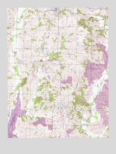
Bevier South, MO USGS Topographic Map
Click on map above to begin viewing in our Map Viewer.

This topographic map contains these locations and features:
Feature Name Type Latitude Longitude GNIS ID View Map
Antioch ChurchChurchN39.6981°W92.5813°713335View Map
ArdmorePopulated PlaceN39.6431°W92.5357°713377View Map
Ardmore SchoolSchoolN39.6442°W92.5374°733733View Map
BevierPopulated PlaceN39.7470°W92.5641°714120View Map
Bevier Fire DepartmentBuildingN39.7482°W92.5642°2621542View Map
Bevier LakeReservoirN39.7442°W92.5455°760719View Map
Bevier Post OfficePost OfficeN39.7478°W92.5648°2782695View Map
BinkleyPopulated PlaceN39.6434°W92.5480°740679View Map
Brammer School (historical)SchoolN39.7131°W92.5966°733726View Map
Burris School (historical)SchoolN39.6684°W92.5963°733727View Map
Central Coal and Coke Corporation Lake DamDamN39.7450°W92.5464°760718View Map
CharitonPopulated PlaceN39.6481°W92.5232°740162View Map
Claybank CreekStreamN39.6467°W92.6149°715913View Map
Dewey School (historical)SchoolN39.7325°W92.5613°733729View Map
Duck CreekStreamN39.7323°W92.5046°717142View Map
Elk Fork School (historical)SchoolN39.6356°W92.5071°733732View Map
Gipson School (historical)SchoolN39.6973°W92.5210°733730View Map
Greenwood SchoolSchoolN39.7220°W92.5135°718850View Map
KeotaPopulated PlaceN39.7075°W92.5766°720549View Map
Keota LakeReservoirN39.7267°W92.5835°760716View Map
Keota Lake DamDamN39.7267°W92.5835°760715View Map
Keota School (historical)SchoolN39.7064°W92.5821°733734View Map
Leathers School (historical)SchoolN39.6303°W92.6024°733728View Map
Miller SchoolSchoolN39.7106°W92.5538°722393View Map
Mount Olive Church (historical)ChurchN39.7053°W92.5213°722822View Map
New Salem ChurchChurchN39.6586°W92.5710°723313View Map
North Fork Claybank CreekStreamN39.6470°W92.6060°723456View Map
NorthwesternLocaleN39.7267°W92.5732°740161View Map
Number EightPopulated PlaceN39.7317°W92.5613°723539View Map
South Fork Claybank CreekStreamN39.6470°W92.6060°726735View Map
Thurman SchoolSchoolN39.6736°W92.5524°727640View Map
Township of BevierCivilN39.7393°W92.5665°766958View Map
Township of CharitonCivilN39.6523°W92.5694°766960View Map
Union CemeteryCemeteryN39.6584°W92.5710°2702434View Map
Winkle School (historical)SchoolN39.6659°W92.5046°733731View Map

Note: Coordinates in the location and feature list above are referenced to NAD83 datum.


Copyright (C) 2008-2024 Ryan Niemi / Sunset Dynamics ... All Rights Reserved