TopoQuest Logo
Do you find TopoQuest useful?
Help keep TopoQuest running and adding new maps/features by donating!
Bitcoin:  19c7KJd3qBynnjoSw5npx9KScwjBe4ifkT
Litecoin:  LXs6TkuXGGXo1vDsWCkWVdjQX94eUKd6ui
Home View Maps Find Maps Find Places Resources & Links


Pool Table Mountain, Colorado Topographic Map

USGS Map Title: Pool Table Mountain, CO
USGS Map MRC: 37106G6
DRG (GeoTIFF) Download: o37106g6.tif


Neighboring USGS Topographic Map Quads:


  Halfmoon Pass, CO  
37106H7
 

  Mesa Mountain, CO  
37106H6
 

  Bowers Peak, CO  
37106H5
 

  Wagon Wheel Gap, CO  
37106G7
 

  Pool Table Mountain, CO  
37106G6
 

  Pine Cone Knob, CO  
37106G5
 

  Lake Humphreys, CO  
37106F7
 

  South Fork West, CO  
37106F6
 

  South Fork East, CO  
37106F5


Map MRC Location:

N38°
W107°
N38°
W106°
H8 H7 H6 H5 H4 H3 H2 H1
G8 G7 G6 G5 G4 G3 G2 G1
F8 F7 F6 F5 F4 F3 F2 F1
E8 E7 E6 E5 E4 E3 E2 E1
D8 D7 D6 D5 D4 D3 D2 D1
C8 C7 C6 C5 C4 C3 C2 C1
B8 B7 B6 B5 B4 B3 B2 B1
A8 A7 A6 A5 A4 A3 A2 A1
N37°
W107°
N37°
W106°

Pool Table Mountain, CO USGS 1:24K Topographic Map Preview:
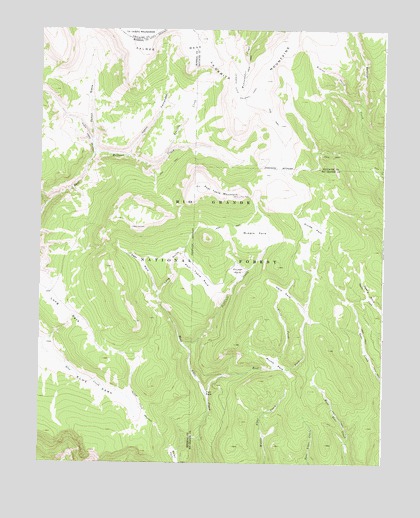
Pool Table Mountain, CO USGS Topographic Map
Click on map above to begin viewing in our Map Viewer.

This topographic map contains these locations and features:
Feature Name Type Latitude Longitude GNIS ID View Map
Alder Stock DrivewayTrailN37.7886°W106.7314°203450View Map
Blue ParkFlatN37.7786°W106.7445°203445View Map
Caņon FernandezValleyN37.8388°W106.7183°189565View Map
Caņon NieveValleyN37.8394°W106.7303°189505View Map
Corral ParkFlatN37.8056°W106.6781°189573View Map
Deer ParkFlatN37.8078°W106.7134°189569View Map
Difficult CreekStreamN37.7842°W106.6984°189574View Map
Divide ParkFlatN37.8175°W106.6512°189575View Map
Dyers ParkFlatN37.7997°W106.6303°189577View Map
East Fork Alder CreekStreamN37.7697°W106.6889°189580View Map
Fish ParkFlatN37.7703°W106.6892°189581View Map
Fremonts CampLocaleN37.8508°W106.6487°197143View Map
Hansons MillLocaleN37.8128°W106.7400°197151View Map
Long GulchValleyN37.7987°W106.7066°189566View Map
Long ParkFlatN37.7975°W106.7462°203444View Map
Middle ParkFlatN37.8158°W106.6717°189571View Map
Palmer MesaSummitN37.8742°W106.7087°203390View Map
Pool Table MountainSummitN37.8297°W106.6920°189570View Map
Pool Table ParkFlatN37.8036°W106.6931°189572View Map
Raven ParkFlatN37.7511°W106.6998°203398View Map
Rincon CreekStreamN37.8522°W106.6350°189568View Map
Round ParkFlatN37.7789°W106.6642°189583View Map
Trujillo CreekStreamN37.8394°W106.7050°189567View Map
Viers CreekStreamN37.7775°W106.6642°189582View Map
Viers ParkFlatN37.7997°W106.6617°189576View Map

Note: Coordinates in the location and feature list above are referenced to NAD83 datum.


Copyright (C) 2008-2025 Ryan Niemi / Sunset Dynamics ... All Rights Reserved