TopoQuest Logo
Do you find TopoQuest useful?
Help keep TopoQuest running and adding new maps/features by donating!
Bitcoin:  19c7KJd3qBynnjoSw5npx9KScwjBe4ifkT
Litecoin:  LXs6TkuXGGXo1vDsWCkWVdjQX94eUKd6ui
Home View Maps Find Maps Find Places Resources & Links


Bicknell, Indiana Topographic Map

USGS Map Title: Bicknell, IN
USGS Map MRC: 38087G3
DRG (GeoTIFF) Download: o38087g3.tif


Neighboring USGS Topographic Map Quads:


  Carlisle, IN  
38087H4
 

  Bucktown, IN  
38087H3
 

  Sandborn, IN  
38087H2
 

  Oaktown, IN  
38087G4
 

  Bicknell, IN  
38087G3
 

  Plainville, IN  
38087G2
 

  Fritchton, IN  
38087F4
 

  Wheatland, IN  
38087F3
 

  Washington, IN  
38087F2


Map MRC Location:

N39°
W88°
N39°
W87°
H8 H7 H6 H5 H4 H3 H2 H1
G8 G7 G6 G5 G4 G3 G2 G1
F8 F7 F6 F5 F4 F3 F2 F1
E8 E7 E6 E5 E4 E3 E2 E1
D8 D7 D6 D5 D4 D3 D2 D1
C8 C7 C6 C5 C4 C3 C2 C1
B8 B7 B6 B5 B4 B3 B2 B1
A8 A7 A6 A5 A4 A3 A2 A1
N38°
W88°
N38°
W87°

Bicknell, IN USGS 1:24K Topographic Map Preview:
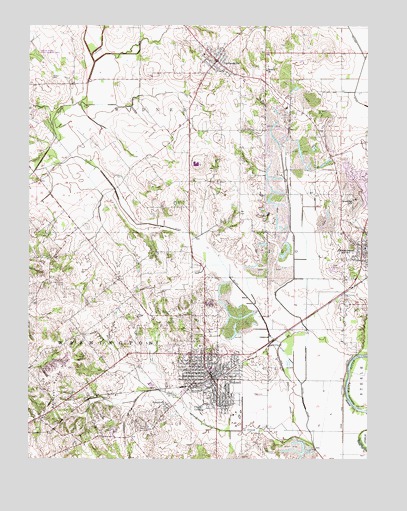
Bicknell, IN USGS Topographic Map
Click on map above to begin viewing in our Map Viewer.

This topographic map contains these locations and features:
Feature Name Type Latitude Longitude GNIS ID View Map
Barefoot Nation HillsSummitN38.7737°W87.3653°430486View Map
Bethel ChurchChurchN38.8623°W87.2875°430920View Map
BicknellPopulated PlaceN38.7742°W87.3078°431003View Map
Bicknell Country ClubLocaleN38.7584°W87.3322°452285View Map
Bicknell Fire DepartmentBuildingN38.7733°W87.3049°2701359View Map
Bicknell Vigo Township Fire DepartmentBuildingN38.7909°W87.3072°2701360View Map
Bicknell Volunteer Fire DepartmentBuildingN38.7733°W87.3050°2625881View Map
Chambers CemeteryCemeteryN38.8314°W87.3406°432387View Map
City LakeLakeN38.7649°W87.3116°432536View Map
City of BicknellCivilN38.7743°W87.3078°2394162View Map
EdwardsportPopulated PlaceN38.8120°W87.2522°434033View Map
Edwardsport Volunteer Fire DepartmentBuildingN38.8080°W87.2534°2626259View Map
Fore and Atkinson LeveeLeveeN38.7673°W87.2592°434642View Map
FreelandvillePopulated PlaceN38.8648°W87.3058°434813View Map
Freelandville Census Designated PlaceCensusN38.8653°W87.3102°2583453View Map
Freelandville Volunteer Fire DepartmentBuildingN38.8645°W87.3064°2626510View Map
Hooper Athletic FieldParkN38.7823°W87.3136°436410View Map
JohnstownPopulated PlaceN38.7645°W87.3233°437070View Map
Knox County Emergency Medical Services BicknellBuildingN38.7733°W87.3049°2719406View Map
Kuhn DitchCanalN38.8000°W87.3181°437469View Map
McClure CemeteryCemeteryN38.7517°W87.2845°438800View Map
Miller DitchCanalN38.7959°W87.2936°439207View Map
Mills PrairieFlatN38.7862°W87.2728°448381View Map
North Knox Central Elementary SchoolSchoolN38.7770°W87.3078°447481View Map
North Knox East Elementary and Junior High SchoolSchoolN38.8112°W87.2514°447478View Map
North Knox High SchoolSchoolN38.8356°W87.3061°447479View Map
Odd Fellows CemeteryCemeteryN38.7964°W87.2595°440506View Map
Pickel DitchCanalN38.7675°W87.2739°441100View Map
Purdy-Marsh DitchCanalN38.8028°W87.2775°441668View Map
Scudder HillSummitN38.8248°W87.2556°443177View Map
Tilley DitchCanalN38.8178°W87.3333°444760View Map
Town of EdwardsportCivilN38.8125°W87.2513°2396922View Map
Township of WidnerCivilN38.8596°W87.3431°454058View Map
Vigo Township Volunteer Fire DepartmentBuildingN38.7728°W87.3054°2625902View Map
Walker CemeteryCemeteryN38.8600°W87.3664°445371View Map

Note: Coordinates in the location and feature list above are referenced to NAD83 datum.


Copyright (C) 2008-2025 Ryan Niemi / Sunset Dynamics ... All Rights Reserved