TopoQuest Logo
Do you find TopoQuest useful?
Help keep TopoQuest running and adding new maps/features by donating!
Bitcoin:  19c7KJd3qBynnjoSw5npx9KScwjBe4ifkT
Litecoin:  LXs6TkuXGGXo1vDsWCkWVdjQX94eUKd6ui
Home View Maps Find Maps Find Places Resources & Links


Port San Luis, California Topographic Map

USGS Map Title: Port San Luis, CA
USGS Map MRC: 35120B7
DRG (GeoTIFF) Download: o35120b7.tif


Neighboring USGS Topographic Map Quads:


  Morro Bay South, CA  
35120C7
 

  San Luis Obispo, CA  
35120C6


  Port San Luis, CA  
35120B7


Map MRC Location:

N36°
W121°
N36°
W120°
H8 H7 H6 H5 H4 H3 H2 H1
G8 G7 G6 G5 G4 G3 G2 G1
F8 F7 F6 F5 F4 F3 F2 F1
E8 E7 E6 E5 E4 E3 E2 E1
D8 D7 D6 D5 D4 D3 D2 D1
C8 C7 C6 C5 C4 C3 C2 C1
B8 B7 B6 B5 B4 B3 B2 B1
A8 A7 A6 A5 A4 A3 A2 A1
N35°
W121°
N35°
W120°

Port San Luis, CA USGS 1:24K Topographic Map Preview:
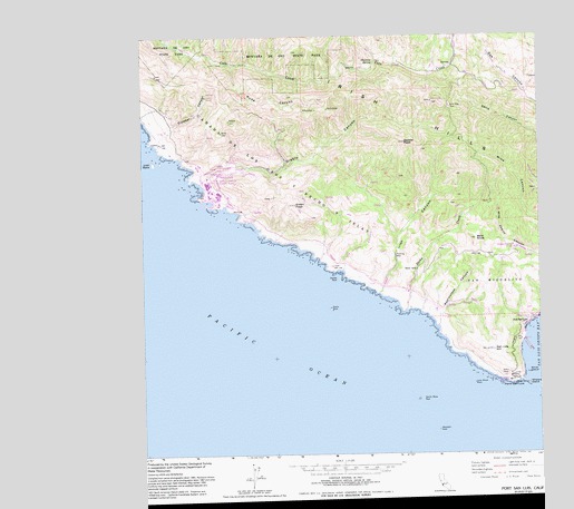
Port San Luis, CA USGS Topographic Map
Click on map above to begin viewing in our Map Viewer.

This topographic map contains these locations and features:
Feature Name Type Latitude Longitude GNIS ID View Map
Bald KnobSummitN35.1972°W120.7705°238919View Map
Crowbar CanyonValleyN35.2269°W120.8666°241128View Map
Diablo CanyonValleyN35.2122°W120.8574°241482View Map
Diablo Canyon Power PlantBuildingN35.2111°W120.8546°1872578View Map
Double RockIslandN35.1869°W120.8143°241581View Map
Glenrose SpringSpringN35.2430°W120.8018°242747View Map
Green PeakSummitN35.2066°W120.8274°242991View Map
Harford PierLocaleN35.1683°W120.7535°253337View Map
Irish CanyonValleyN35.1828°W120.8016°1655185View Map
Irish HillsRangeN35.2378°W120.7805°271726View Map
Lion RockIslandN35.2178°W120.8727°244889View Map
Little Irish CanyonValleyN35.1908°W120.8124°241359View Map
Lone Black RockBarN35.1597°W120.7716°245035View Map
Mount BuchonRangeN35.2222°W120.7930°253332View Map
Pecho CreekStreamN35.1786°W120.7930°247343View Map
Pecho RockIslandN35.1794°W120.8166°247344View Map
Point San LuisCapeN35.1608°W120.7582°247648View Map
Port San LuisPopulated PlaceN35.1750°W120.7552°1661251View Map
Rattlesnake CanyonValleyN35.1778°W120.7810°273211View Map
Ruda CanyonValleyN35.2428°W120.8468°248464View Map
Saddle PeakSummitN35.2222°W120.7927°248512View Map
San Luis HillSummitN35.1683°W120.7655°273497View Map
San Luis Obispo Light StationLocaleN35.1605°W120.7610°1872600View Map
Santa Rosa ReefBarN35.1555°W120.7888°249118View Map
Smith IslandIslandN35.1625°W120.7546°249588View Map
Tunnel PointCapeN35.1761°W120.7521°1670901View Map
Vineyard CanyonValleyN35.1844°W120.7999°251072View Map
Westdahi RockBarN35.1478°W120.7830°251394View Map
Whalers IslandIslandN35.1594°W120.7546°1662332View Map

Note: Coordinates in the location and feature list above are referenced to NAD83 datum.


Copyright (C) 2008-2024 Ryan Niemi / Sunset Dynamics ... All Rights Reserved