TopoQuest Logo
Do you find TopoQuest useful?
Help keep TopoQuest running and adding new maps/features by donating!
Bitcoin:  19c7KJd3qBynnjoSw5npx9KScwjBe4ifkT
Litecoin:  LXs6TkuXGGXo1vDsWCkWVdjQX94eUKd6ui
Home View Maps Find Maps Find Places Resources & Links


Portage Lake East, Maine Topographic Map

USGS Map Title: Portage Lake East, ME
USGS Map MRC: 46068G4
DRG (GeoTIFF) Download: o46068g4.tif


Neighboring USGS Topographic Map Quads:


  Winterville, ME  
46068H5
 

  McClusky Lake, ME  
46068H4
 

  Hanford, ME  
46068H3
 

  Portage Lake West, ME  
46068G5
 

  Portage Lake East, ME  
46068G4
 

  Bull Brook, ME  
46068G3
 

  Little Machias Lake, ME  
46068F5
 

  Ashland, ME  
46068F4
 

  York Ridge, ME  
46068F3


Map MRC Location:

N47°
W69°
N47°
W68°
H8 H7 H6 H5 H4 H3 H2 H1
G8 G7 G6 G5 G4 G3 G2 G1
F8 F7 F6 F5 F4 F3 F2 F1
E8 E7 E6 E5 E4 E3 E2 E1
D8 D7 D6 D5 D4 D3 D2 D1
C8 C7 C6 C5 C4 C3 C2 C1
B8 B7 B6 B5 B4 B3 B2 B1
A8 A7 A6 A5 A4 A3 A2 A1
N46°
W69°
N46°
W68°

Portage Lake East, ME USGS 1:24K Topographic Map Preview:
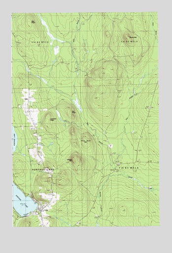
Portage Lake East, ME USGS Topographic Map
Click on map above to begin viewing in our Map Viewer.

This topographic map contains these locations and features:
Feature Name Type Latitude Longitude GNIS ID View Map
Allen St Peter Memorial AirportAirportN46.7523°W68.4723°582211View Map
Bear RidgeRidgeN46.8703°W68.4856°561875View Map
Bolstridge CampLocaleN46.8034°W68.4503°562714View Map
BuffaloPopulated PlaceN46.8270°W68.4859°579161View Map
Buffalo CemeteryCemeteryN46.7916°W68.4767°563135View Map
Burpee BrookStreamN46.7789°W68.4056°563275View Map
Carpenter RidgeRidgeN46.8128°W68.4698°563587View Map
East Branch Beaver BrookStreamN46.7831°W68.4123°565530View Map
Goodblood CemeteryCemeteryN46.7813°W68.4679°2678648View Map
Lanigan MountainSummitN46.7888°W68.4480°569376View Map
Moose MountainSummitN46.8609°W68.4011°571609View Map
Oak RidgeRidgeN46.8181°W68.4528°572636View Map
Our Lady of the Lake Catholic CemeteryCemeteryN46.7510°W68.4744°2678649View Map
PortagePopulated PlaceN46.7631°W68.4759°573678View Map
Portage Lake Municipal Seaplane BaseAirportN46.7625°W68.4781°582212View Map
Portage Lake Volunteer Fire DepartmentBuildingN46.7593°W68.4736°2552954View Map
Portage Post OfficePost OfficeN46.7594°W68.4755°1910557View Map
Three Burnt MountainSummitN46.8016°W68.4390°577051View Map
West Branch Beaver BrookStreamN46.7831°W68.4120°578035View Map

Note: Coordinates in the location and feature list above are referenced to NAD83 datum.


Copyright (C) 2008-2025 Ryan Niemi / Sunset Dynamics ... All Rights Reserved