TopoQuest Logo
Do you find TopoQuest useful?
Help keep TopoQuest running and adding new maps/features by donating!
Bitcoin:  19c7KJd3qBynnjoSw5npx9KScwjBe4ifkT
Litecoin:  LXs6TkuXGGXo1vDsWCkWVdjQX94eUKd6ui
Home View Maps Find Maps Find Places Resources & Links


Portal Peak, Arizona Topographic Map

USGS Map Title: Portal Peak, AZ
USGS Map MRC: 31109G2
DRG (GeoTIFF) Download: o31109g2.tif


Neighboring USGS Topographic Map Quads:


  Rustler Park, AZ  
31109H3
 

  Portal, AZ  
31109H2
 

  Portal NE, AZ  
31109H1
 

  Chiricahua Peak, AZ  
31109G3
 

  Portal Peak, AZ  
31109G2
 

  Rodeo, NM  
31109G1
 

  Swede Peak, AZ  
31109F3
 

  Apache, AZ  
31109F2
 

  Skull Canyon, NM  
31109F1


Map MRC Location:

N32°
W110°
N32°
W109°
H8 H7 H6 H5 H4 H3 H2 H1
G8 G7 G6 G5 G4 G3 G2 G1
F8 F7 F6 F5 F4 F3 F2 F1
E8 E7 E6 E5 E4 E3 E2 E1
D8 D7 D6 D5 D4 D3 D2 D1
C8 C7 C6 C5 C4 C3 C2 C1
B8 B7 B6 B5 B4 B3 B2 B1
A8 A7 A6 A5 A4 A3 A2 A1
N31°
W110°
N31°
W109°

Portal Peak, AZ USGS 1:24K Topographic Map Preview:
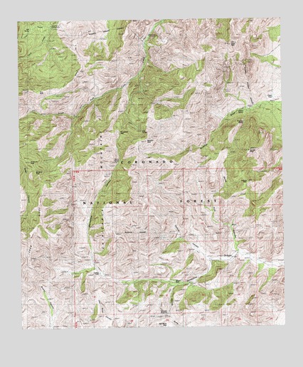
Portal Peak, AZ USGS Topographic Map
Click on map above to begin viewing in our Map Viewer.

This topographic map contains these locations and features:
Feature Name Type Latitude Longitude GNIS ID View Map
Basin Trail Two Hundred FortysevenTrailN31.8612°W109.2423°21925View Map
Bird TankReservoirN31.8609°W109.1314°21943View Map
Blevins DrawValleyN31.7665°W109.1781°1679View Map
Burro SpringSpringN31.8183°W109.2032°2258View Map
Darnell PeakSummitN31.8215°W109.1417°3707View Map
Dripping SpringSpringN31.8329°W109.1439°4105View Map
Herb Martyr Forest CampLocaleN31.8709°W109.2340°5730View Map
Horseshoe PassGapN31.8293°W109.2034°6015View Map
Horseshoe Tank Number FourReservoirN31.7851°W109.1687°22077View Map
Horseshoe Tank Number OneReservoirN31.7668°W109.1542°22078View Map
Horseshoe Tank Number ThreeReservoirN31.7587°W109.1657°22079View Map
Horseshoe Tank Number TwoReservoirN31.7534°W109.1573°22080View Map
Icebox TankReservoirN31.8098°W109.1289°22089View Map
Jack Wood PassGapN31.7501°W109.1798°6305View Map
Jack Wood TankReservoirN31.7598°W109.2126°22091View Map
Jones PeakSummitN31.7909°W109.2437°6495View Map
Jones RidgeRidgeN31.7948°W109.2451°6497View Map
Kambitsch TankReservoirN31.7558°W109.1812°6595View Map
Licklog TankReservoirN31.7724°W109.2133°7000View Map
Little North Fork TankReservoirN31.7887°W109.1756°22124View Map
Log SpringSpringN31.8362°W109.1978°7272View Map
Maple CampLocaleN31.8473°W109.1978°22133View Map
Monte Vista Peak LookoutTowerN31.8251°W109.2317°22142View Map
Mountaintop TankReservoirN31.7918°W109.1323°22144View Map
North Fork CanyonValleyN31.7773°W109.1603°9692View Map
North TankReservoirN31.8001°W109.1839°22154View Map
Portal PeakSummitN31.8645°W109.1495°9658View Map
Portal TankReservoirN31.8459°W109.1317°22179View Map
Pothole CanyonValleyN31.7813°W109.1476°8719View Map
Pothole PeakSummitN31.8068°W109.1439°9685View Map
Pothole TankReservoirN31.8034°W109.1589°22180View Map
Red Rock TankReservoirN31.7534°W109.2181°22191View Map
Roush RanchLocaleN31.7682°W109.1689°10560View Map
Sentinel PeakSummitN31.8137°W109.2423°11084View Map
Snowshed TrailTrailN31.8520°W109.2245°11506View Map
South Fork Canyon Trail Two Hundred FortythreeTrailN31.8334°W109.1964°22235View Map
South Fork Forest CampLocaleN31.8676°W109.1887°11596View Map
Sulphur PeakSummitN31.8251°W109.1898°11939View Map
Sulphur SpringSpringN31.8379°W109.1460°11940View Map
Warren WellWellN31.7676°W109.1778°13361View Map

Note: Coordinates in the location and feature list above are referenced to NAD83 datum.


Copyright (C) 2008-2024 Ryan Niemi / Sunset Dynamics ... All Rights Reserved