TopoQuest Logo
Do you find TopoQuest useful?
Help keep TopoQuest running and adding new maps/features by donating!
Bitcoin:  19c7KJd3qBynnjoSw5npx9KScwjBe4ifkT
Litecoin:  LXs6TkuXGGXo1vDsWCkWVdjQX94eUKd6ui
Home View Maps Find Maps Find Places Resources & Links


Pound Ridge, New York Topographic Map

USGS Map Title: Pound Ridge, NY
USGS Map MRC: 41073B5
DRG (GeoTIFF) Download: o41073b5.tif


Neighboring USGS Topographic Map Quads:


  Croton Falls, NY  
41073C6
 

  Peach Lake, NY  
41073C5
 

  Bethel, CT  
41073C4
 

  Mount Kisco, NY  
41073B6
 

  Pound Ridge, NY  
41073B5
 

  Norwalk North, CT  
41073B4
 

  Glenville, CT  
41073A6
 

  Stamford, CT  
41073A5
 

  Norwalk South, CT  
41073A4


Map MRC Location:

N42°
W74°
N42°
W73°
H8 H7 H6 H5 H4 H3 H2 H1
G8 G7 G6 G5 G4 G3 G2 G1
F8 F7 F6 F5 F4 F3 F2 F1
E8 E7 E6 E5 E4 E3 E2 E1
D8 D7 D6 D5 D4 D3 D2 D1
C8 C7 C6 C5 C4 C3 C2 C1
B8 B7 B6 B5 B4 B3 B2 B1
A8 A7 A6 A5 A4 A3 A2 A1
N41°
W74°
N41°
W73°

Pound Ridge, NY USGS 1:24K Topographic Map Preview:
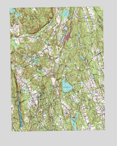
Pound Ridge, NY USGS Topographic Map
Click on map above to begin viewing in our Map Viewer.

This topographic map contains these locations and features:
Feature Name Type Latitude Longitude GNIS ID View Map
Abbott - Scofield CemeteryCemeteryN41.2479°W73.5601°2776858View Map
Ambler CemeteryCemeteryN41.2002°W73.5943°2776859View Map
Ayers CemeteryCemeteryN41.1661°W73.6007°942741View Map
Bartlett Arboretum Historic PreserveParkN41.1348°W73.5496°1941671View Map
Bartlett Arboretum LibraryBuildingN41.1348°W73.5496°1941672View Map
Bear Rock PondReservoirN41.1272°W73.5829°205351View Map
Becks HillSummitN41.2232°W73.5176°943477View Map
Becks Hill CemeteryCemeteryN41.2228°W73.5188°943478View Map
Bernardine ConventChurchN41.1429°W73.5529°205456View Map
Bi-Cultural Day SchoolSchoolN41.1445°W73.5498°1941722View Map
Bishop Family Burial GroundCemeteryN41.1902°W73.5379°2776864View Map
Blue Heron LakeReservoirN41.1960°W73.5918°944304View Map
Brown - Cooper Family Burial GroundCemeteryN41.2107°W73.5387°2776865View Map
Brown CemeteryCemeteryN41.2186°W73.5447°944905View Map
Burial HillSummitN41.2003°W73.5700°2556389View Map
Candlewood HillsRangeN41.2117°W73.5856°2556393View Map
Chestnut Hill ParkParkN41.1259°W73.5710°206251View Map
Chichester CemeteryCemeteryN41.1964°W73.5969°946568View Map
Collins PondLakeN41.1633°W73.5373°206382View Map
Cox's DamDamN41.2142°W73.5544°2517414View Map
Dantown CemeteryCemeteryN41.1822°W73.5509°2776861View Map
Deercrest Country ClubLocaleN41.1332°W73.6240°212923View Map
Delavan CemeteryCemeteryN41.2479°W73.5598°948263View Map
Doughnut LakeLakeN41.1694°W73.5671°206726View Map
East WoodsPopulated PlaceN41.2112°W73.5310°949281View Map
Fancher - Fitch Burial GroundCemeteryN41.2040°W73.5069°2776856View Map
Garden Center CemeteryCemeteryN41.1590°W73.5095°207247View Map
Gibses RidgeRidgeN41.1661°W73.5978°2556772View Map
Gilmore PondReservoirN41.2356°W73.5698°951136View Map
Grays PondReservoirN41.1394°W73.6235°207425View Map
Grays Pond BrookStreamN41.1359°W73.6157°207426View Map
Grays Pond DamDamN41.1390°W73.6224°1770289View Map
Great HillSummitN41.1844°W73.5994°2557062View Map
Halle RavineValleyN41.2102°W73.5613°2557070View Map
Halle Ravine PreserveParkN41.2133°W73.5619°2557082View Map
Heroy Recreation AreaLocaleN41.1751°W73.5607°1942215View Map
High RidgePopulated PlaceN41.1690°W73.5637°207816View Map
High Ridge Country ClubLocaleN41.1793°W73.5665°974404View Map
Highland LakeLakeN41.1657°W73.6042°952784View Map
Hiram Halle Memorial LibraryBuildingN41.2111°W73.5733°2617307View Map
Holmes CemeteryCemeteryN41.2415°W73.6182°953013View Map
Holy Spirit SchoolSchoolN41.1257°W73.5532°1942232View Map
Honey HollowBasinN41.2401°W73.5982°953143View Map
Horseshoe HillPopulated PlaceN41.1962°W73.5721°953238View Map
Hoyt CemeteryCemeteryN41.2322°W73.5510°953343View Map
Hoyt CemeteryCemeteryN41.2161°W73.5170°2041420View Map
Hunting Ridge ChurchChurchN41.1443°W73.5862°208034View Map
Jeremy Richard LibraryBuildingN41.1384°W73.5576°1942357View Map
Knapp - Bouton - Interlacken CemeteryCemeteryN41.2326°W73.5518°954754View Map
Lake KitchawanLakeN41.2434°W73.5491°954730View Map
Lake SusanLakeN41.1644°W73.5860°211303View Map
Laurel ReservoirReservoirN41.1699°W73.5502°1770286View Map
Laurel Reservoir DamDamN41.1651°W73.5446°1770285View Map
LewisboroPopulated PlaceN41.2382°W73.5226°955254View Map
Lockwood PondLakeN41.1739°W73.5310°208539View Map
Long RidgePopulated PlaceN41.1557°W73.5962°208579View Map
Long Ridge Congregational ChurchChurchN41.1559°W73.5937°1942424View Map
Long Ridge Fire Company Station 1BuildingN41.1531°W73.5926°2420475View Map
Long Ridge Fire Company Station 2BuildingN41.1565°W73.5589°2420489View Map
Long Ridge SchoolSchoolN41.1398°W73.6007°208580View Map
Long Ridge Union CemeteryCemeteryN41.1490°W73.5973°208581View Map
Long Ridge Village Historic DistrictParkN41.1582°W73.5954°1942428View Map
Mallard LakeReservoirN41.1864°W73.5875°956303View Map
McManus LakeLakeN41.1289°W73.5708°208799View Map
Meads CornerLocaleN41.2086°W73.5750°2556222View Map
Mianus GorgeValleyN41.1667°W73.6160°957060View Map
Mianus ReservoirReservoirN41.1432°W73.6130°208857View Map
Mianus Reservoir DamDamN41.1296°W73.6118°1770287View Map
Mill RiverStreamN41.1598°W73.5387°957280View Map
Miller CemeteryCemeteryN41.1734°W73.6046°957298View Map
Murphy's CornerLocaleN41.1992°W73.5719°2557685View Map
New Canaan Country SchoolSchoolN41.1318°W73.5218°206480View Map
New Canaan Nature CenterBuildingN41.1543°W73.5023°1942533View Map
New Canaan ReservoirReservoirN41.1799°W73.5152°209224View Map
New Canaan Reservoir DamDamN41.1775°W73.5135°1770295View Map
North StamfordPopulated PlaceN41.1382°W73.5435°209377View Map
North Stamford Congregational ChurchChurchN41.1384°W73.5435°1942597View Map
North Stamford ReservoirReservoirN41.1324°W73.5398°209378View Map
Northrup - Caldwell Burial GroundCemeteryN41.2435°W73.5248°2776857View Map
Old Church CemeteryCemeteryN41.1576°W73.5004°1942627View Map
Orient Lodge LakeLakeN41.1569°W73.5864°209533View Map
Pea PondLakeN41.2312°W73.6241°960023View Map
Pinneys CornersPopulated PlaceN41.1865°W73.5226°209815View Map
Piping BrookStreamN41.1404°W73.6246°209818View Map
Pitch SwampSwampN41.2151°W73.6189°960636View Map
PonusPopulated PlaceN41.1268°W73.5198°209920View Map
Pound RidgePopulated PlaceN41.2087°W73.5748°961064View Map
Pound Ridge CemeteryCemeteryN41.1998°W73.5725°963012View Map
Pound Ridge Lions Ambulance CorpsBuildingN41.1917°W73.5540°2720805View Map
Pound Ridge MuseumBuildingN41.2089°W73.5746°2617513View Map
Pound Ridge Police DepartmentBuildingN41.1982°W73.5682°2781190View Map
Pound Ridge Post OfficePost OfficeN41.1900°W73.5500°2618076View Map
Pound Ridge Town HallBuildingN41.1983°W73.5694°2617670View Map
Pound Ridge Volunteer Fire DepartmentBuildingN41.1906°W73.5528°2716013View Map
Raven RocksCliffN41.2387°W73.5685°962228View Map
Robin Hood LakeReservoirN41.1653°W73.6102°962658View Map
Rockrimmon Country ClubLocaleN41.1615°W73.5957°974844View Map
Saint Pauls ChurchChurchN41.2220°W73.5171°964108View Map
Sarles CemeteryCemeteryN41.1687°W73.6013°964495View Map
Sarles CornersPopulated PlaceN41.1843°W73.5693°964496View Map
Scofield - Green - Stone Hill Burial GroundCemeteryN41.2210°W73.5986°2776866View Map
Scofield - Hoyt CemeteryCemeteryN41.1844°W73.5716°2776862View Map
Scofield Magnet Middle SchoolSchoolN41.1364°W73.5589°2079251View Map
Scofield ParkParkN41.1398°W73.5593°1942902View Map
Scotts BrookStreamN41.2304°W73.5023°210714View Map
Scotts CornersPopulated PlaceN41.1893°W73.5507°964692View Map
Scotts Corners Census Designated PlaceCensusN41.1889°W73.5561°2390266View Map
Scotts ReservoirReservoirN41.2331°W73.5055°964693View Map
Sellecks Corner CemeteryCemeteryN41.1862°W73.5344°1942912View Map
Sellecks CornersPopulated PlaceN41.1854°W73.5340°210758View Map
Silas Brown PlotCemeteryN41.2214°W73.5345°2776860View Map
Siscowit ReservoirReservoirN41.1976°W73.5287°210881View Map
Siscowit Reservoir DamDamN41.1929°W73.5240°1770297View Map
Smith RidgeRidgeN41.1879°W73.5015°210930View Map
Stamford MuseumBuildingN41.1259°W73.5468°1942991View Map
Stamford Nature CenterBuildingN41.1259°W73.5468°1942992View Map
The Lake in the LedgesLakeN41.1580°W73.6234°970708View Map
Town of Pound RidgeCivilN41.2115°W73.5746°979394View Map
Trinity LakeReservoirN41.2230°W73.5519°967831View Map
Twin LakesLakeN41.1912°W73.6122°968040View Map
University of Connecticut Stamford BranchSchoolN41.1384°W73.5576°1943119View Map
VistaPopulated PlaceN41.2023°W73.5101°968579View Map
Vista Fire DepartmentBuildingN41.2141°W73.5163°2716020View Map
Ward Pound Ridge ReservationParkN41.2487°W73.5887°968789View Map
Waterbury CemeteryCemeteryN41.2324°W73.5518°968895View Map
Wildcat HollowValleyN41.2382°W73.5976°971250View Map
Williams CemeteryCemeteryN41.2271°W73.6191°971304View Map
Wood - Waterbury Family Burial GroundCemeteryN41.1797°W73.5876°2776863View Map
Wren KnollsSummitN41.1687°W73.5582°1943239View Map

Note: Coordinates in the location and feature list above are referenced to NAD83 datum.


Copyright (C) 2008-2024 Ryan Niemi / Sunset Dynamics ... All Rights Reserved