TopoQuest Logo
Do you find TopoQuest useful?
Help keep TopoQuest running and adding new maps/features by donating!
Bitcoin:  19c7KJd3qBynnjoSw5npx9KScwjBe4ifkT
Litecoin:  LXs6TkuXGGXo1vDsWCkWVdjQX94eUKd6ui
Home View Maps Find Maps Find Places Resources & Links


Powers Lake, North Dakota Topographic Map

USGS Map Title: Powers Lake, ND
USGS Map MRC: 48102E6
DRG (GeoTIFF) Download: o48102e6.tif


Neighboring USGS Topographic Map Quads:


  Grand View, ND  
48102F7
 

  Grubb Lake, ND  
48102F6
 

  Helde Lake, ND  
48102F5
 

  Battleview, ND  
48102E7
 

  Powers Lake, ND  
48102E6
 

  Lunds Valley, ND  
48102E5
 

  White Earth, ND  
48102D7
 

  Ross NW, ND  
48102D6
 

  Cottonwood Lake, ND  
48102D5


Map MRC Location:

N49°
W103°
N49°
W102°
H8 H7 H6 H5 H4 H3 H2 H1
G8 G7 G6 G5 G4 G3 G2 G1
F8 F7 F6 F5 F4 F3 F2 F1
E8 E7 E6 E5 E4 E3 E2 E1
D8 D7 D6 D5 D4 D3 D2 D1
C8 C7 C6 C5 C4 C3 C2 C1
B8 B7 B6 B5 B4 B3 B2 B1
A8 A7 A6 A5 A4 A3 A2 A1
N48°
W103°
N48°
W102°

Powers Lake, ND USGS 1:24K Topographic Map Preview:
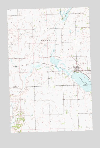
Powers Lake, ND USGS Topographic Map
Click on map above to begin viewing in our Map Viewer.

This topographic map contains these locations and features:
Feature Name Type Latitude Longitude GNIS ID View Map
Bethel CemeteryCemeteryN48.5459°W102.6671°1034094View Map
Bethel CemeteryCemeteryN48.5469°W102.6681°1027948View Map
City of Powers LakeCivilN48.5640°W102.6466°1036228View Map
Enget LakeLakeN48.5712°W102.6800°1028888View Map
Paradise MeadowSwampN48.5566°W102.7249°1030628View Map
Powers LakeLakeN48.5448°W102.6255°1030793View Map
Powers LakePopulated PlaceN48.5628°W102.6480°1030794View Map
Powers Lake Ambulance AssociationBuildingN48.5607°W102.6487°2658803View Map
Powers Lake City HallBuildingN48.5623°W102.6464°2745179View Map
Powers Lake Elementary SchoolSchoolN48.5636°W102.6427°2748140View Map
Powers Lake Fire Protection District StationBuildingN48.5608°W102.6491°2637779View Map
Powers Lake High SchoolSchoolN48.5603°W102.6376°2748141View Map
Powers Lake Historical Museum and Blacksmith ShopBuildingN48.5671°W102.6474°2749242View Map
Powers Lake Police DepartmentBuildingN48.5624°W102.6464°2734403View Map
Powers Lake Post OfficePost OfficeN48.5620°W102.6471°2742828View Map
Smishek LakeLakeN48.6224°W102.6555°1032132View Map
Smishek Lake DamDamN48.6100°W102.6638°1033280View Map
Township of ColvilleCivilN48.5910°W102.6922°1037097View Map
Township of Powers LakeCivilN48.5029°W102.6902°1037198View Map

Note: Coordinates in the location and feature list above are referenced to NAD83 datum.


Copyright (C) 2008-2024 Ryan Niemi / Sunset Dynamics ... All Rights Reserved