TopoQuest Logo
Do you find TopoQuest useful?
Help keep TopoQuest running and adding new maps/features by donating!
Bitcoin:  19c7KJd3qBynnjoSw5npx9KScwjBe4ifkT
Litecoin:  LXs6TkuXGGXo1vDsWCkWVdjQX94eUKd6ui
Home View Maps Find Maps Find Places Resources & Links


Premont East, Texas Topographic Map

USGS Map Title: Premont East, TX
USGS Map MRC: 27098C1
DRG (GeoTIFF) Download: o27098c1.tif


Neighboring USGS Topographic Map Quads:


  Seeligson Ranch, TX  
27098D2
 

  Ella, TX  
27098D1
 

  Escondido Lake, TX  
27097D8
 

  Premont West, TX  
27098C2
 

  Premont East, TX  
27098C1
 

  Paisano Lake, TX  
27097C8
 

  Falfurrias, TX  
27098B2
 

  Flowella, TX  
27098B1
 

  La Paloma Ranch, TX  
27097B8


Map MRC Location:

N28°
W99°
N28°
W98°
H8 H7 H6 H5 H4 H3 H2 H1
G8 G7 G6 G5 G4 G3 G2 G1
F8 F7 F6 F5 F4 F3 F2 F1
E8 E7 E6 E5 E4 E3 E2 E1
D8 D7 D6 D5 D4 D3 D2 D1
C8 C7 C6 C5 C4 C3 C2 C1
B8 B7 B6 B5 B4 B3 B2 B1
A8 A7 A6 A5 A4 A3 A2 A1
N27°
W99°
N27°
W98°

Premont East, TX USGS 1:24K Topographic Map Preview:
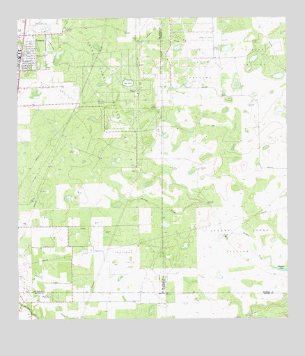
Premont East, TX USGS Topographic Map
Click on map above to begin viewing in our Map Viewer.

This topographic map contains these locations and features:
Feature Name Type Latitude Longitude GNIS ID View Map
Alazan PastureFlatN27.3678°W98.0142°1372263View Map
Big LakeLakeN27.3484°W98.0736°1330616View Map
Big Lake WindmillLocaleN27.3448°W98.0706°1330620View Map
Canales WindmillLocaleN27.3381°W98.0606°1332057View Map
Cantarawas WindmillLocaleN27.3706°W98.1022°1332110View Map
CIG 402 HeliportAirportN27.2567°W98.0942°1384789View Map
City of PremontCivilN27.3586°W98.1244°2411486View Map
Cuchillo WindmillLocaleN27.2512°W98.0172°1333782View Map
El Cinco WindmillLocaleN27.3125°W98.0403°1335177View Map
El Ocho WindmillLocaleN27.3131°W98.0539°1335236View Map
Falfurrias Oil FieldOilfieldN27.2756°W98.0767°1335670View Map
Finados WindmillLocaleN27.3431°W98.0306°1335795View Map
Huisacne WindmillLocaleN27.2987°W98.0375°1338268View Map
Javalin WindmillLocaleN27.3200°W98.0989°1338654View Map
Jensen TrapFlatN27.3728°W98.0361°1374285View Map
Jensen WindmillLocaleN27.3617°W98.0322°1338711View Map
La Labor WindmillLocaleN27.3695°W98.0747°1339339View Map
La Mula WindmillLocaleN27.3406°W98.0872°1339365View Map
La Paloma Emergency Medical ServiceBuildingN27.3614°W98.1246°2655843View Map
La Salada WindmillLocaleN27.3550°W98.0686°1339408View Map
Laguna Larga PastureFlatN27.2823°W98.0225°1339461View Map
Laiva WindmillLocaleN27.2506°W98.0244°1339480View Map
Las Comas WindmillLocaleN27.3389°W98.0181°1339653View Map
Paisano WindmillLocaleN27.2842°W98.0283°1343447View Map
Pedro Jaramillo CemeteryCemeteryN27.2500°W98.1192°1343797View Map
PremontPopulated PlaceN27.3606°W98.1236°1344536View Map
Premont Police DepartmentBuildingN27.3593°W98.1250°2334998View Map
Premont Post OfficePost OfficeN27.3584°W98.1245°2731295View Map
Tijerina Oil FieldOilfieldN27.3675°W98.0464°1376458View Map
Tijerina-Canales-Blucher Oil FieldOilfieldN27.3548°W98.0894°1376459View Map
Vallejos WindmillLocaleN27.3653°W98.0158°1349156View Map

Note: Coordinates in the location and feature list above are referenced to NAD83 datum.


Copyright (C) 2008-2025 Ryan Niemi / Sunset Dynamics ... All Rights Reserved