TopoQuest Logo
Do you find TopoQuest useful?
Help keep TopoQuest running and adding new maps/features by donating!
Bitcoin:  19c7KJd3qBynnjoSw5npx9KScwjBe4ifkT
Litecoin:  LXs6TkuXGGXo1vDsWCkWVdjQX94eUKd6ui
Home View Maps Find Maps Find Places Resources & Links


Priscilla Peak, Montana Topographic Map

USGS Map Title: Priscilla Peak, MT
USGS Map MRC: 47115F2
DRG (GeoTIFF) Download: o47115f2.tif


Neighboring USGS Topographic Map Quads:


  Vermilion Peak, MT  
47115G3
 

  Fishtrap Lake, MT  
47115G2
 

  Richards Peak, MT  
47115G1
 

  Mount Headley, MT  
47115F3
 

  Priscilla Peak, MT  
47115F2
 

  Calico Creek, MT  
47115F1
 

  Thompson Falls, MT  
47115E3
 

  Eddy Mountain, MT  
47115E2
 

  Big Hole Peak, MT  
47115E1


Map MRC Location:

N48°
W116°
N48°
W115°
H8 H7 H6 H5 H4 H3 H2 H1
G8 G7 G6 G5 G4 G3 G2 G1
F8 F7 F6 F5 F4 F3 F2 F1
E8 E7 E6 E5 E4 E3 E2 E1
D8 D7 D6 D5 D4 D3 D2 D1
C8 C7 C6 C5 C4 C3 C2 C1
B8 B7 B6 B5 B4 B3 B2 B1
A8 A7 A6 A5 A4 A3 A2 A1
N47°
W116°
N47°
W115°

Priscilla Peak, MT USGS 1:24K Topographic Map Preview:
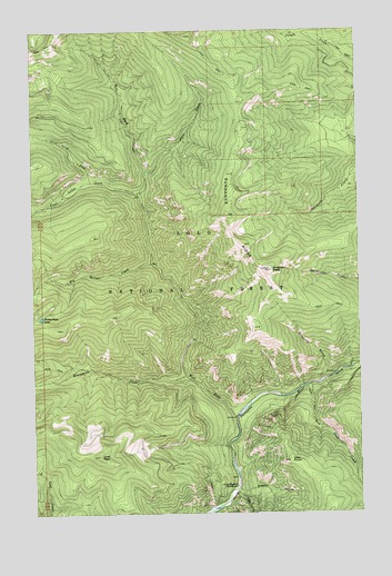
Priscilla Peak, MT USGS Topographic Map
Click on map above to begin viewing in our Map Viewer.

This topographic map contains these locations and features:
Feature Name Type Latitude Longitude GNIS ID View Map
Anne CreekStreamN47.7135°W115.2074°779053View Map
Bay State CreekStreamN47.6585°W115.1440°779455View Map
Big Spruce CreekStreamN47.6897°W115.2049°779883View Map
Clark Memorial CampgroundLocaleN47.6322°W115.1735°781322View Map
Four Lakes CreekStreamN47.7080°W115.2093°783642View Map
Honeymoon CreekStreamN47.6602°W115.1921°784979View Map
Honeymoon LakeLakeN47.6758°W115.2481°784980View Map
Liver PeakSummitN47.6397°W115.2260°786400View Map
North Fork Four Lakes CreekStreamN47.7108°W115.2279°788167View Map
Priscilla GulchValleyN47.6605°W115.1374°789196View Map
Priscilla PeakSummitN47.6880°W115.1601°789198View Map
Priscilla Peak LookoutLocaleN47.6885°W115.1604°794338View Map
Sanders CountyCivilN47.6748°W115.1333°1719578View Map
Sleepy GulchValleyN47.6313°W115.1726°790651View Map
Sundance RidgeRidgeN47.7022°W115.1763°791686View Map
View PointSummitN47.6385°W115.1532°792706View Map
West Fork Thompson RiverStreamN47.6499°W115.1735°793086View Map

Note: Coordinates in the location and feature list above are referenced to NAD83 datum.


Copyright (C) 2008-2025 Ryan Niemi / Sunset Dynamics ... All Rights Reserved